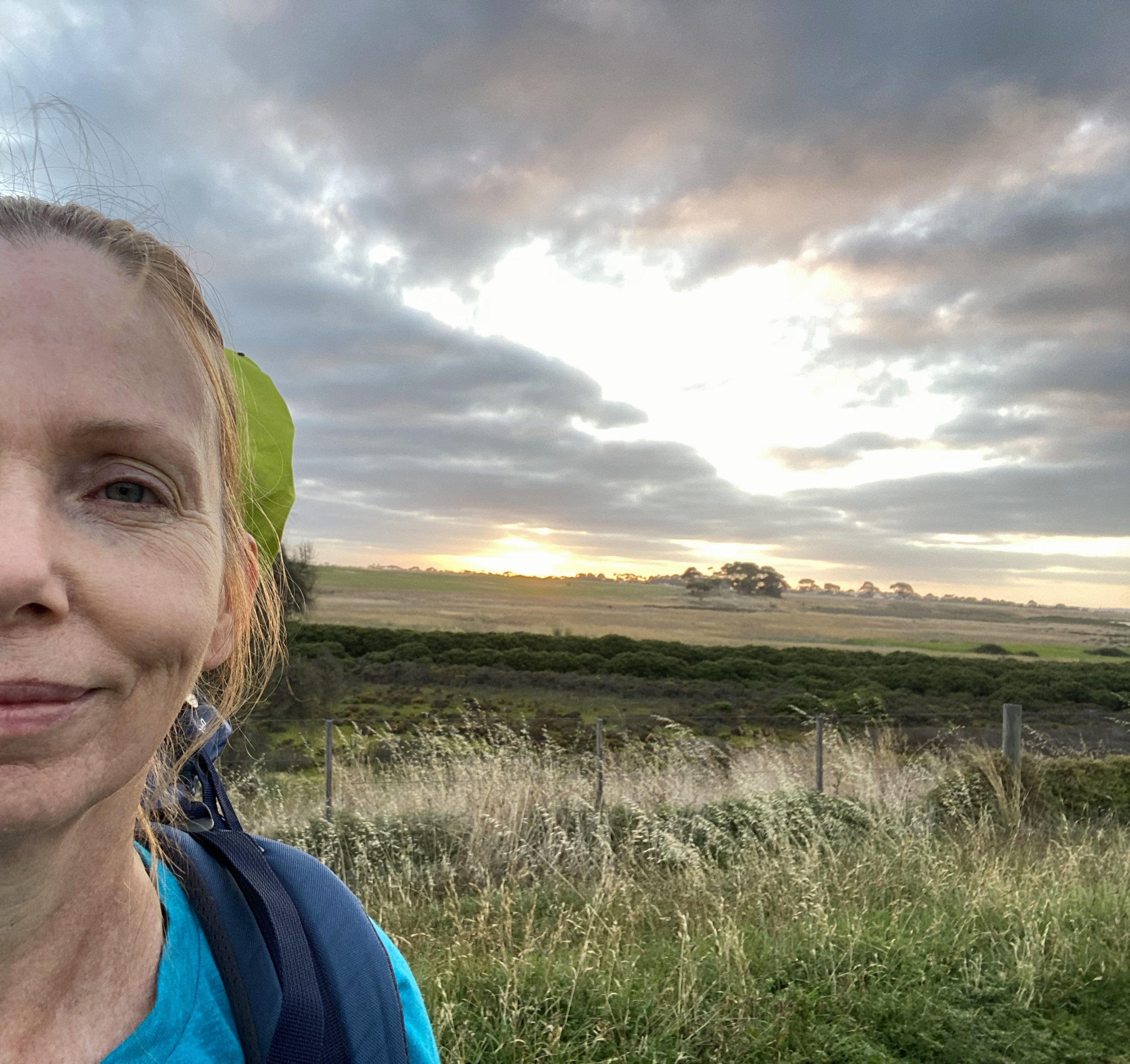
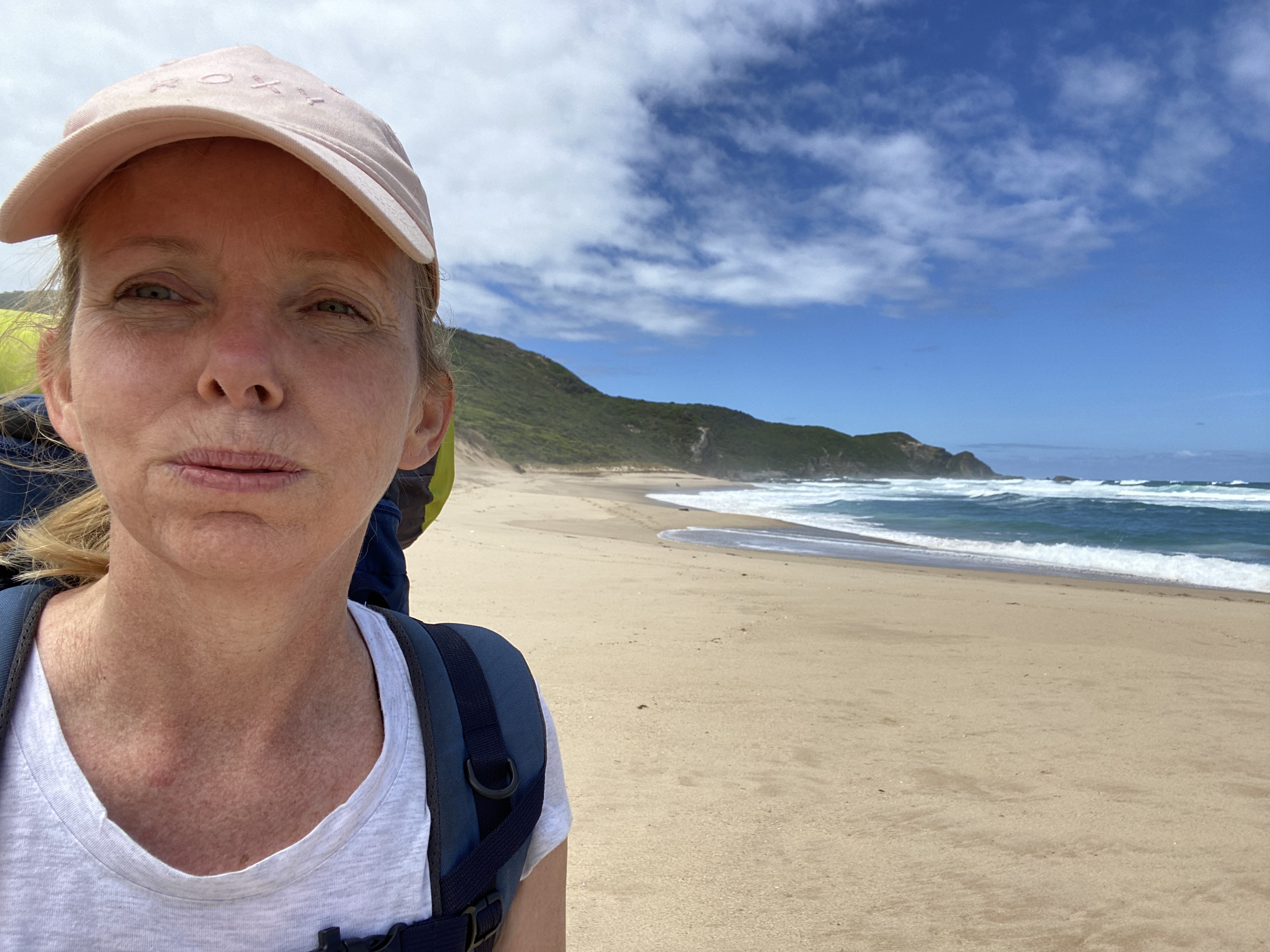
I did it! I walked 150km by myself, with everything I needed on my back. And I didn’t end up on the 6 o’clock news.
Having just completed the Great Ocean Walk, in Victoria, Australia, I’m a bit tired and sore… but having completed it alone… I feel incredibly proud. I might even admit to feeling like I’ve accomplished something that not many 50-year-old women could (or would want to) do and that makes me feel like I can now be included in a small and unique group of adventurers.
Heck, I feel like I kicked some serious Great Ocean Walk butt!!!! I still can’t wipe the smile off my face.
I’m certainly not the first person to complete this hike. Many hikers have recounted their own adventures completing this walk. And several women have already described their own solo hikes – (thank you twenty-something-year-old Elisha from BeyondWildPlaces for providing the vast majority of background knowledge that got me organized enough to start).
But, no longer being in my twenties, I wasn’t sure how my body would cope with carrying a heavy pack, or if I could manage the daily slog of walking quite long distances over rough terrain for days on end.
As confident as I may have sounded before I started, I still had a few doubts. I knew it wouldn’t be easy… but that’s the thing – I wasn’t looking for easy. What I wanted was a challenge.
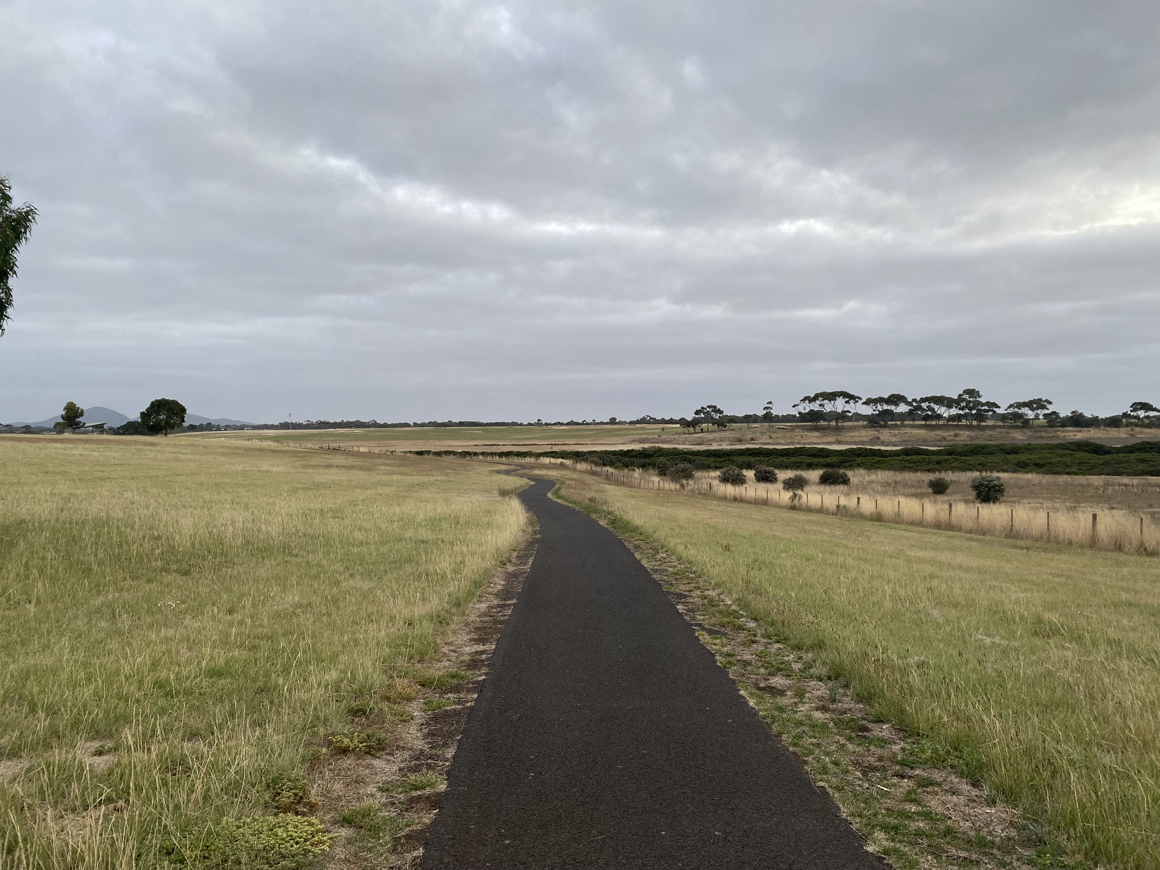
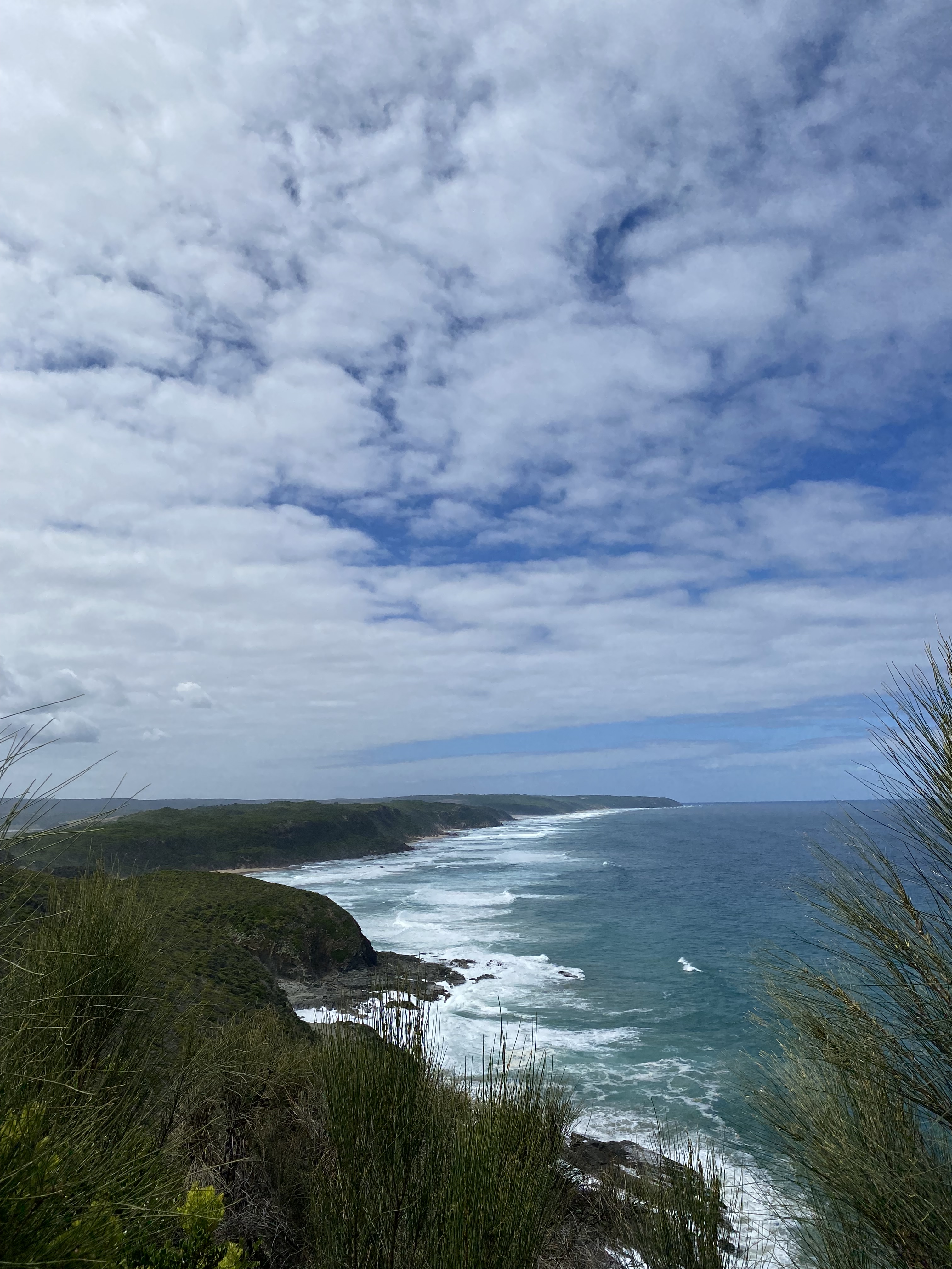
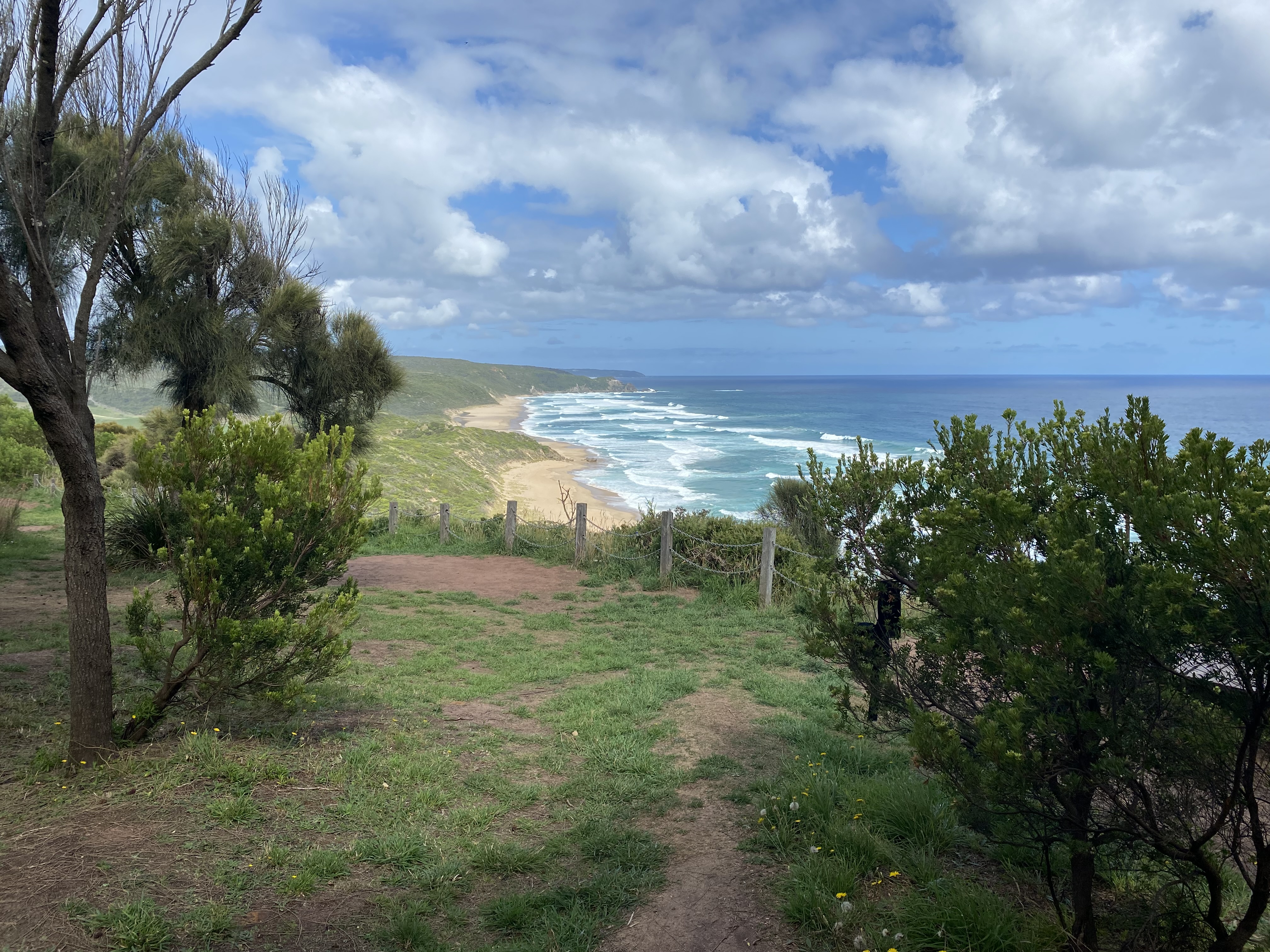
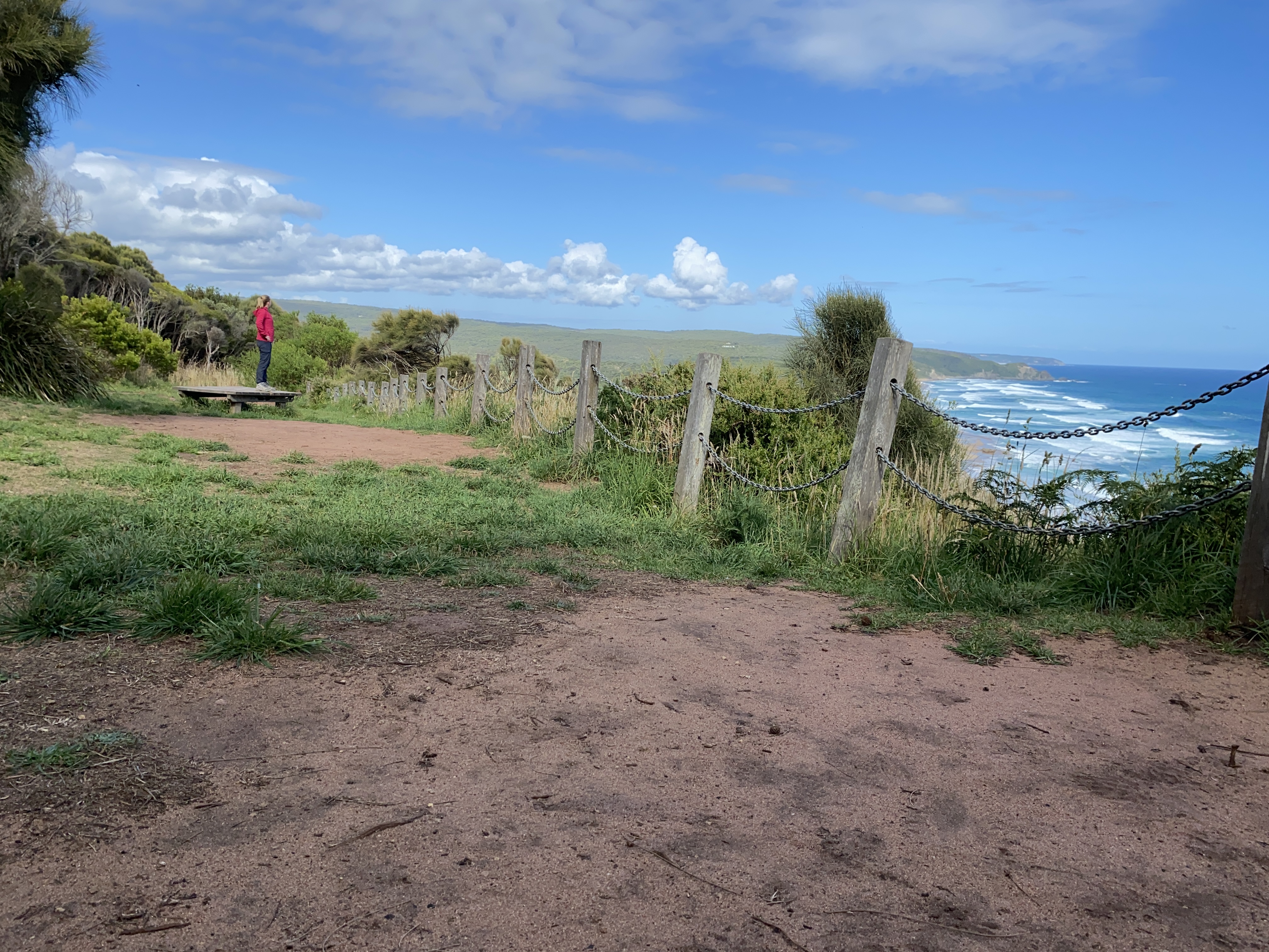
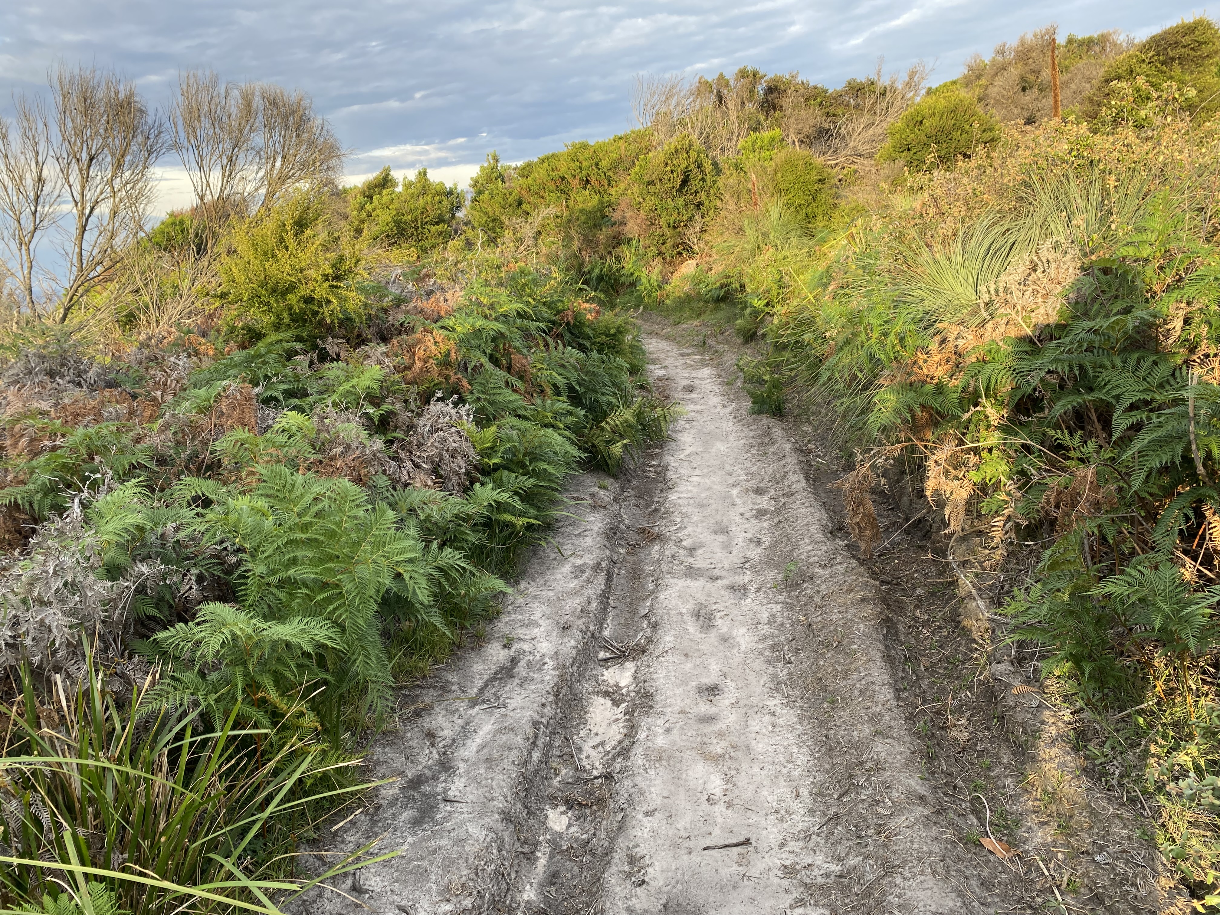
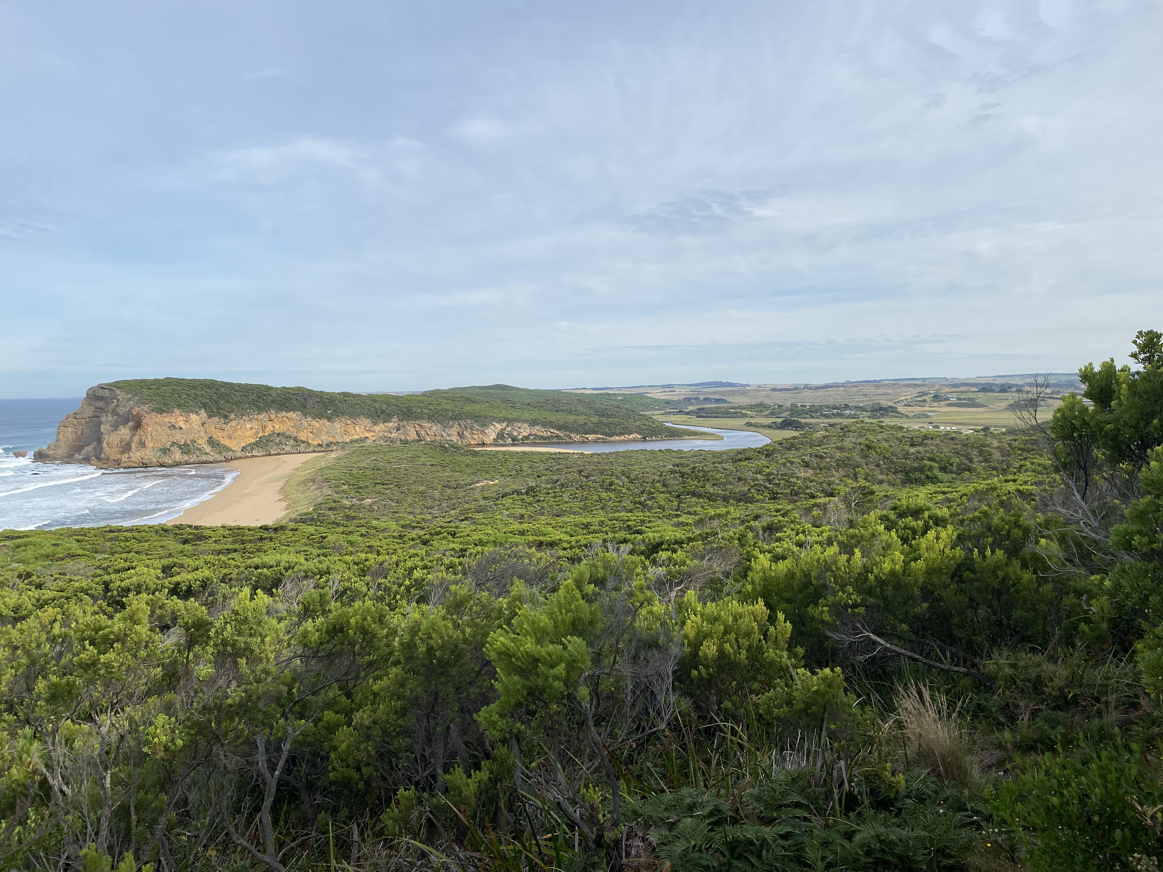
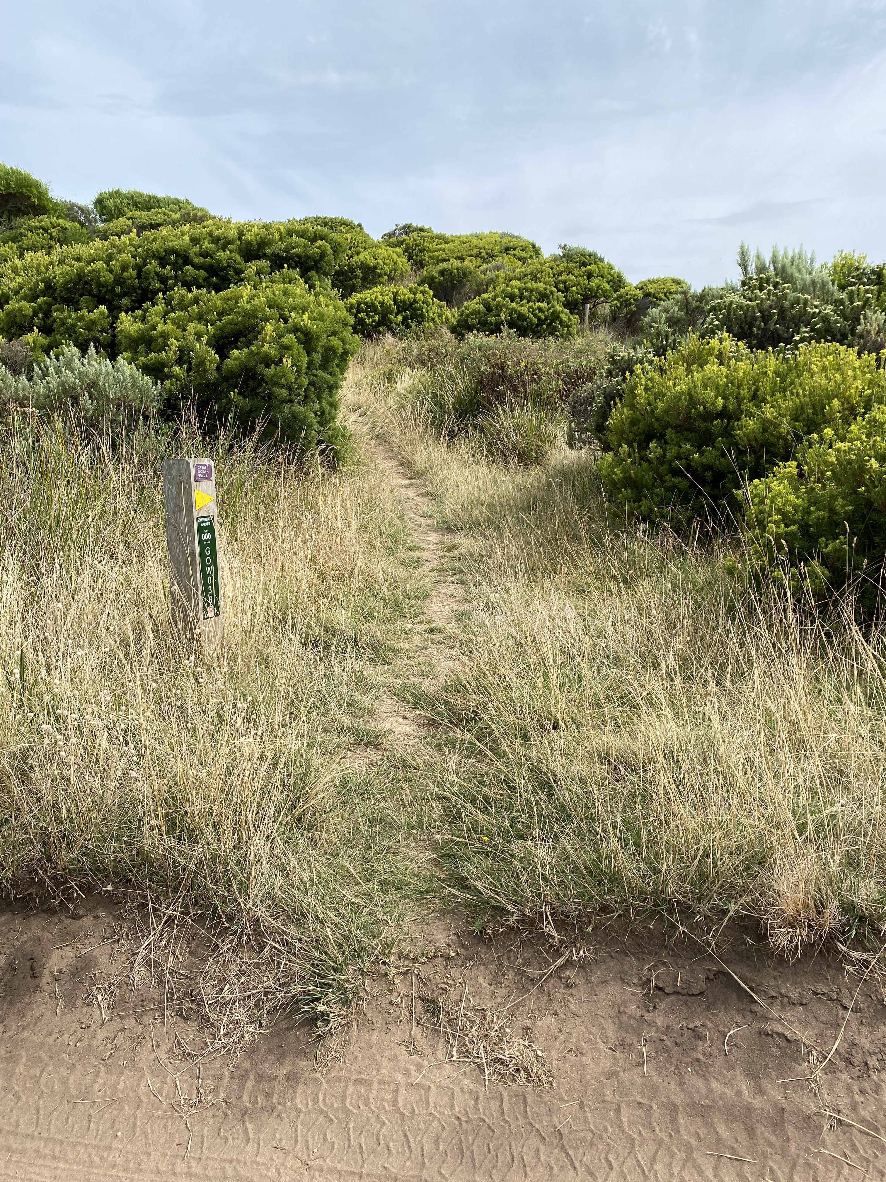
Now, this walk follows the coastline from the Apollo Bay Visitors Information Centre and spits you out at the Twelve Apostles. The guidebooks say that the length of it is about 104km, but my Smartwatch told me I’d walked 149.9km during the 8 days it took me to complete it. A few other hikers were also a little befuddled as their Smartwatches calculated similarly. We decided that the distances provided may not have taken the gradients into consideration. Didn’t matter. I loved every km, and it gave me more time to enjoy the amazing scenery.
Since I’d booked my campsites in advance, I do admit to feeling locked into that timeframe of 8 days. By nature, I’m very competitive so I would have tried to walk further each day. But in hindsight, I’m so glad I kept to the Guidebook’s recommendations since it meant that I got to enjoy it all, without the pressure of having to hurry. It still wasn’t easy… even when spread out over 8 days; it’s a long time to be hiking alone for a novice overnight hiker. And it’s a long time to go without a shower.
Short or long, I was sad when it was over.
This account summarizes my hike and the unique experiences I had along the way.
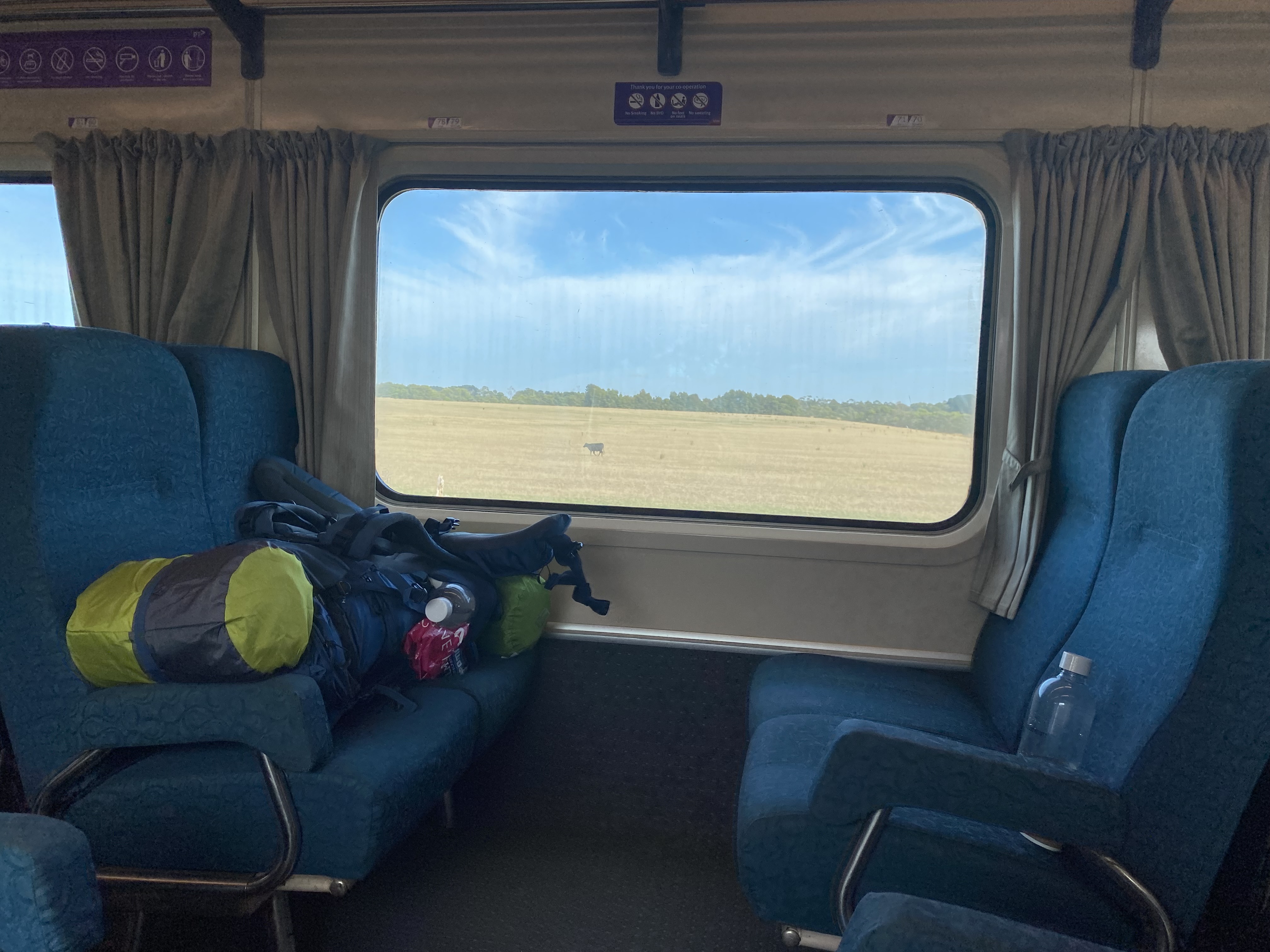
Getting there: It took a bit of effort to get to Apollo Bay from the Gold Coast. I flew into Avalon airport on an afternoon flight and stayed the first night in Coiro. The following morning, I woke early (4.45am) to walk 12km to Lara train station; my train was due to depart at 7.53am.
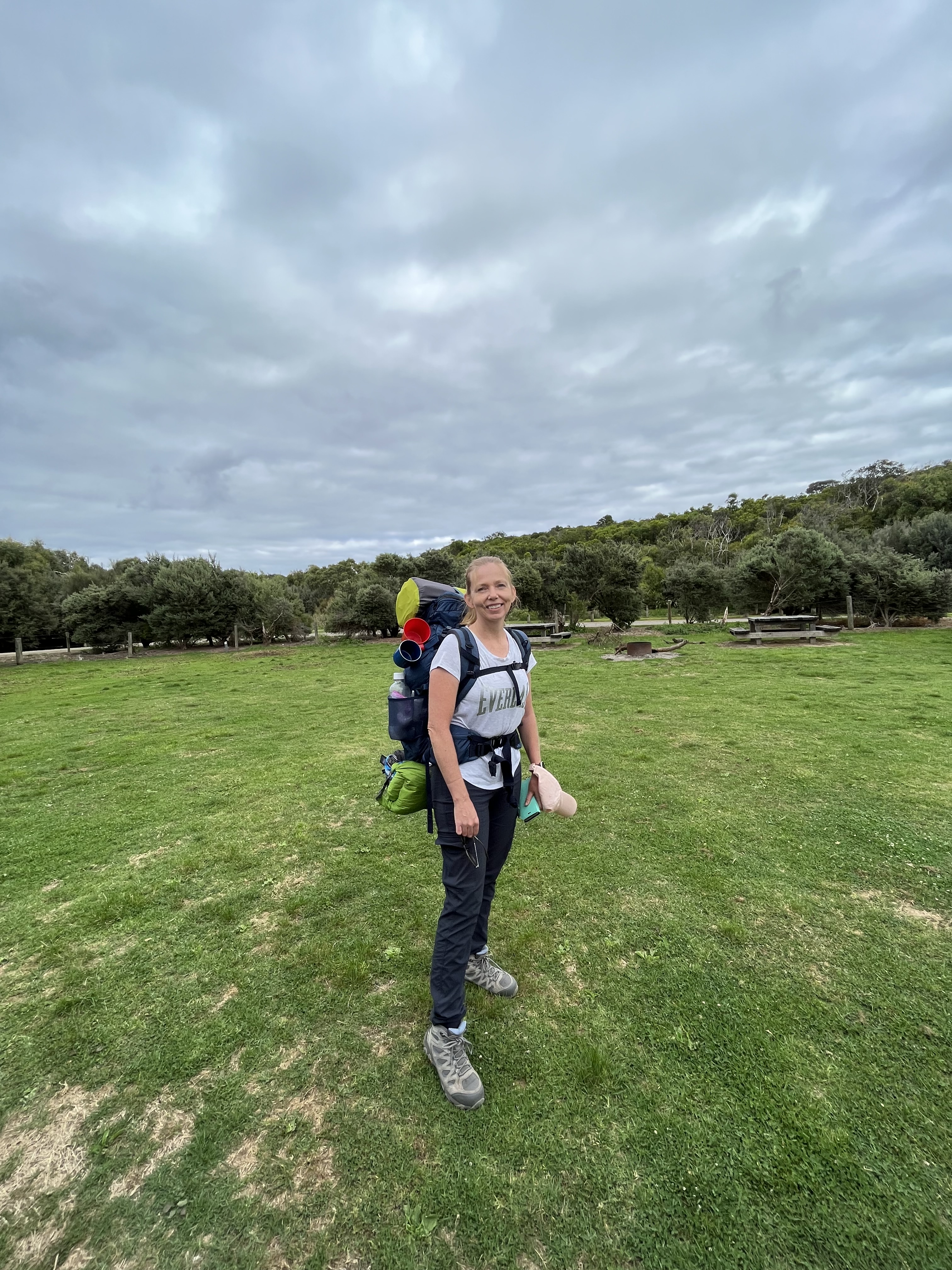
Realizing that I had underestimated how long the walk was, I had to jog with my pack for short distances. Not the easiest thing to do, given its weight. Twenty-five ridiculous kilos to be exact! I started to doubt my ability to manage that weight a few times, but I’m incredibly stubborn.
I made the train with five minutes to spare.
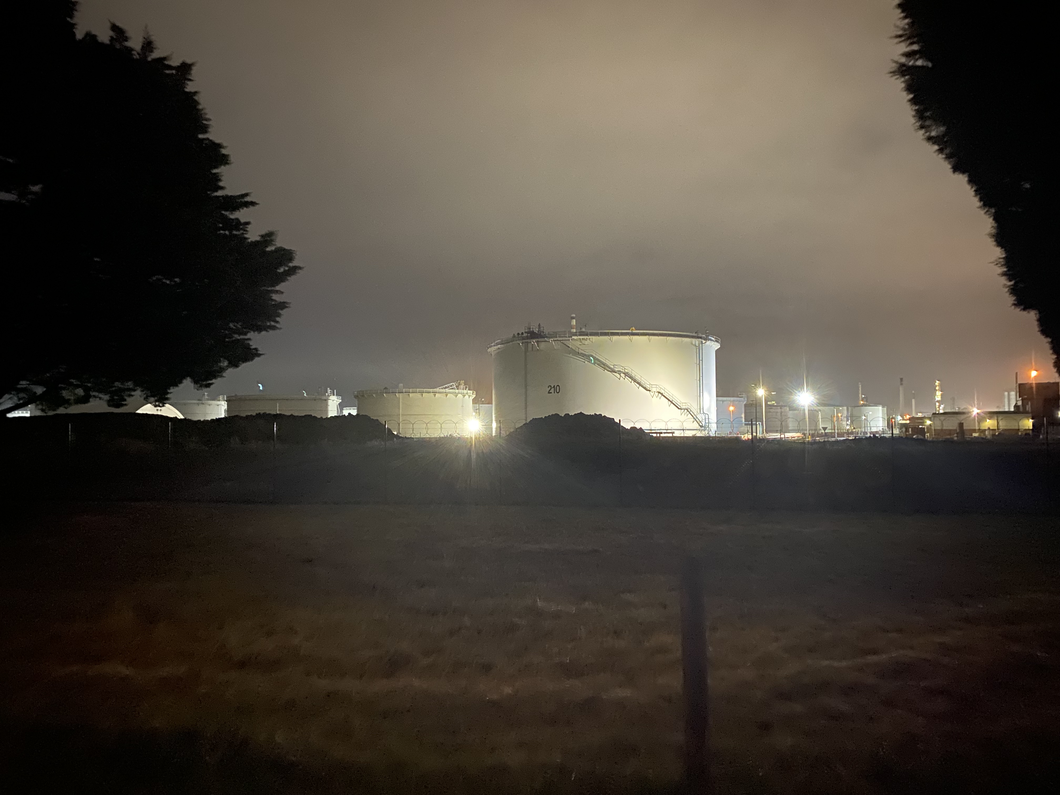
That morning’s trek was probably the riskiest part of the whole trip. I walked in the dark along near-empty roads for many km, through a deserted industrial area, and along country roads.
Google maps, however, eventually directed me toward Port Phillip Bay, which was such an unexpected treat. There were flat well-maintained paths and a few happy joggers who gave me some curious looks. Hearing and seeing the birds waking up as the sun appeared above the horizon was pure magic.
After reaching Lara train station, I hopped aboard, changing trains at Geelong to get on the V/Line. I then settled in for a lovely long train ride, with a carriage to myself, finally arriving in Colac. Here I walked around for another 3km or so, exploring the town a little. My main aim however was to confirm that the once-weekly bus to Apollo Bay was indeed coming and that I was waiting in the right place. It thankfully appeared as promised. I must admit to feeling a little out of place, given that it was a shopping bus for Senior Citizens, but it was heading in the right direction, my stop being 70km away.
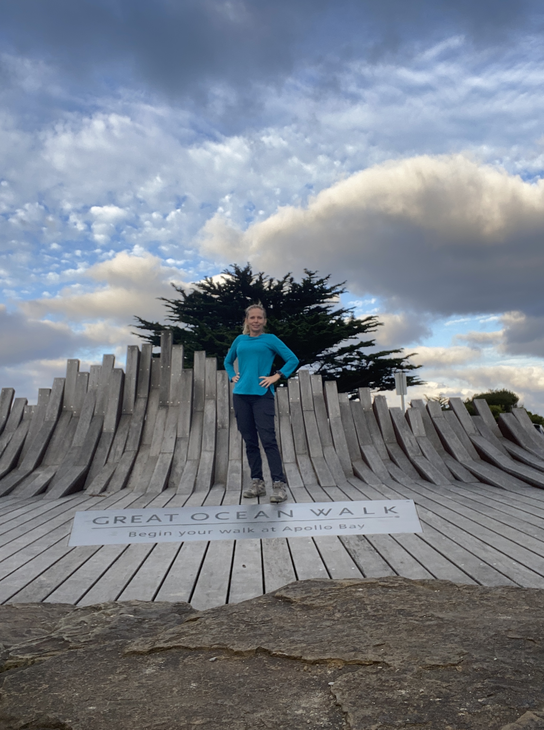
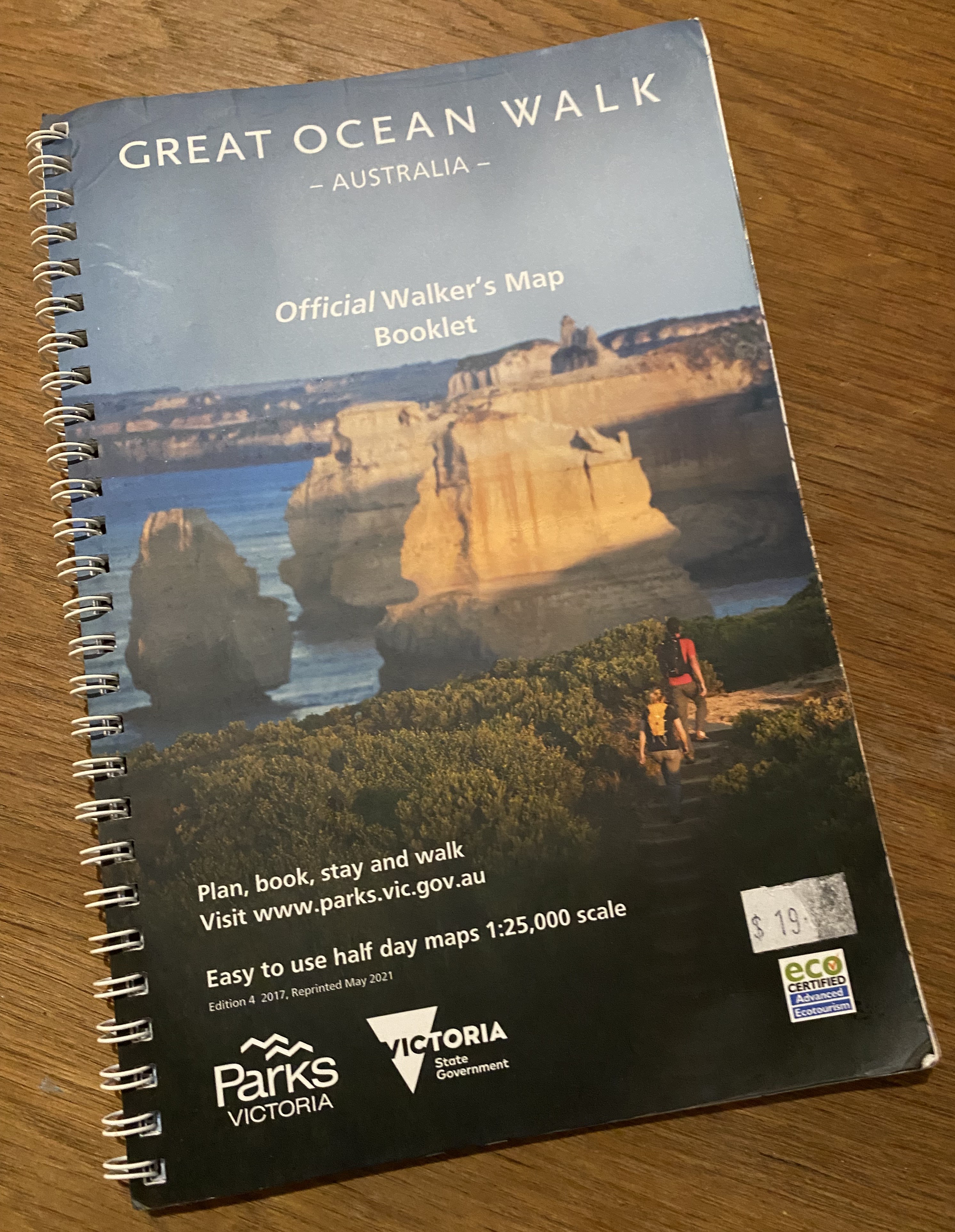
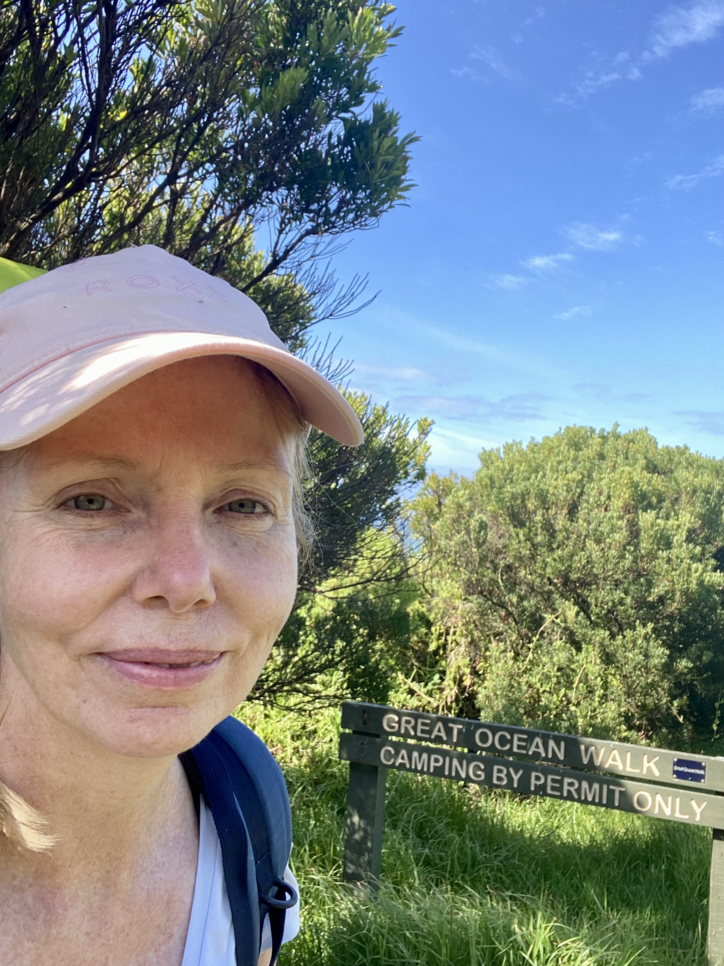
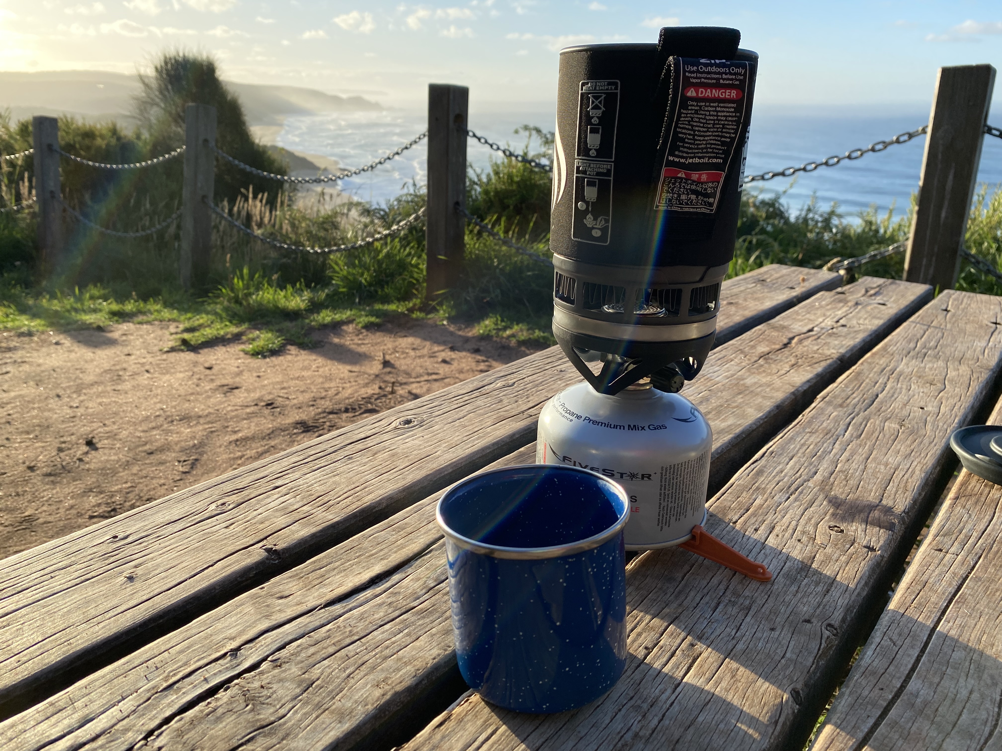
Arriving in Apollo Bay, I headed straight to the Visitors Information Centre where the incredibly helpful staff answered my questions, gave me a list of tide times, sold me the priceless Great Ocean Walk guidebook, and instructed me as to where I could buy gas for my Jet Boil since I had not been able to bring mine with me on the plane.


Day 1. Apollo Bay to Elliot Ridge. Guidebook distance: 10km. Smartwatch distance: 15.3km. Elevation gained: 350m. 10am to 1pm.
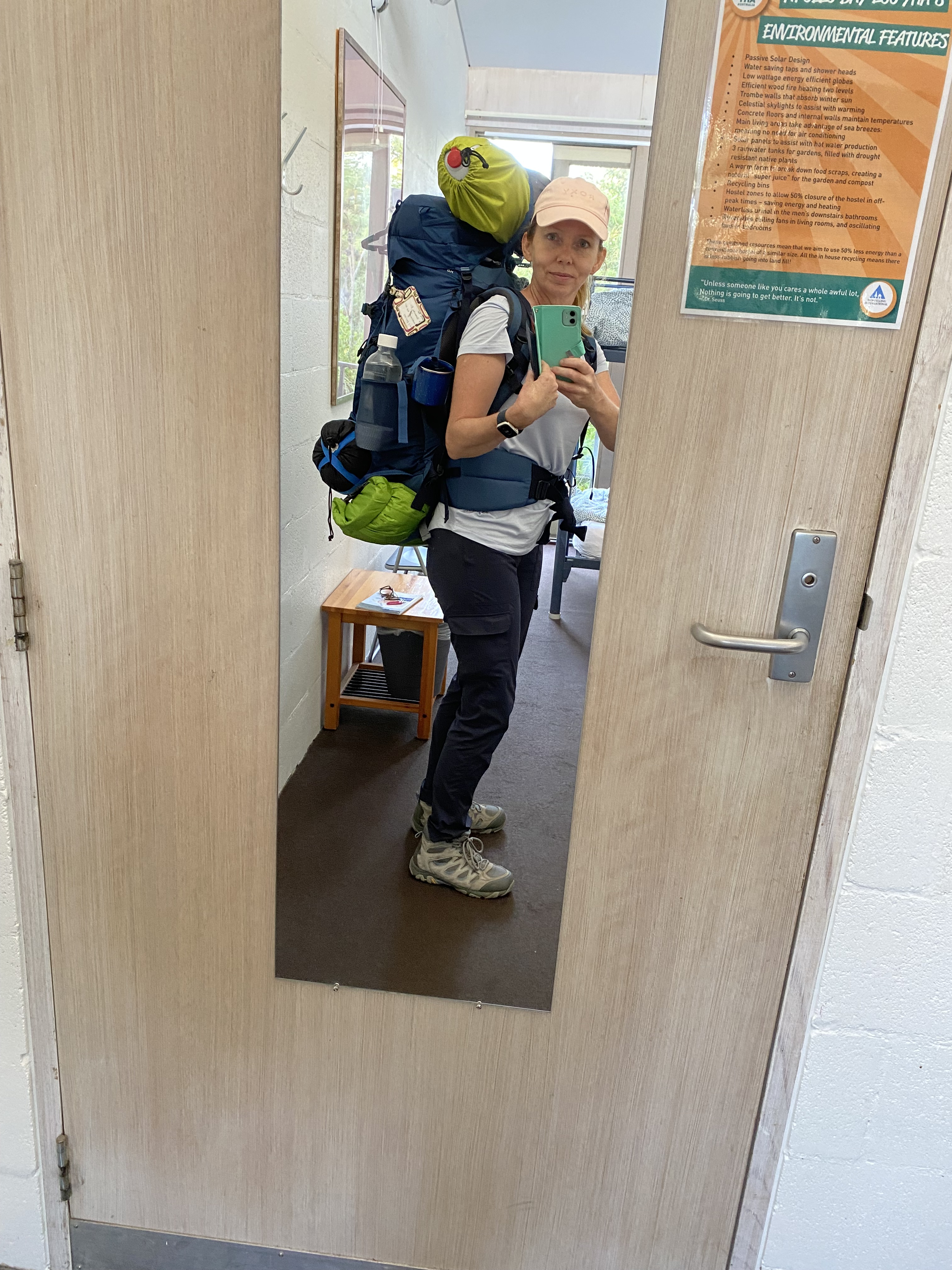
On the first official day of my hike, I woke up in a top bunk in a dormitory room at the YHA Hostel in Apollo Bay. (Since there are no age restrictions on ‘youth’ hostels, I thought I’d include that experience as well). I was a little concerned in the morning, since the lovely girl from Birmingham, who’d slept on the bunk bed beneath me, woke up with a sniffle and a sore throat. I was not particularly keen to get sick while in the middle of the bush, but by that stage, I was committed.
Someone asked me if I’d packed enough toilet paper for the trip. No. I hadn’t packed any. So, I raided the public toilets on my way to the trail starting point, stuffing my pockets. Turned out that I didn’t need it. The drop toilets at the GOW camps were extremely well-equipped with toilet paper.
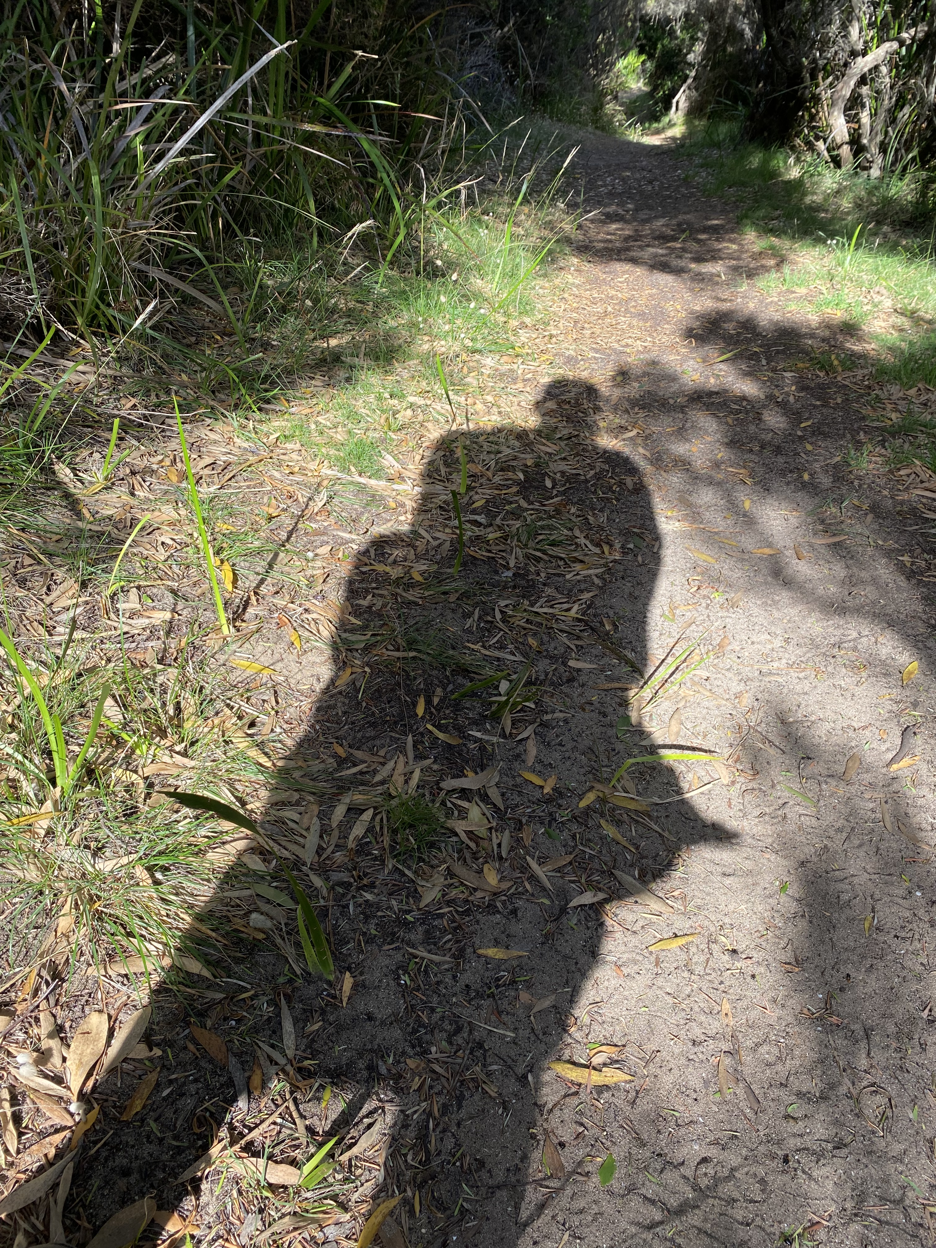
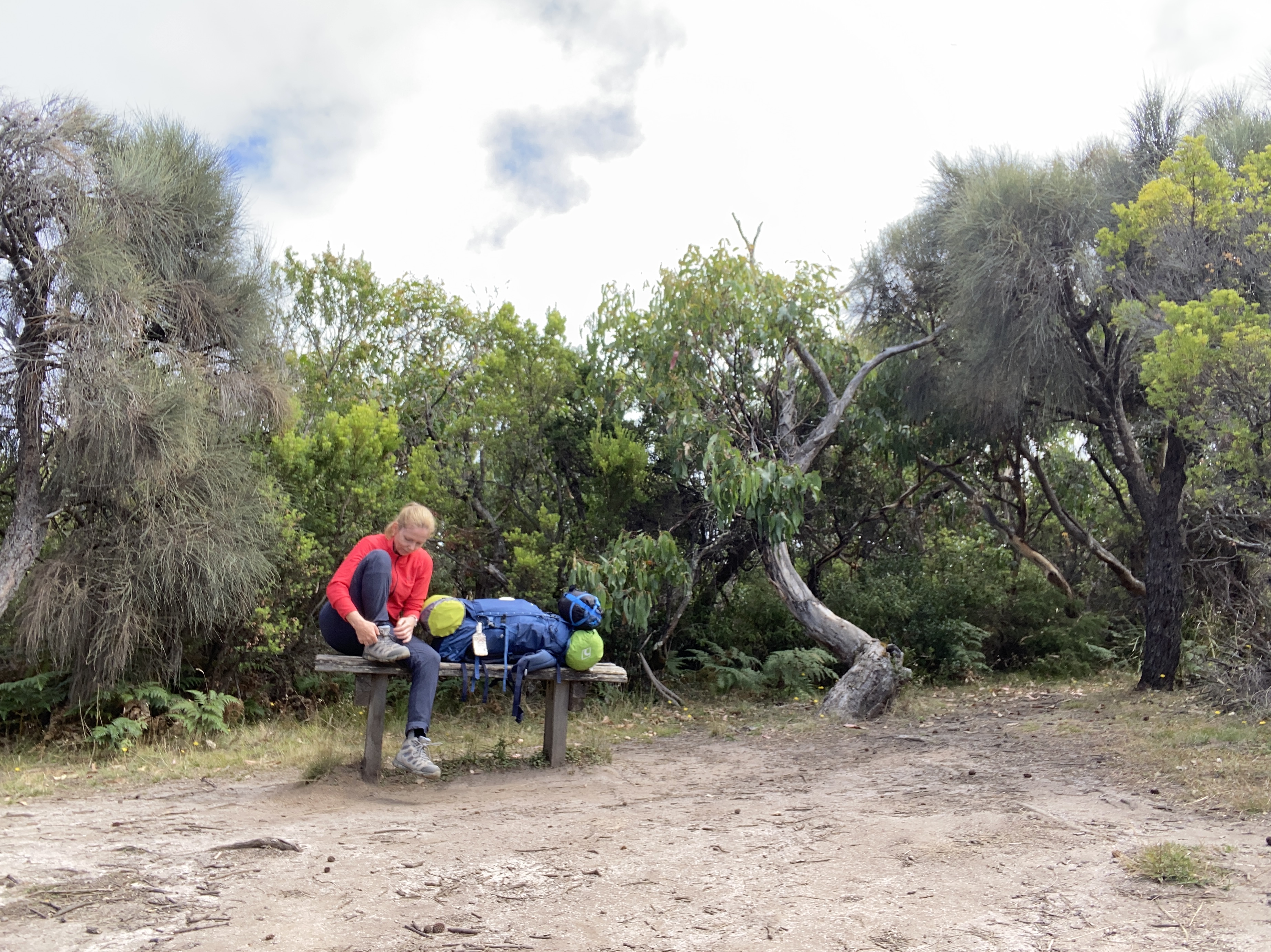
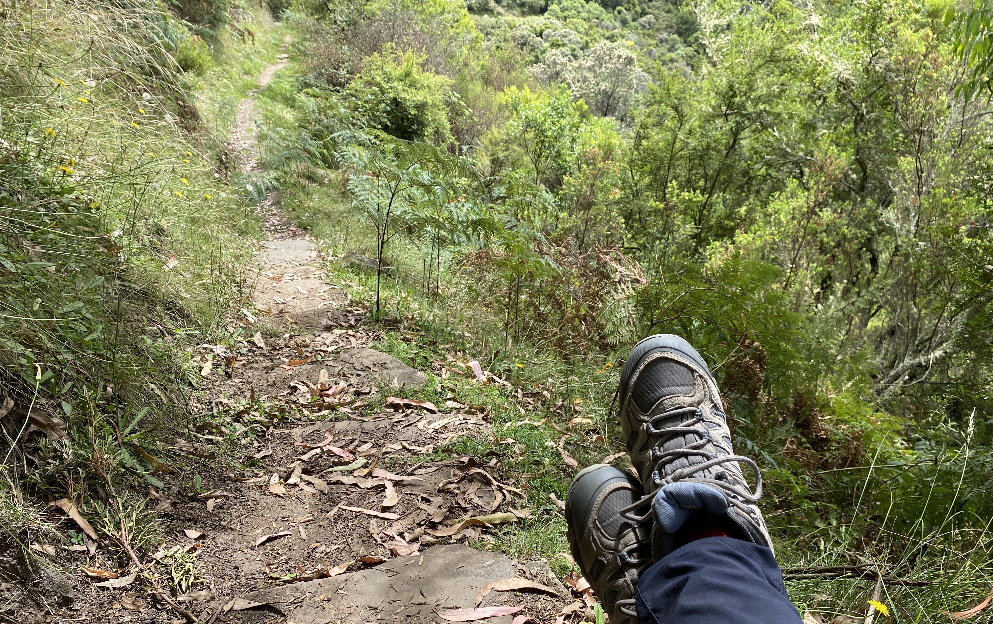
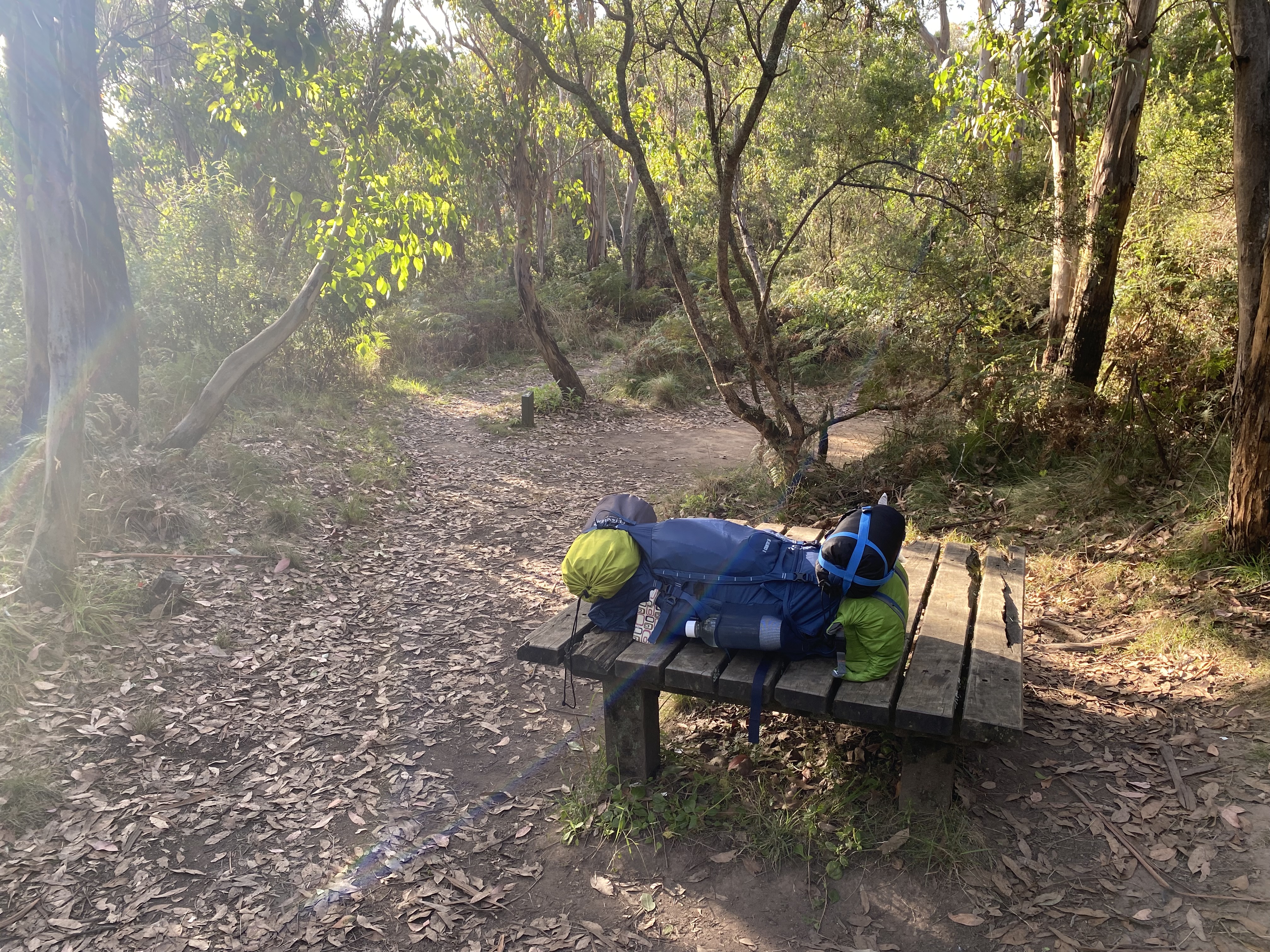
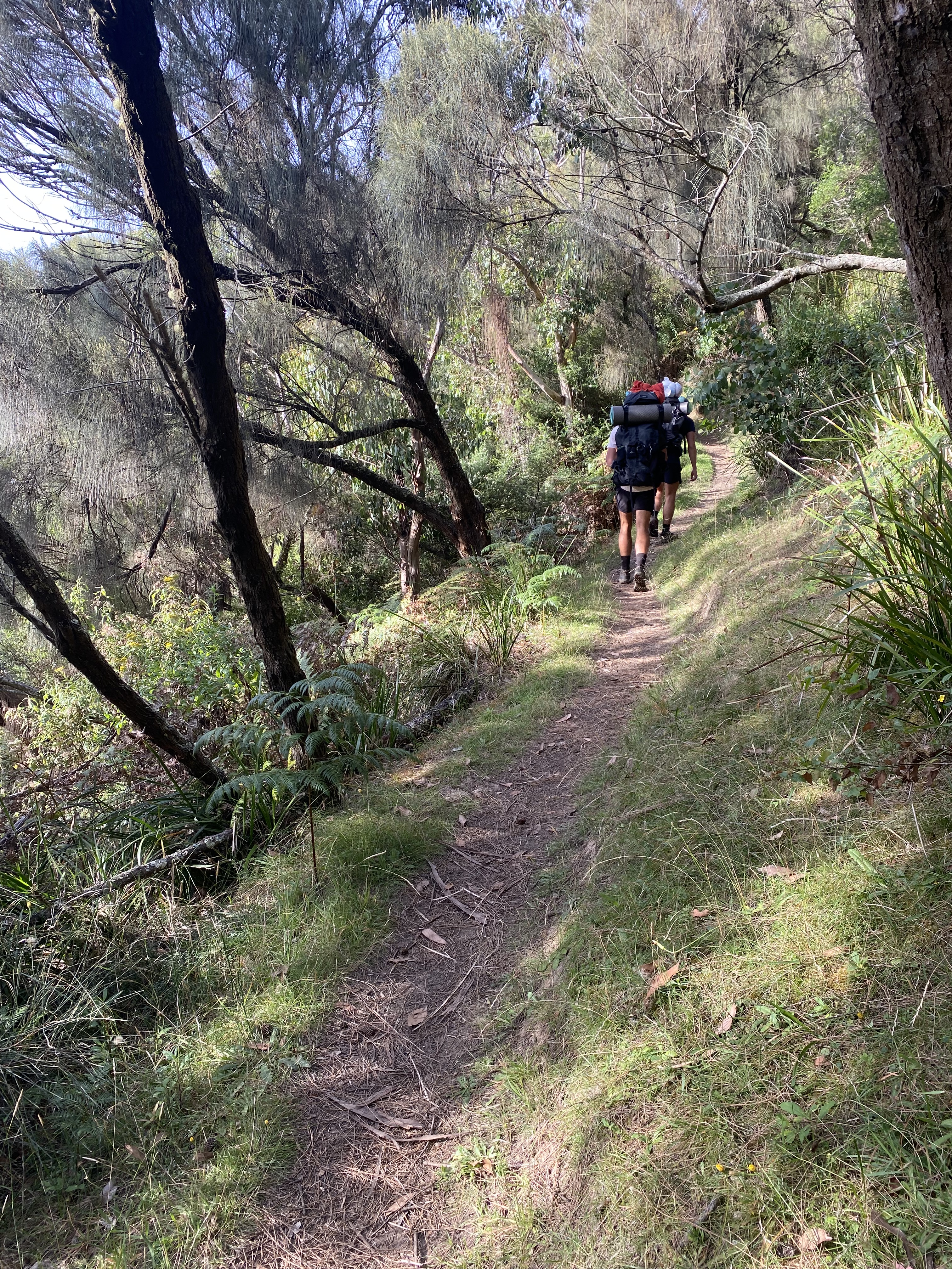
My trek had begun. My pack seemed to take up an inordinate amount of real estate in my consciousness as I set off. I found it rather intrusive as it left very little space for deep introspection. I thought I’d be solving all the problems of the world as I walked. Ha! The pack weighed very heavily on my shoulders – even more than the day before since I’d added water to my pack. I found it difficult to take a proper breath. I kept having to stop and lean forward, hands on my thighs, to relieve the pressure off my shoulders and breathe deeply.
To complicate things further, I couldn’t reach my water bottles since they were in my pack’s side pockets which were behind me, so I had to wait till there was a bench where I could offload my pack, to reach them. I truthfully was not able to get my pack back on, unless it was on something close to the height of a chair. I dared not stop anywhere for a rest unless there was a bench/boulder or stump I could use.
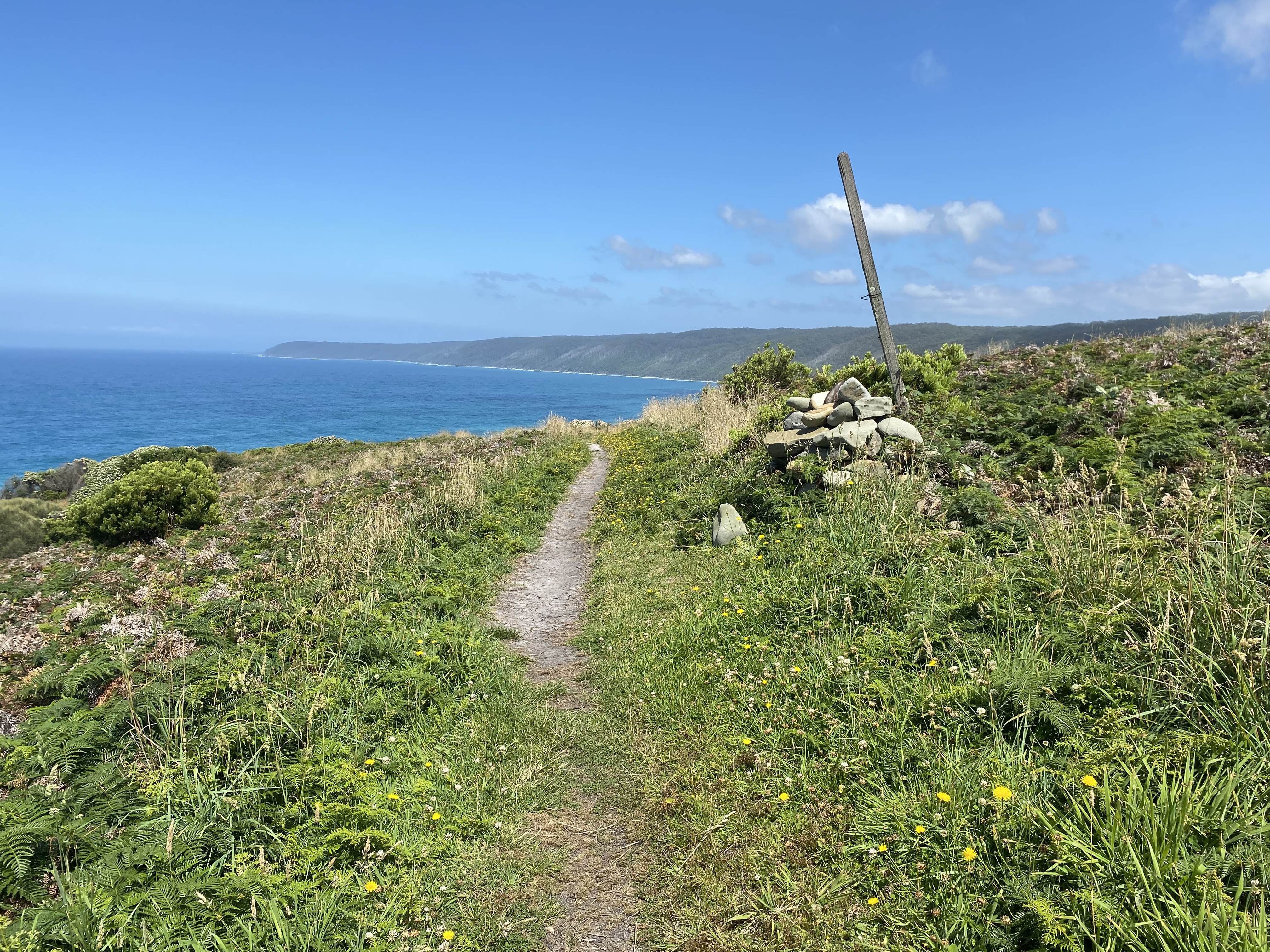
Taking my mind off my discomfort, was the absolute spectacular beauty of my surroundings. I kept stopping to take photos. The flowers. The birds. The phenomenal views. It was gobsmackingly beautiful. Like something out of a storybook.
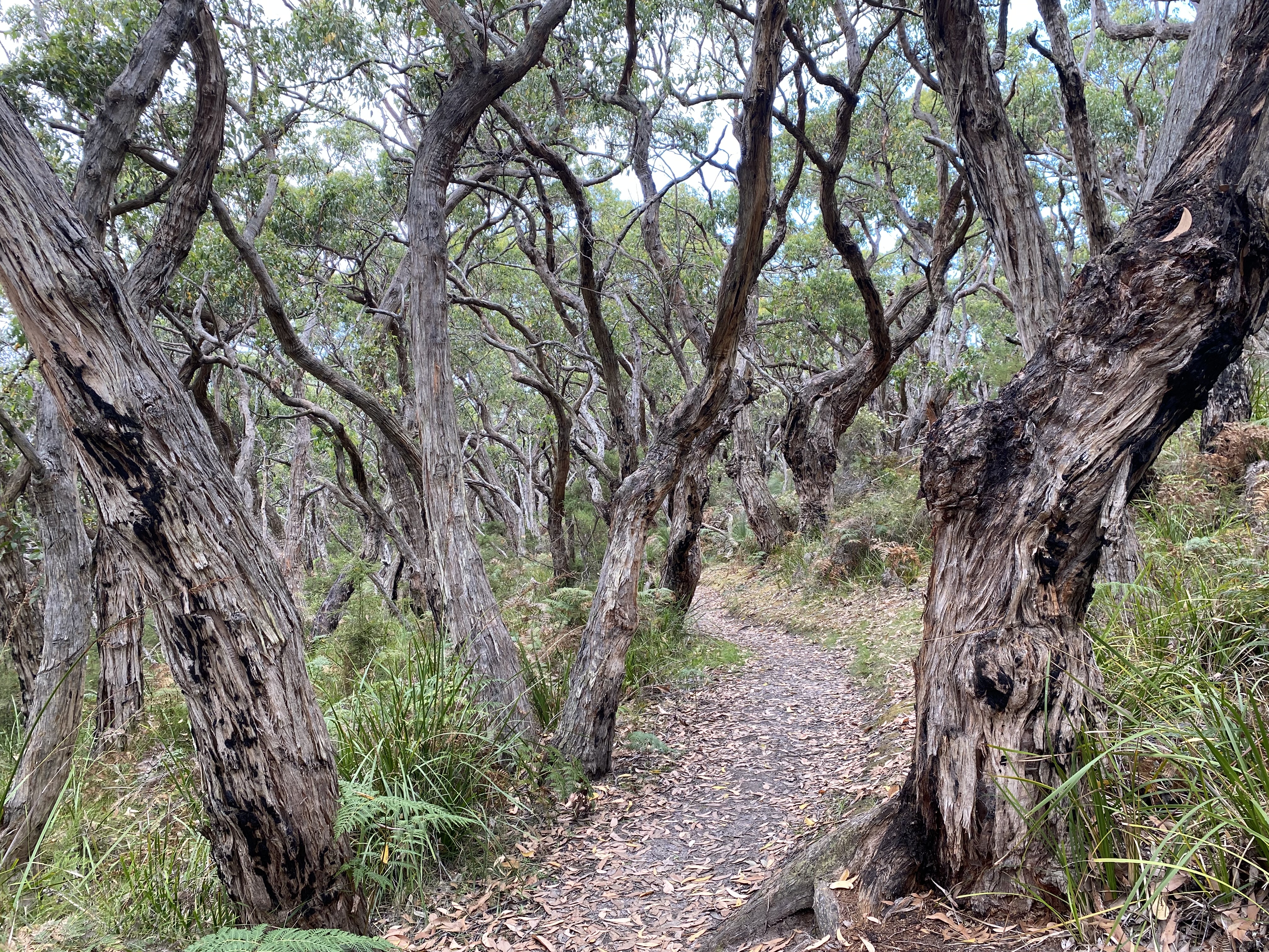
After passing through Marengo Holiday Park, the path led away from civilization. The path was consistently going uphill. It was very hot, and my shirt was wet within an hour. Luckily there was a cool constant breeze flowing in from the ocean when the landscape allowed it.
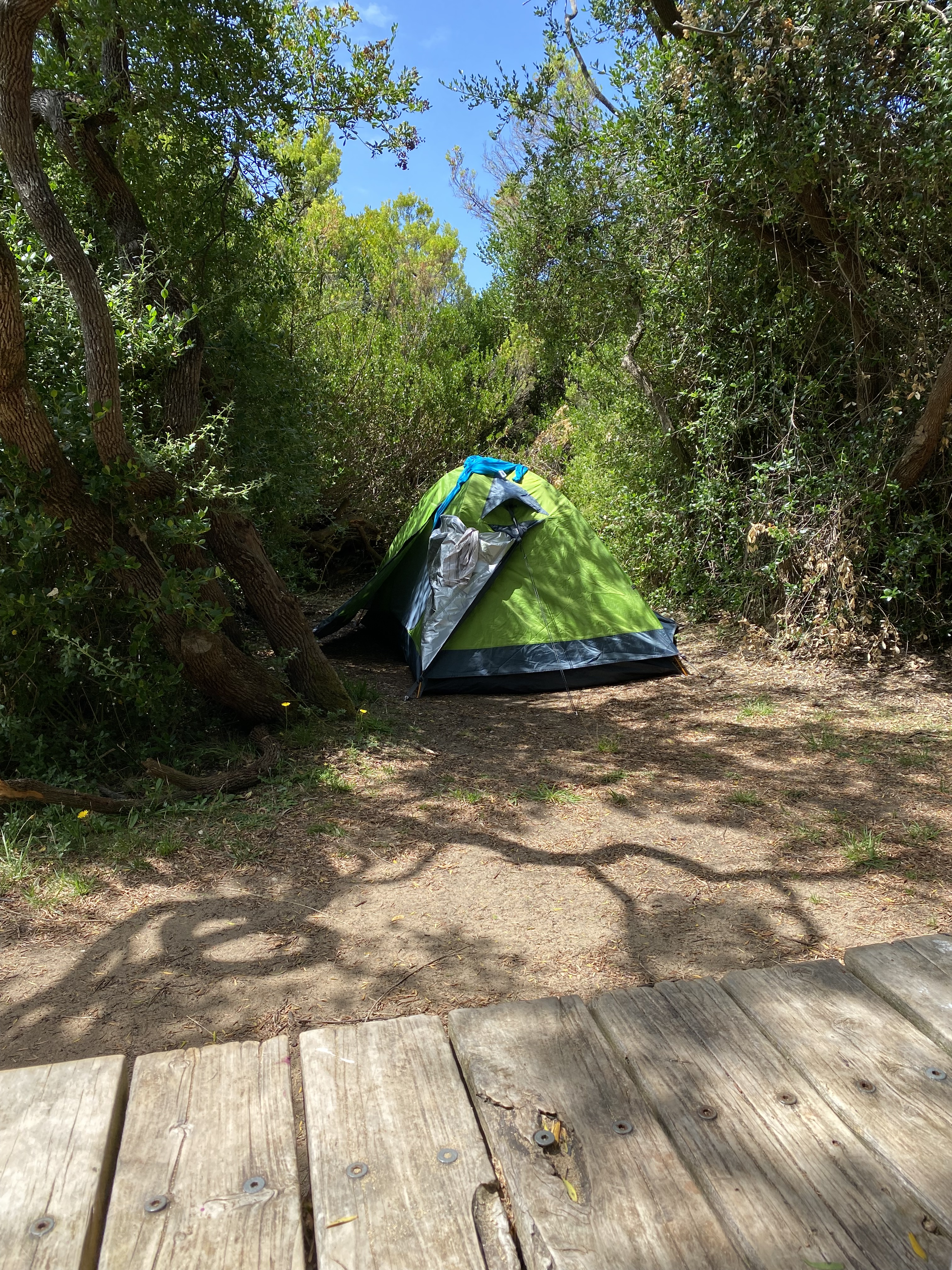
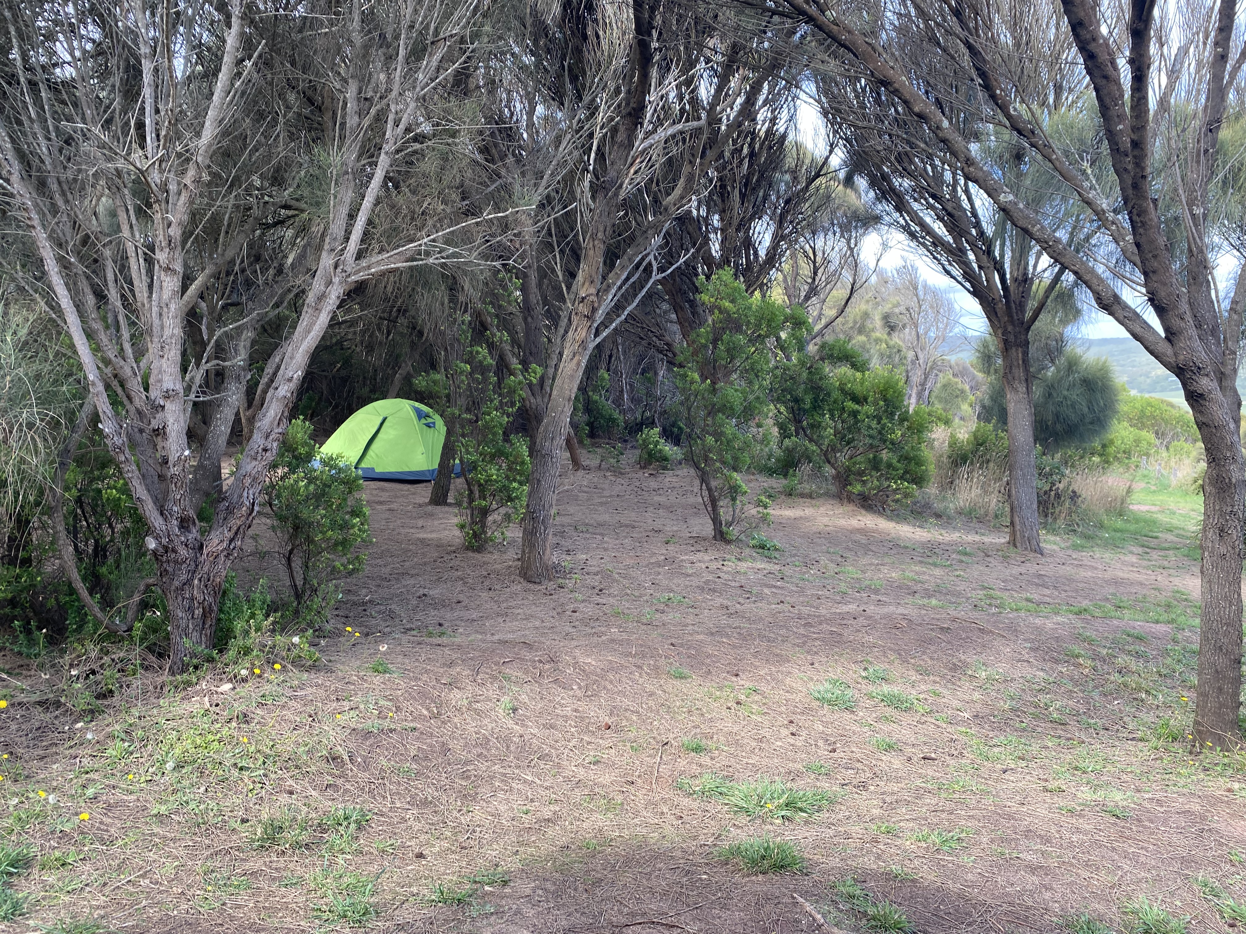
It was with great relief that I walked into Elliot Ridge GOW camp around 1pm. I had expected there to be loads of people before me since the lady in the Information Centre had mentioned that the camps were fully booked, but it was completely empty. I picked campsite number 1 and had a bit of trouble getting my tent up since the ground was completely compacted. I could not find a single rock to bang in my tent pegs. Who ever heard of a forest without rocks? I discovered that it was possible to get pegs into the hard ground by hitting them with a firm stumpy branch and every bit of muscle strength I could muster.
I took a better look around then. The campsite was well laid out. None of the sites were directly underneath any of the big eucalypt trees. Dense forest surrounded the campsites, and low ferns covered the undergrowth. This GOW (like all of them) had a lovely three-walled, sturdy-looking shelter and I set myself up there, to begin boiling water for the next day. There was thankfully plenty of water in the rain tanks. As the hike progressed, I realized that no one else boiled their water, just adding sterilizing drops, but I kept going with my routine despite having those drops in my pack as well. Once I commit to a theme, I need a good reason to stop.
By about 4pm I had understood that I was spending the night there by myself. I was feeling alright about that, though truthfully, did still feel some relief when, at about 4.30pm, a 61-year-old woman (from Holland) and her daughter turned up. They were very fit and had recently completed a triathlon. The mother’s husband had sadly just passed away, and her daughter had wanted to come along with her on this trek to make sure she was alright. We spent a very enjoyable night and morning, chatting away like best friends already. They had been training hard for this trip, hiking long distances with weights and bricks in their packs. Compared to them, I felt rather unprepared.
I mentioned to them that I was having some problems with my pack. In the morning, they kindly checked how I had set it up. They only made one small adjustment, releasing the straps at my shoulders just a little. This levered the top of my pack backward so that more of the weight fell onto my hips. It made a HUGE difference and meant that I could continue on while still being able to breathe properly. They also pointed out that my pack was too short for my torso. At the longest setting, the hip strap, went around my waist, just skimming the top part of my pelvis. It should have sat snugly around my hips.
This could have been rather a big deal in the long term. It made the pack far from ideal since tightening that very important strap just squeezed my stomach. In the end, I resigned myself to having an ill-fitting pack. Once I stopped fighting it, my body got used to it.


Day 2. Elliot Ridge to Blanket Bay. Guidebook distance: 12km. Smartwatch distance: 19.5km. Elevation: 590m. 9am to 1pm
The night had been very cold. I deeply regretted not bringing my thermals to sleep in. I had been awake a lot during the night, some of the time shivering from the cold. The koalas made some very interesting noises and I also kept waking up thinking there was a storm coming – the wind was howling like a freight train through the trees. There was no storm and, when I poked my head out of my tent in the morning, everything was peaceful and calm.
I was happy to move onwards again. I’d washed a t-shirt and some socks the night before, but they had not dried during the night, so I attached them to the outside of my pack. My morning eyes were really puffy and continued to look like that for the first few hours of every day, from that day onwards. In hindsight, I think it may have been a combination of dehydration and poor sleep. The puffy-eyed monster look went completely away as soon as I finished the trek. Other than that, my body was coping well. I had a couple of blisters but nothing seriously amiss.
The two women departed before me since they wanted to complete two camp hops the next day, to arrive in Cape Otway before nightfall. I was heading to the next camp at Blanket Bay. They were made of tough stuff. I overtook them around lunchtime and met up with them again after I had set up camp at Blanket Bay.
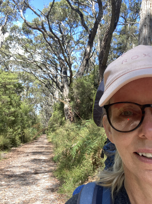
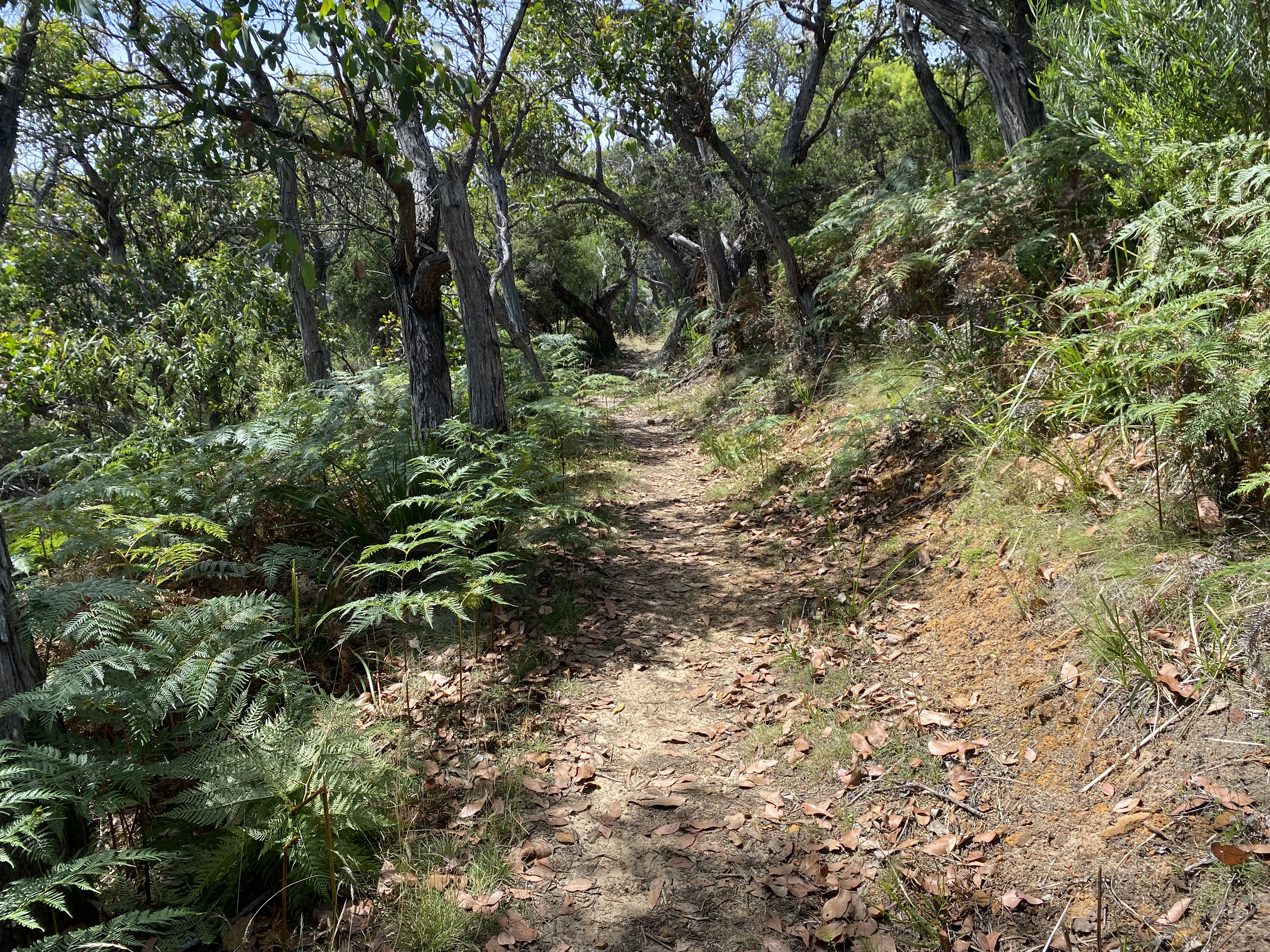
The day’s walking was mostly inland; a wide trail meandering through dense forest on wide trails. There were a lot of strategically placed tree stumps and a few benches, so I had many opportunities to stop for a drink.
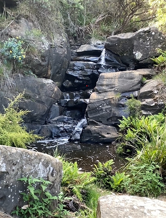
Blanket Bay was spectacular. It is a popular tourist spot accessible by 4WD, so there were lots of campers and tents in the main camping area. The gorgeous hike-in GOW camp had plenty of spots to choose from. I selected a nice grassy tent site and my tent pegs went in with ease. The beach was just a short distance away, with an inland waterfall less than 10 meters away from my tent.
I spent the afternoon happily exploring the beach, and getting bitten by sandflies. I must be allergic to sandflies as the bites on my ankles and feet swelled up quite badly and were incredibly itchy, bothering me a lot over the next five days. Thankfully, I’d bought some ointment that was an antiseptic, anti-itch, and pain relief in one. Best thing I brought with me on that trip.

Day 3. Blanket Bay to Cape Otway. Guidebook distance: 11km. Smartwatch distance: 17.2km. Elevation: 250m. 9am to 1pm
When I woke naturally, I took my time getting ready. It was such a beautiful spot and I knew I had more than enough time to get to my next destination. Again, I reflected that I could have walked a lot longer each day and skipped camps. But in hindsight, those people I met on the hike who were skipping campsites, looked a bit stressed and flustered. I really appreciated the amount of daylight I had at the end of the day and was happy each time I reached my day’s destination, feeling like I’d walked far enough. I was glad I was not in a hurry and I allowed myself to stop and relax when I wanted to.
My legs felt a bit heavy and sluggish that morning, but my pack felt a bit more manageable (being two meals lighter). It took me a long time to break camp, but once I got going, I was excited about whatever lay ahead.
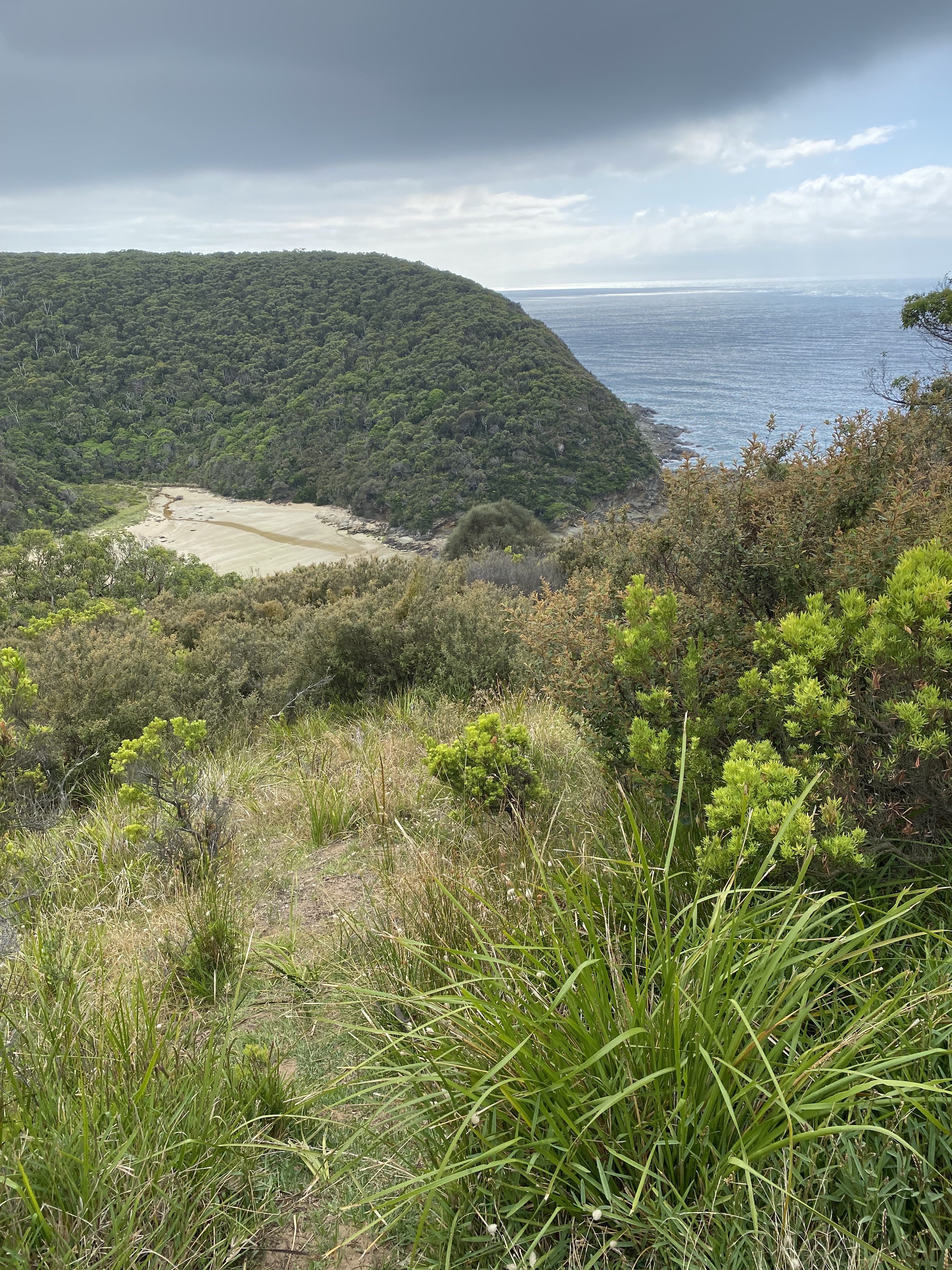
To get onto the beach at Parker Inlet, I had to scramble down a steep gully, before climbing back up the other side. The ‘up’ bit was not so easy with my heavy pack, and while trying to rise from a crouching position, I felt a ‘twinge’ in my right knee. It hurt a bit afterward and kept clicking for the next few days. My right hip was also starting to give me a bit of strife. I was starting to limp a little. I knew that symmetry and good gait were important to avoid other problems, so I tried to walk normally. I did my best to ‘pretend’ away the pain by thinking about other things and alternating this with periods of really focusing so deeply on the pain that it became a thing I could detach from. Not an easy process to explain here, but it worked for me. *Obviously the pain was not that bad, or it wouldn’t have worked.
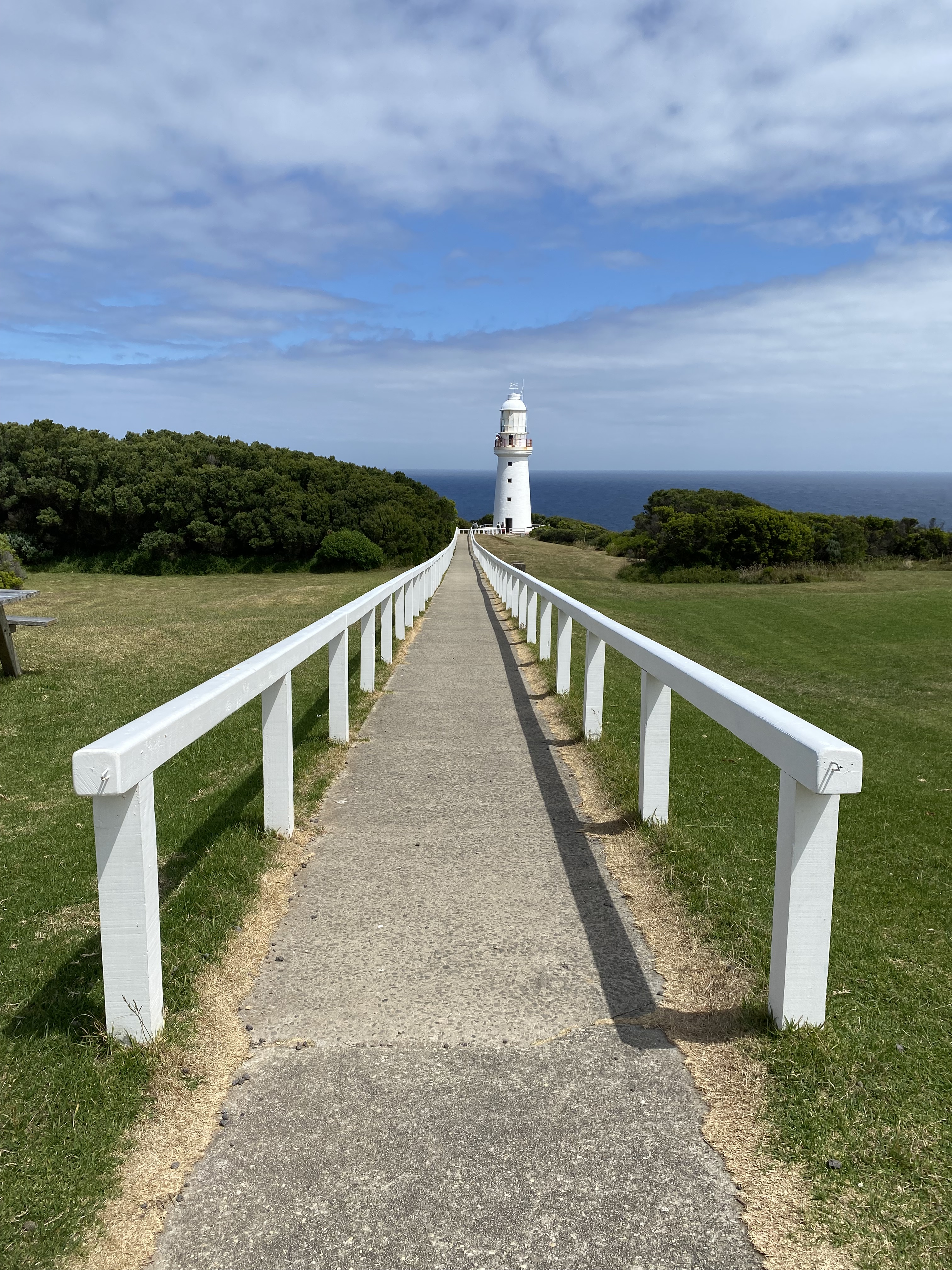
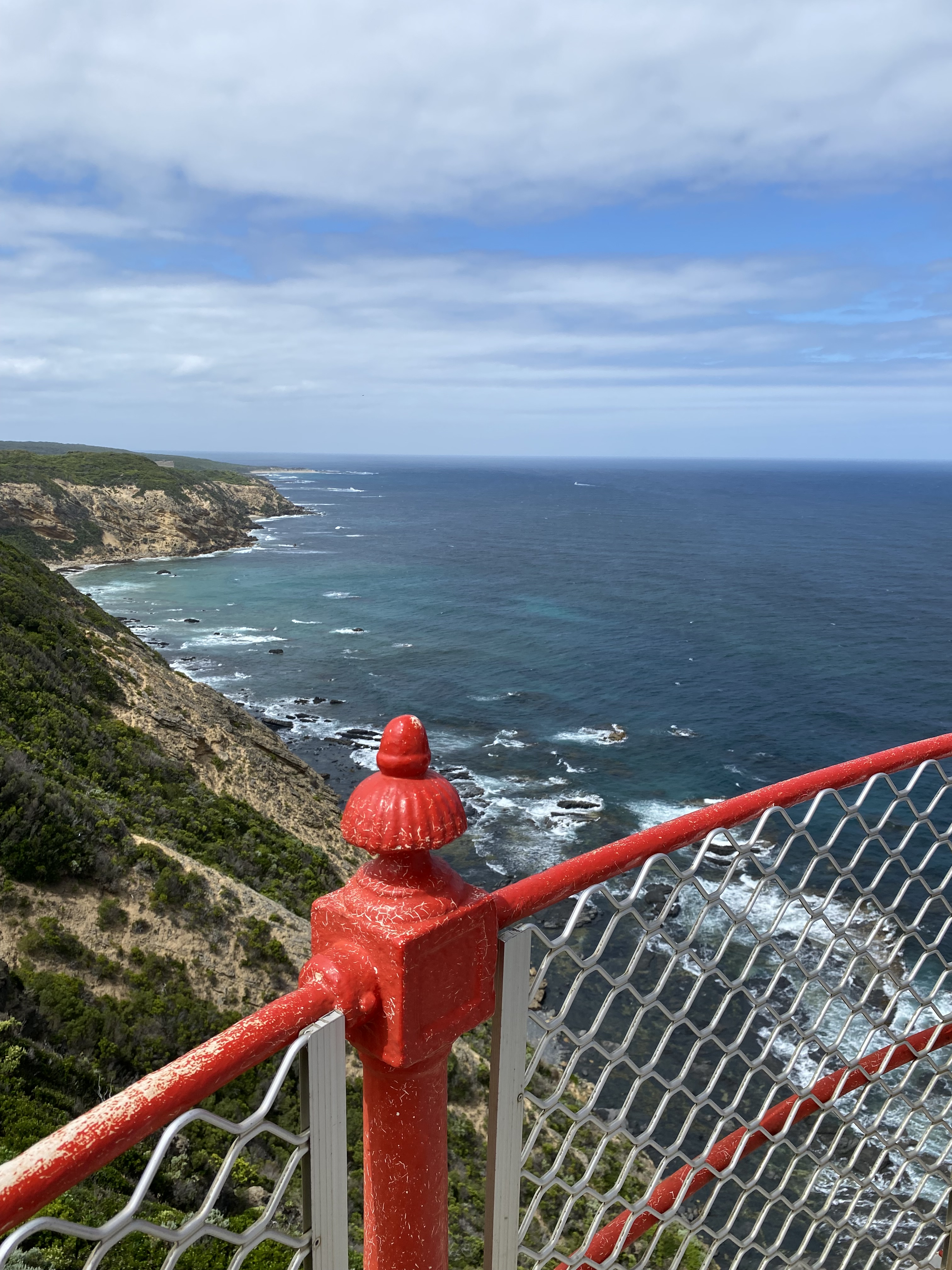
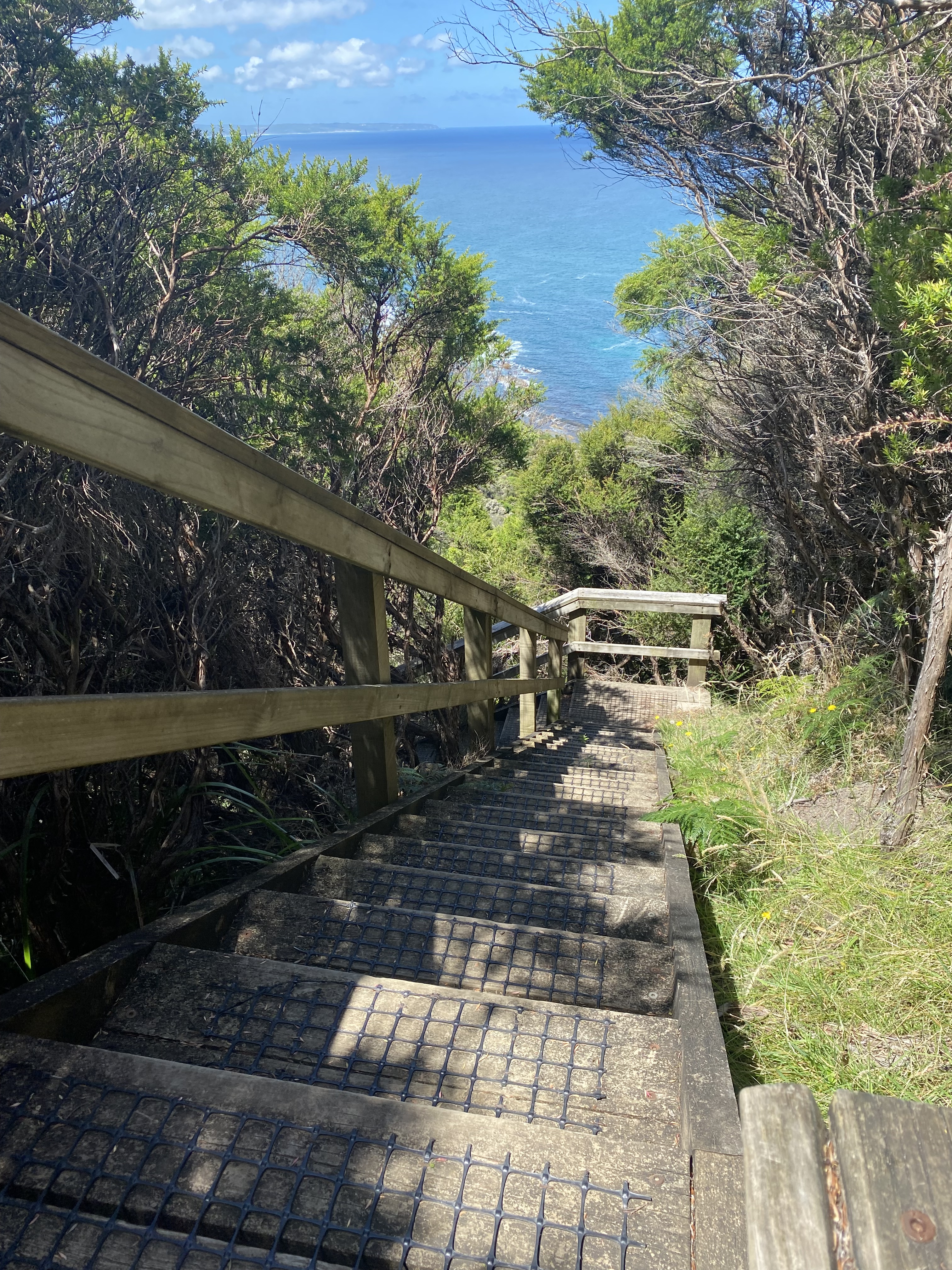
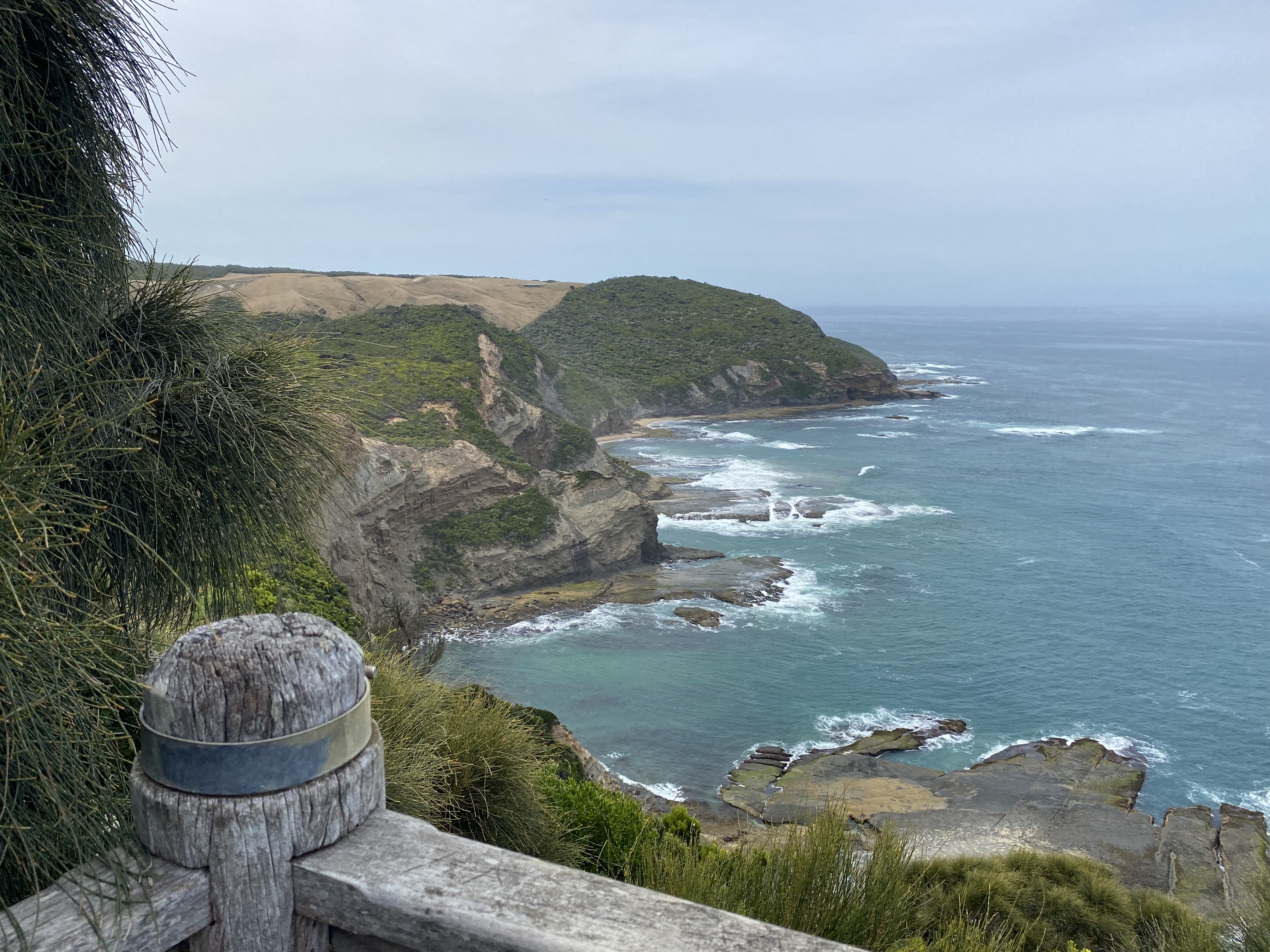
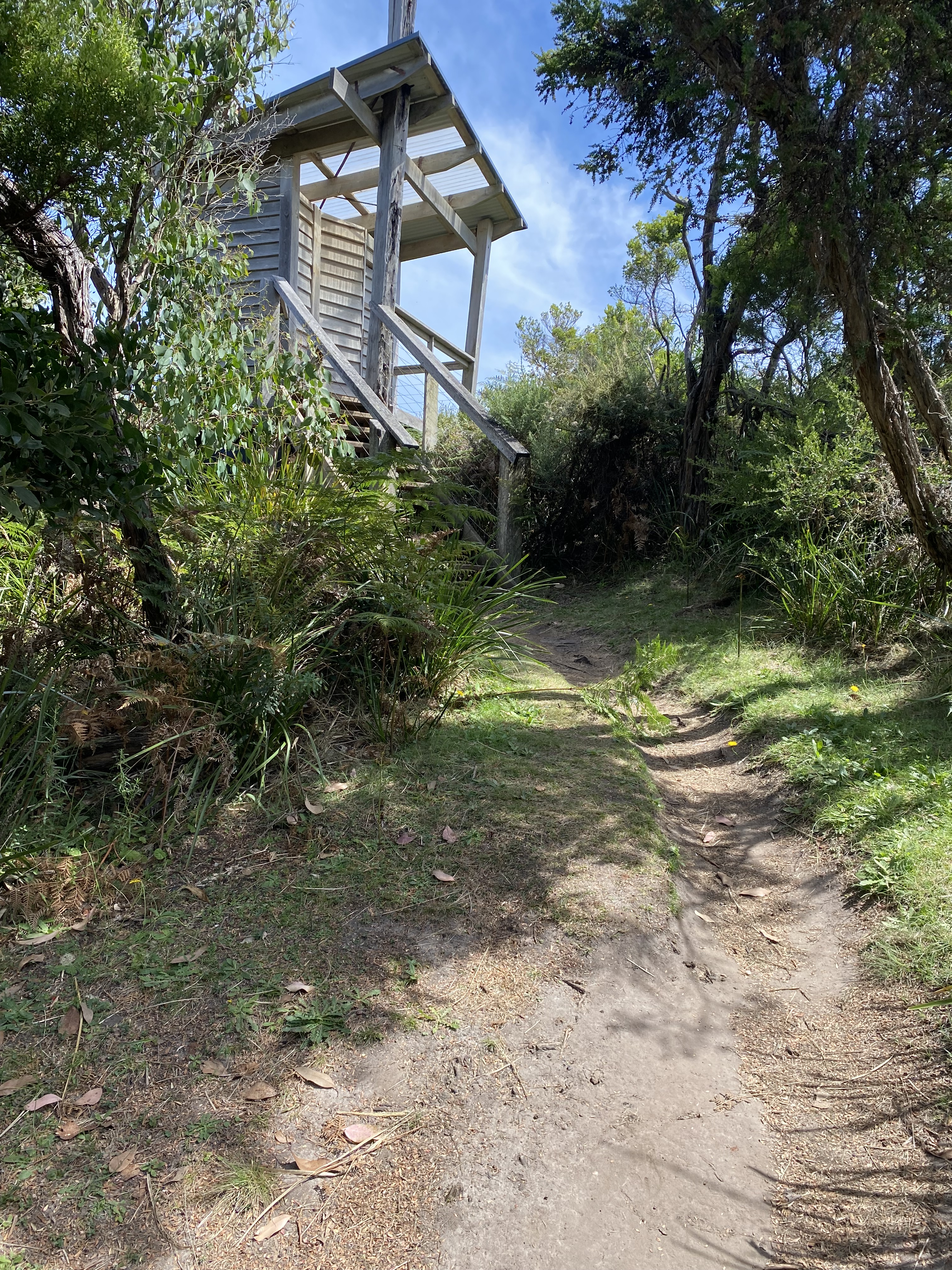
Crossing the inlet was easy as it was just past low tide. The hike up from the inlet however was quite a brutal climb up a long series of stone steps. Once I’d reached the top, the trail continued along the coastline. I could see the Otway Lighthouse getting closer and close as I walked. Having that known endpoint in sight did make me more tired than I otherwise might have been, had I not been able to see how far I still had to go. Funny how the mind works.
300 meters past the Lighthouse and carpark, I walked into the GOW hikers camp and found that I was completely on my own. It was a sandy camp and very easy to set up my tent. I then put some things in a small bag and left my big pack in my tent, heading back towards the Lighthouse to explore.
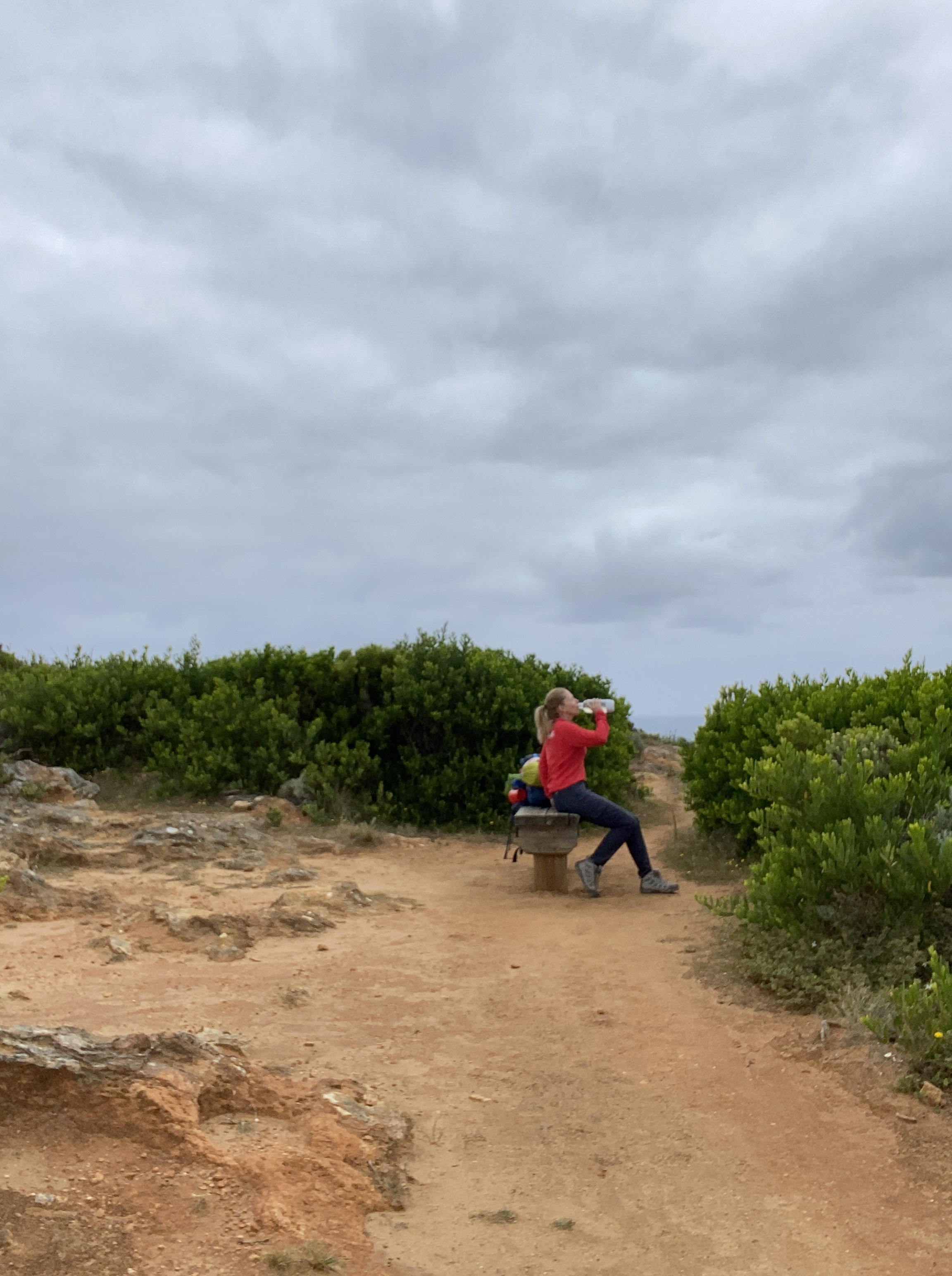
I felt so happy in my own space. I had no real desire to speak to anyone, though was surprisingly happy when a lady I met in the café at the Otway Lighthouse had lots of questions about my solo hiking expedition. This would be my only opportunity to buy anything along the way, so I bought myself a GF cake and coffee. I sat outside on a bench, enjoying every mouthful, watching people carry on with their lives. I felt happily separate from everyone; the toddler having a tantrum, the couple taking countless selfies of their new engagement rings, and the groups of German, Swedish, and Indian tourists chatting excitedly. I enjoyed the feeling of being almost invisible. I wrote in my diary as I sat there: “I’m so good on my own. I’m so peaceful and at ease. I feel so relaxed. My face is sore from smiling all the time. I’m genuinely, wholeheartedly in my happy place”.
That night, the wind and the ocean were incredibly noisy. I admit to feeling initially a little on edge. It was the first night, that there would be nobody within ‘helping’ distance. However, once I was tucked safely inside my tent, any anxiety seemed to drift away. Those four ‘walls’ of my tent, seemed to create a safe little oasis within the madness that I could hear playing out outside.
By this time, I’d learned to put on every item of clothing I owned before going to sleep. Still, consistently, 4am seemed to be the time when my body temperature dropped the most and I started to shiver.


Day 4. Cape Otway to Aire River.Guidebook distance: 10km. Smartwatch distance: 16.9km. Elevation 340m. 9am to 12.30pm.
Again, packing up camp seemed to take longer than it should but it didn’t matter as I had plenty of time. The first bit of the walk each day always felt so good to me.
The Otway Cemetery was not far from the campsite, and I really enjoyed exploring the small, though rather sad historical site.
This day of the hike was the easiest day by far. My pack was again lighter and I had started carrying only 1.5 liters of water, which seemed to be about what I needed for the distance I had to travel. It was a cool and overcast day and while it threatened to rain, I got no more than a slight drizzle that barely covered my skin.
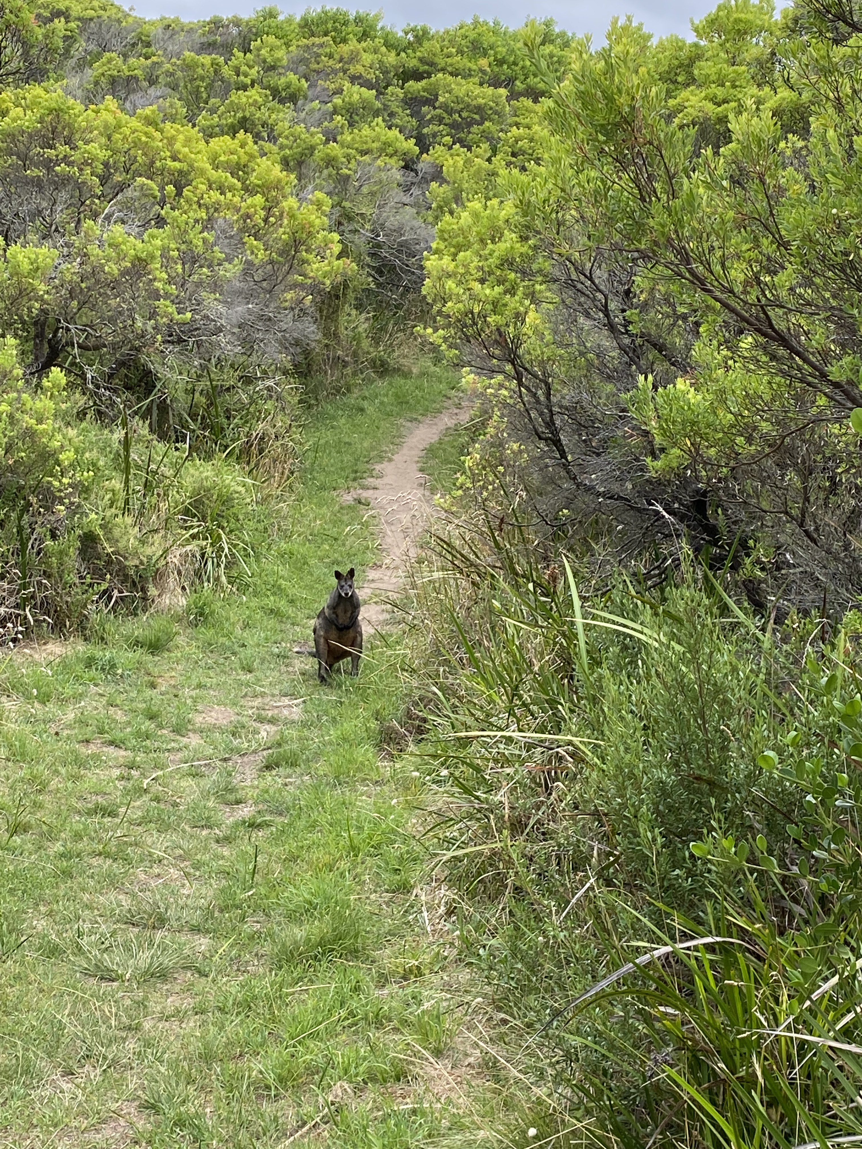
The track was wide and sandy, and there were many places to stop and rest and take photos. The cliff-top views were spectacular. The little nooks and crannies made by the resident wallabies and kangaroos in the bushes were a curious distraction, and I met quite a few animals along the way.
When I saw my destination in the distance, I was truly disappointed. I was not ready to stop.
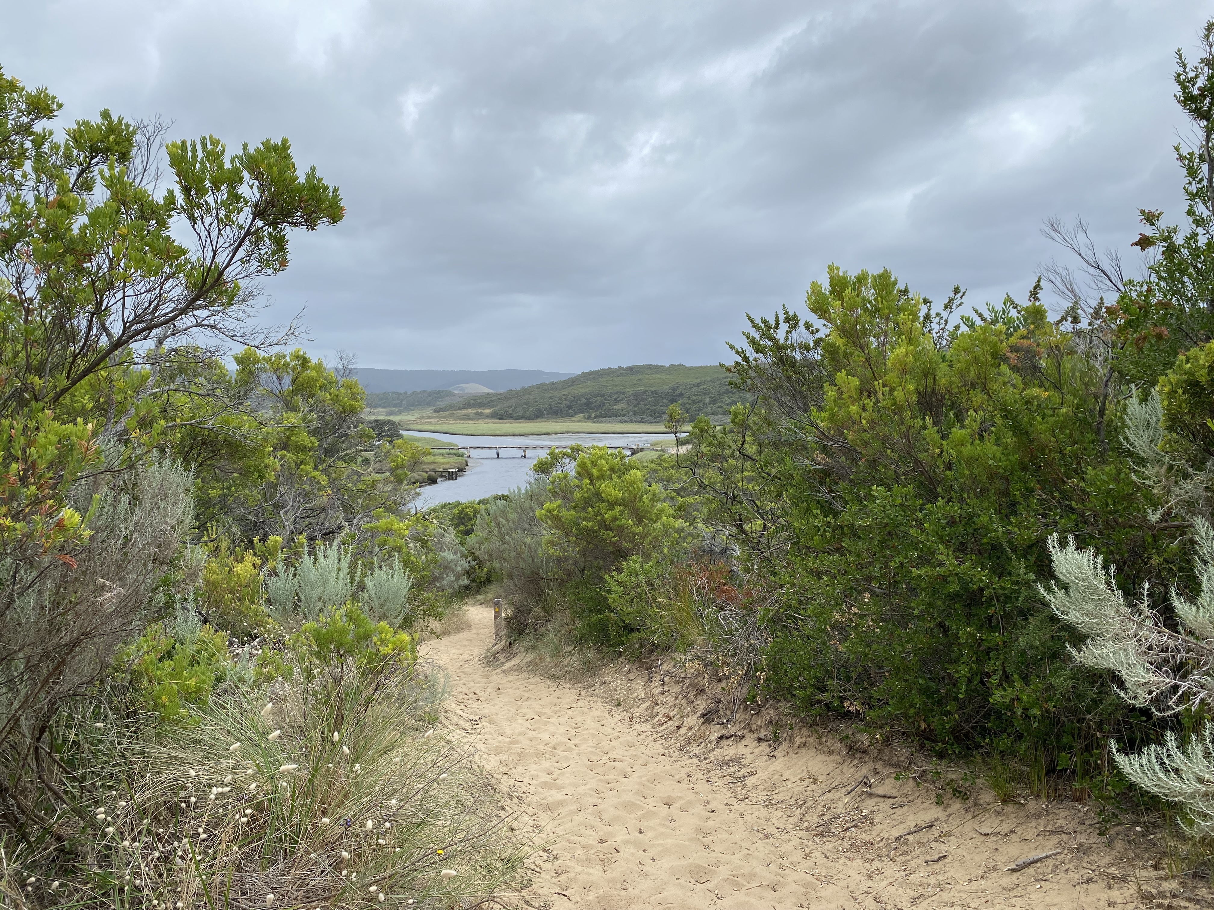
Approaching Aire River, I reflected that I had not seen another human for about 35 hours. When I saw a mother and her two toddlers crossing the bridge over the river, I realized that I was about to pass them by. As she came nearer, I had the biggest smile plastered on my face. It came as such a shock when she didn’t look in my direction at all. She was within a meter and completely ignored me, and there was nobody else around. Funny how that was such a surprise. I reflected that she, most likely, was not having a very good day and I wished her well… inside my head.
There were day campers along the river, but the GOW camp was a little further up. There was not a single soul there. I set up my tent, nestled in a little clearing that barely fitted my tent. I sat on a little purpose-built platform, warming myself in the sun and writing in my diary when a day camper wandered up there. We chatted for a while, and he asked if I’d like to join him for dinner. Saying that I had plenty of food of my own, I happily agreed to come down at 5pm, for a chat.
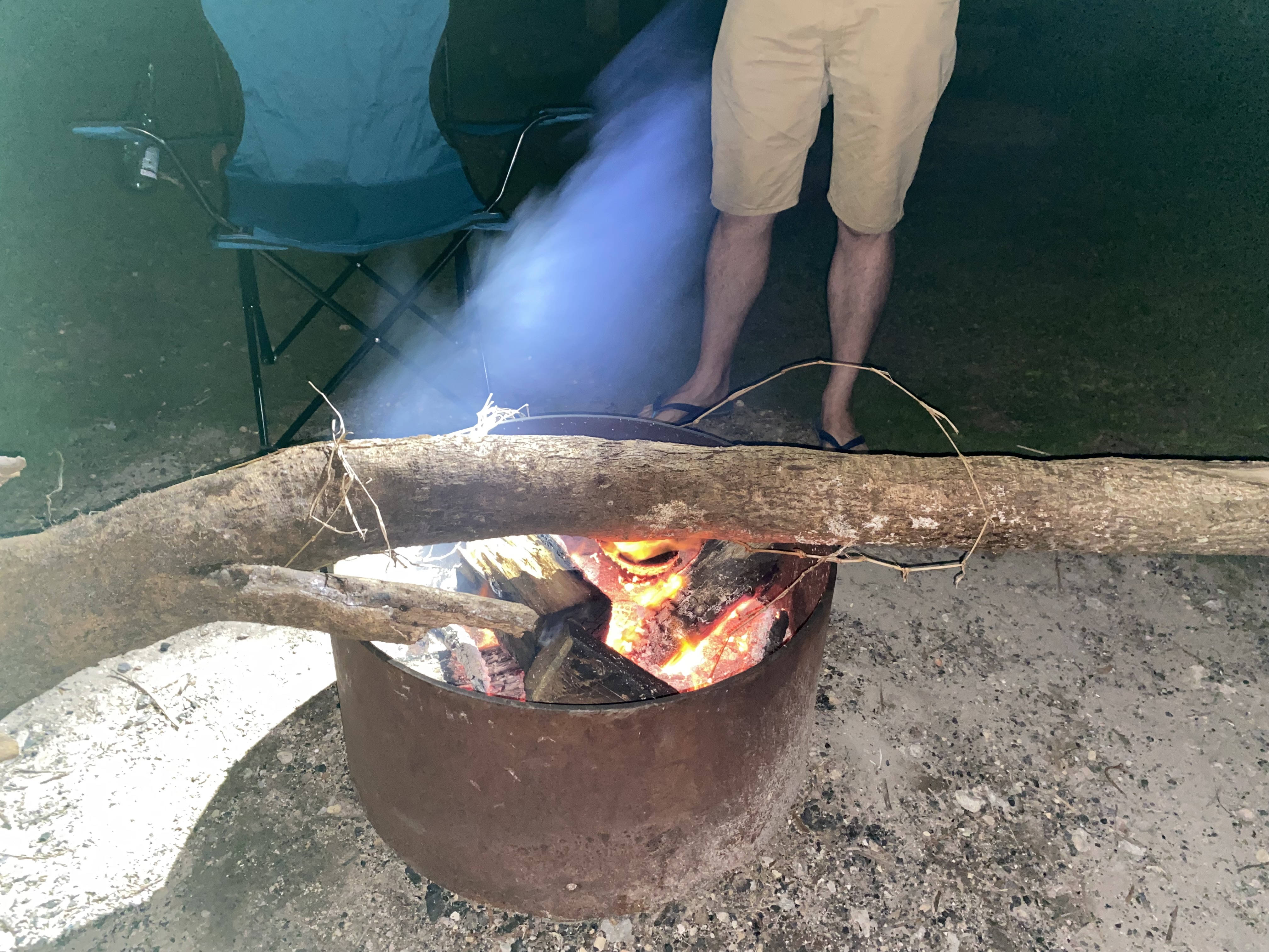
A very enjoyable night was spent with Chris, the accounting analyst from Melbourne, and Tom, the 24-year-old French backpacker who had just cycled from Geelong to Aire River with the contents of a 20kg pack distributed over his small bicycle. Chris made one of the coldest log fires in the history of log fires, but I would still have given him an A+ for effort. He showed Tom and me how to use the Southern Cross constellation – clearly visible that night – to find due South. Very cool.
I went to my tent at about 10pm, trembling like I had never trembled before. It was so cold. It took a long time for me to get my core temperature back up.


Day 5. Aire River to Johanna Beach. Guidebook distance: 13km. Smartwatch distance: 19.3km. Elevation 435m. 8.30am to 2pm.
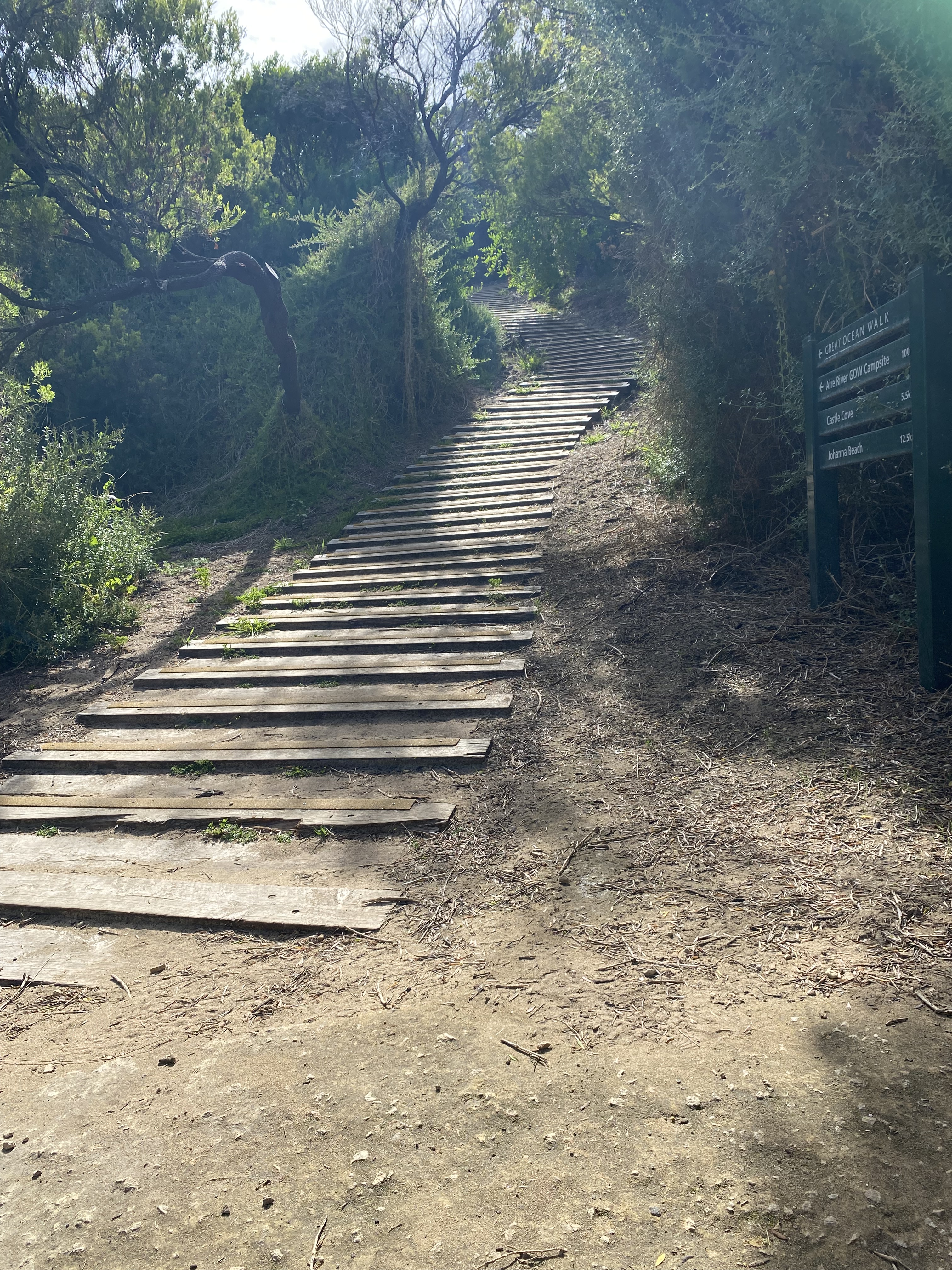
In the morning, I went down to say goodbye to my new friends before heading back uphill to get back on the Great Ocean Walk track. I was aware that I would need to time my hike around tide times, for the Jonanna beach crossing.
The first 5km were pretty easy and I covered that distance very quickly. There were beautiful views galore. It was a little overcast which made it nice and cool for hiking. When I got to Castle Cove, I saw two people who had been 4WD camping near Chris’ campsite, and they looked very surprised when they saw me there. It seemed like they were not expecting me to have arrived at that place already.
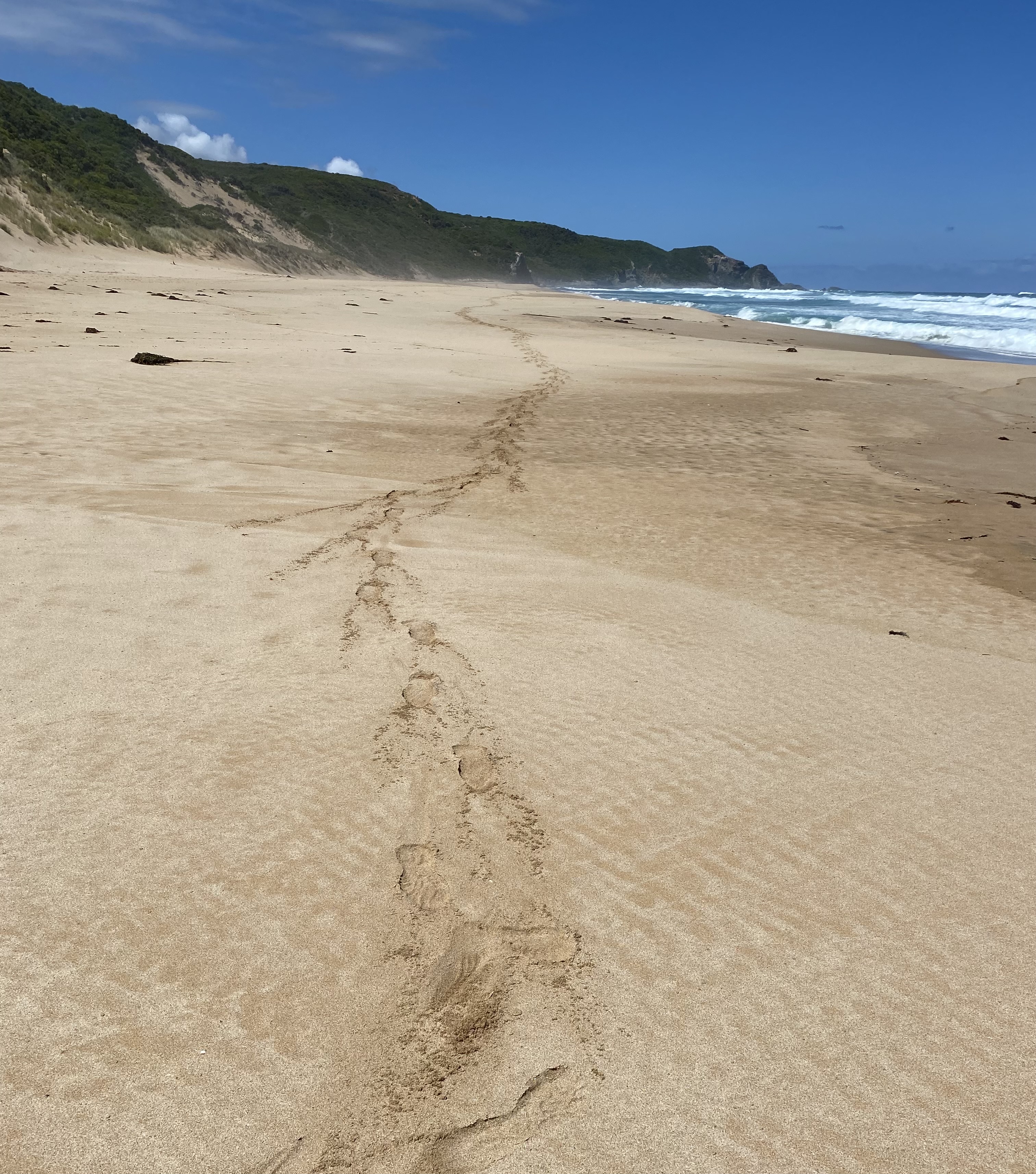
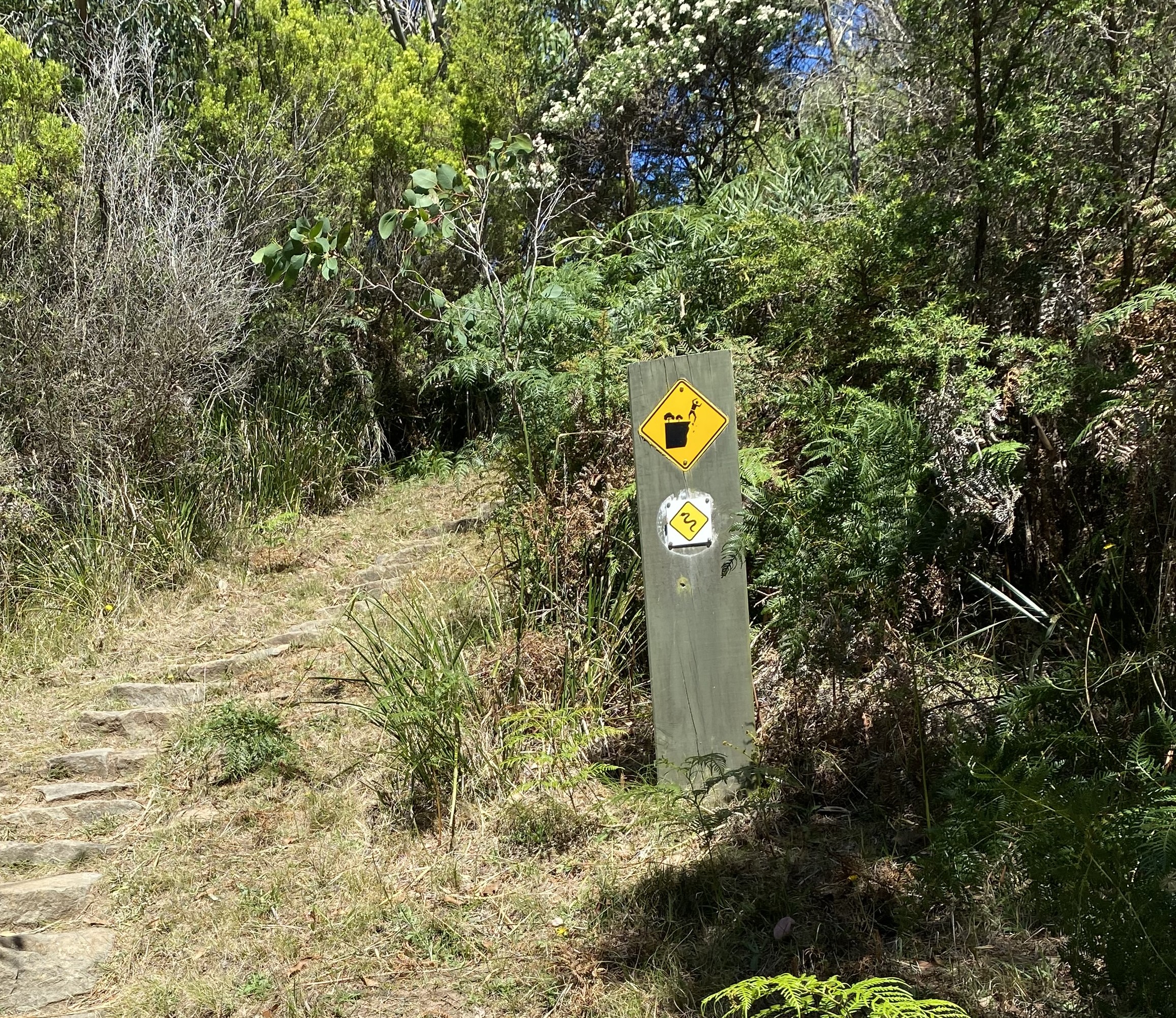
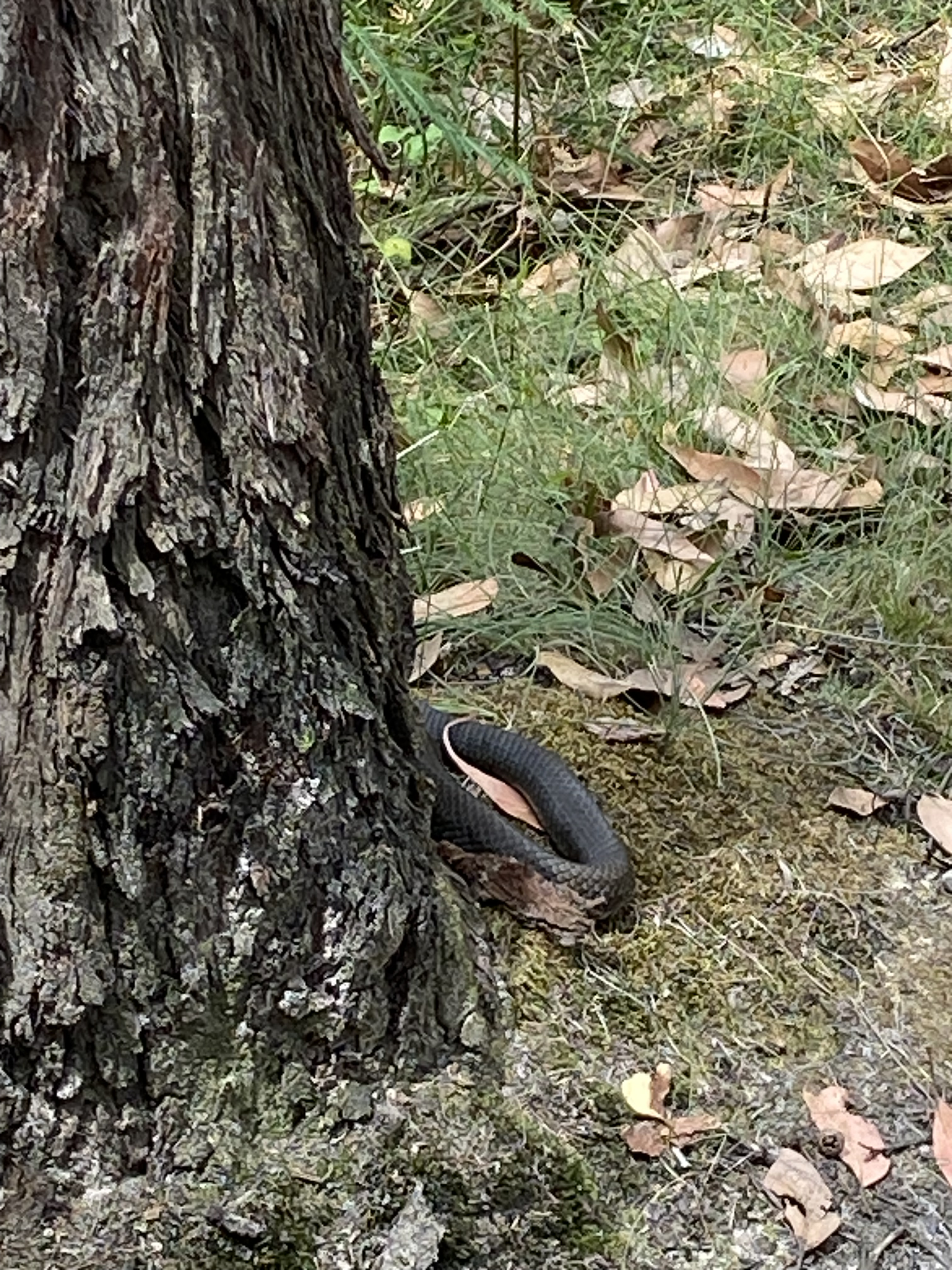
I was paying very close attention to the likelihood of snakes. I knew that they would be hard to spot in the bushes and grass alongside the narrow paths. Luckily I’d been paying attention, since, at about midday, I spotted a rather large black/grey and white striped snake a little further up the path. I assumed it was a tiger snake since I knew they lived in these southern parts of Australia. It did not look happy to see me and it was very much aware of my presence. I suspect it was smelling (tasting) my fear on its tongue that was darting in and out. I did, what any good city slicker would do, and brought out my phone to take a photo and video. I finally started to stomp my feet and clap my hands, till it did what I’d hoped it would do, and slid off into the bushes.
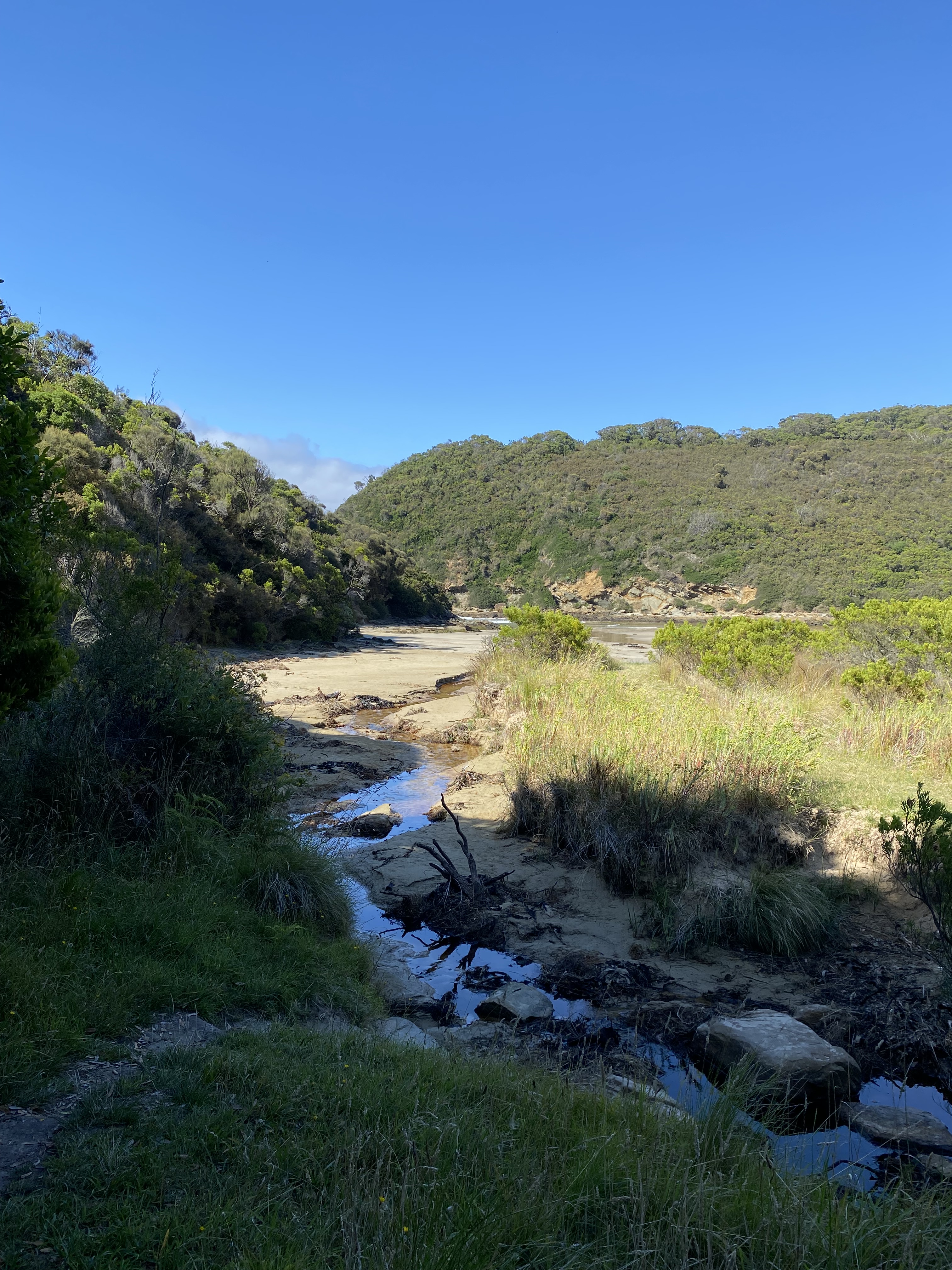
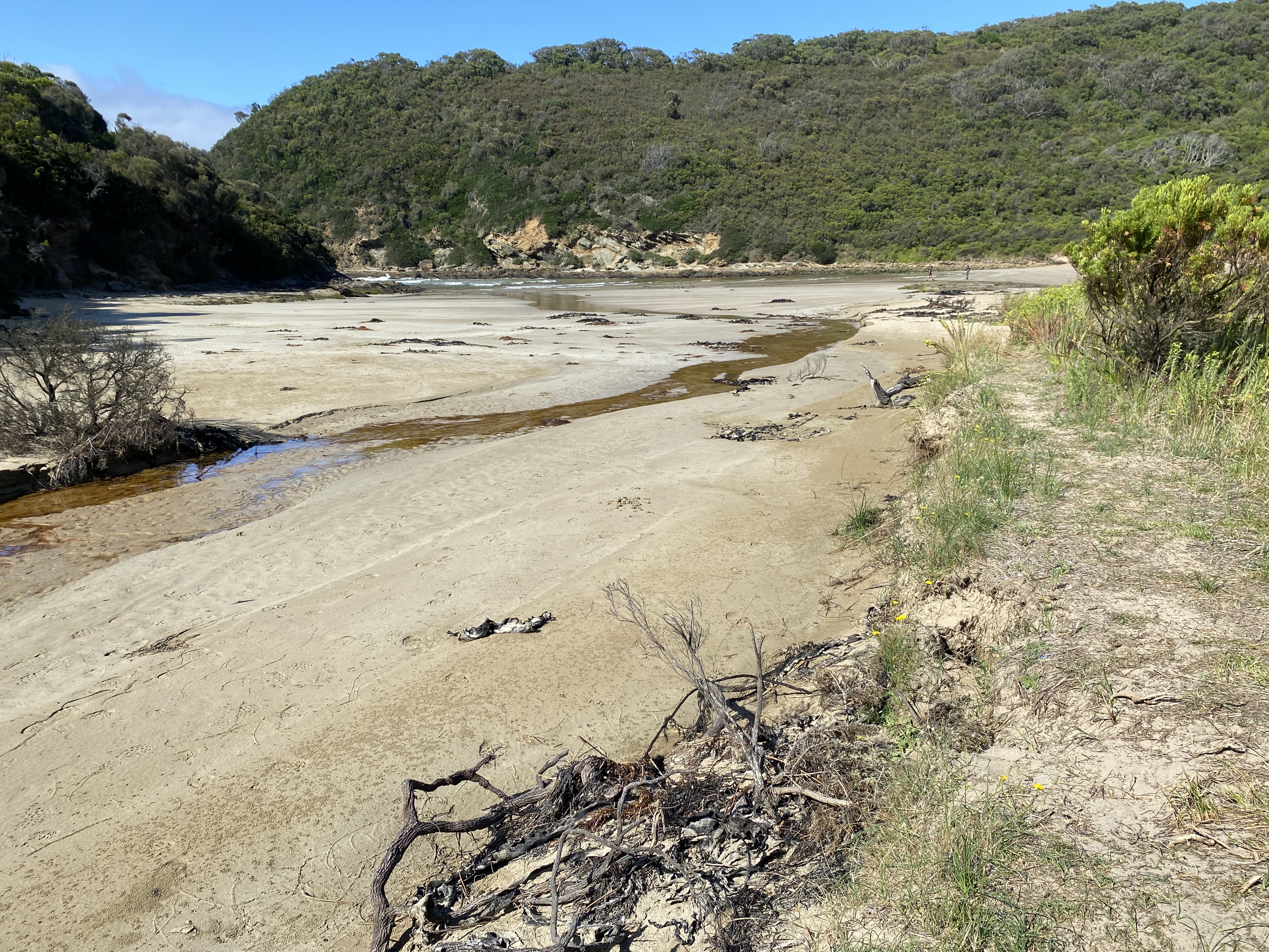
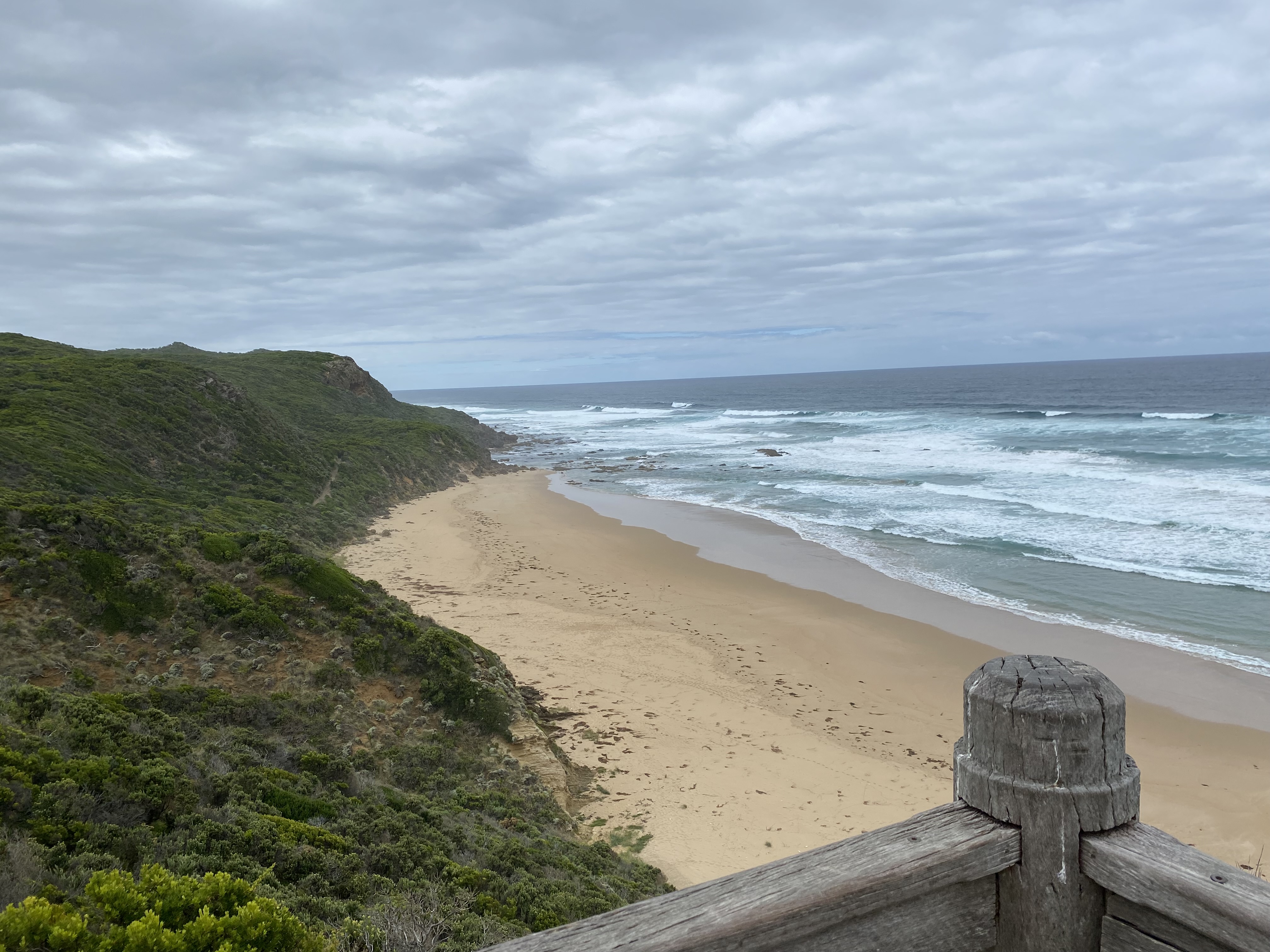
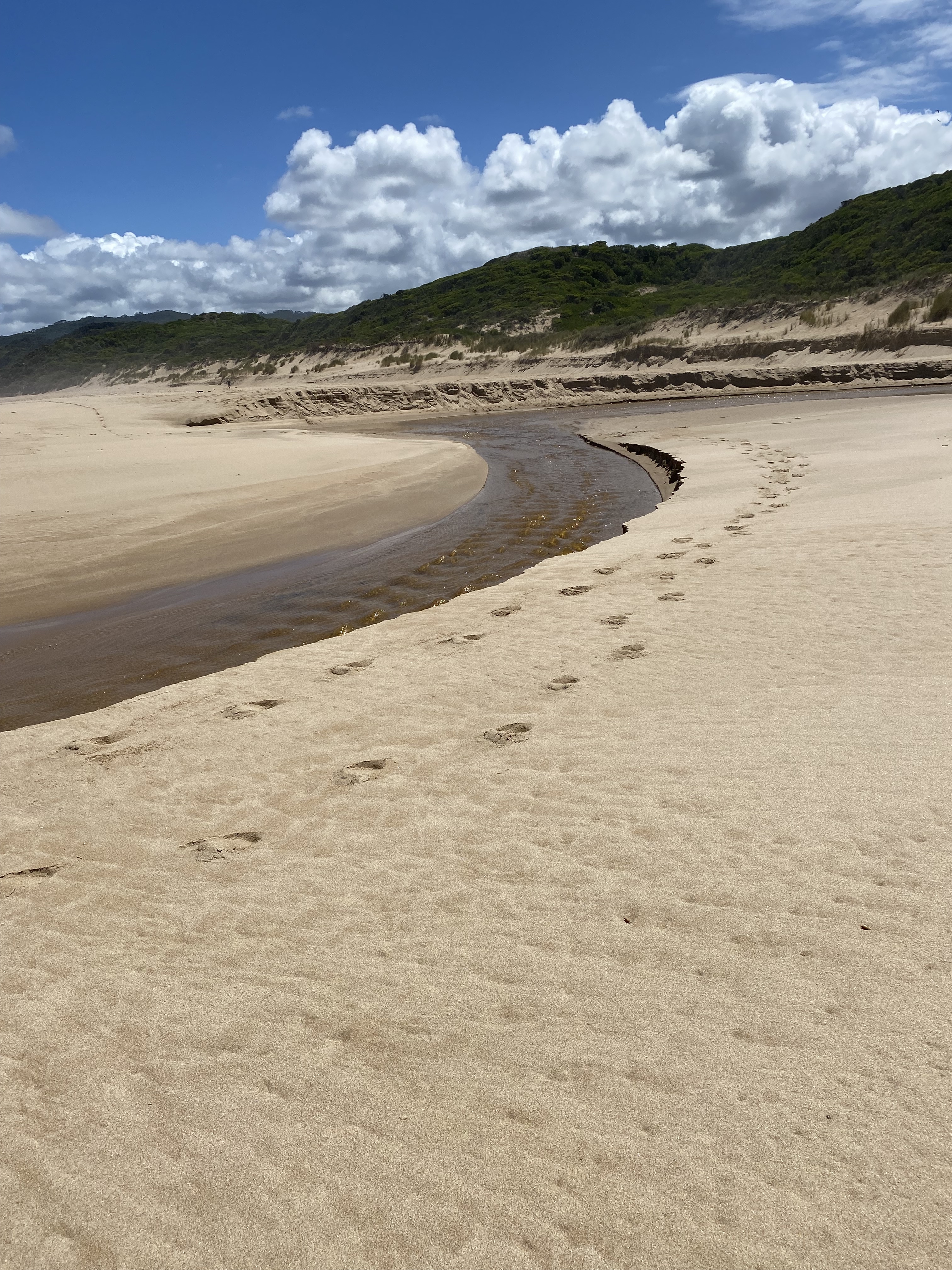
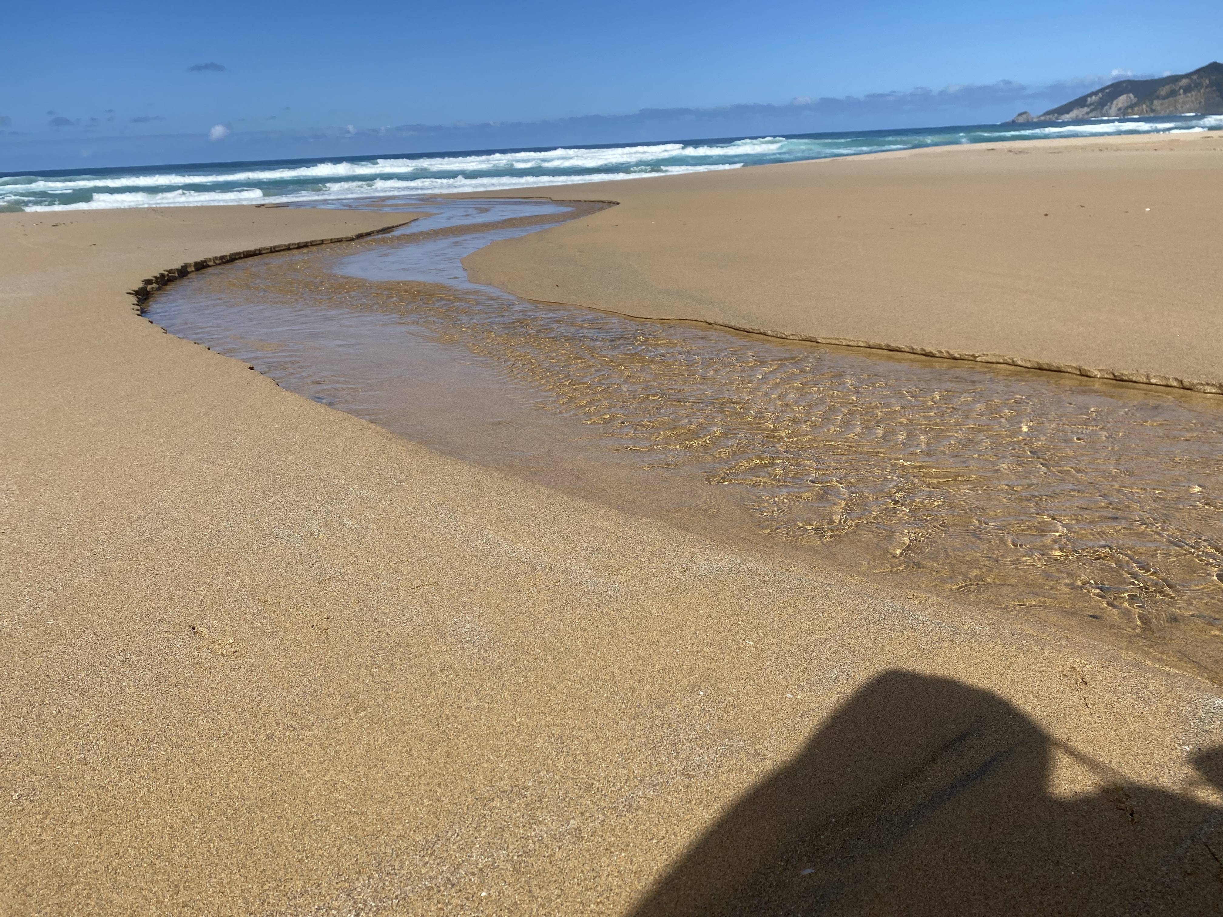
Once I got close to the Johanna beach crossing, I became mindful that I’d been taking my time, and that low tide time had already passed two hours earlier. I thought I could see that there were less than 5 meters of beach left to pass along the river mouth so I rushed down the stone steps to the inlet, feeling that, surely… at any minute, the rest of the beach would be covered by the rising tide. Of course, it didn’t, and the crossing was completely uneventful.
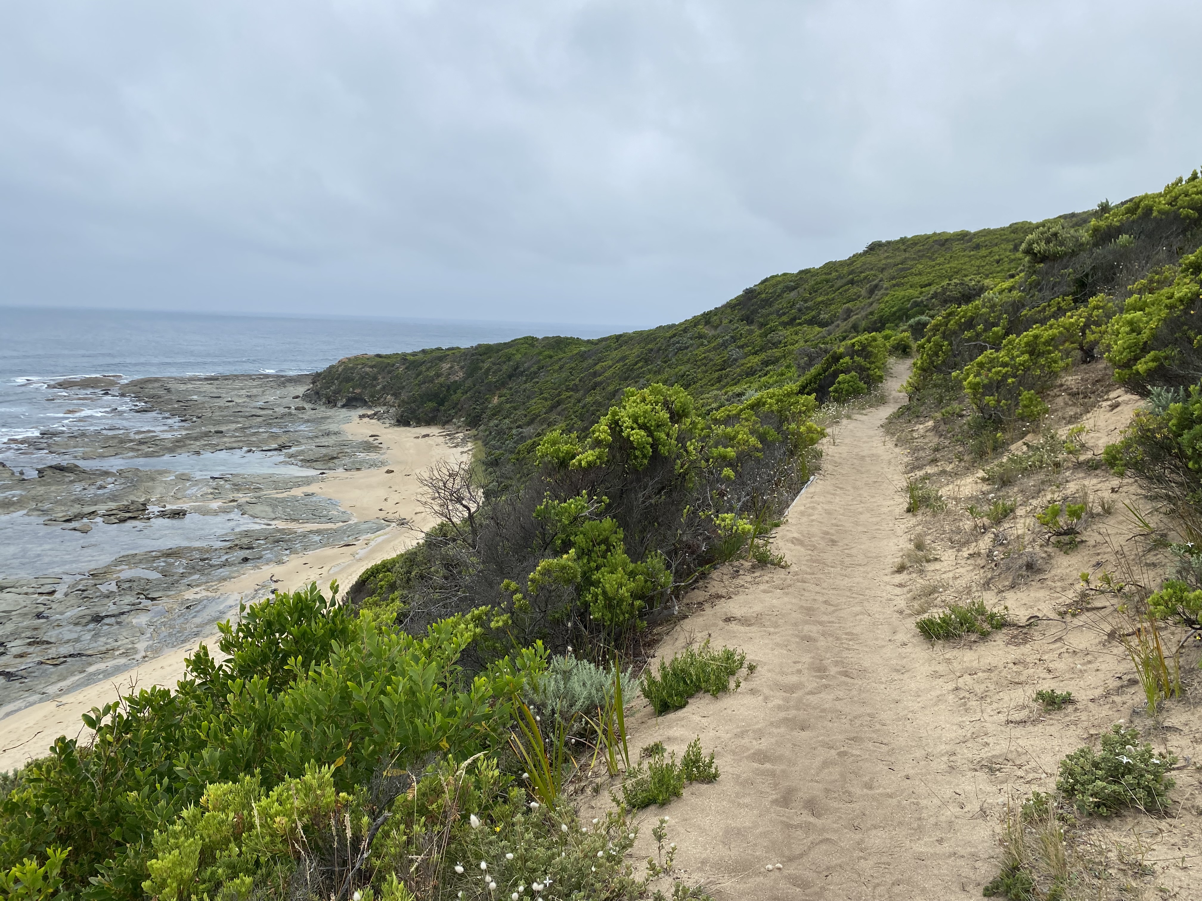
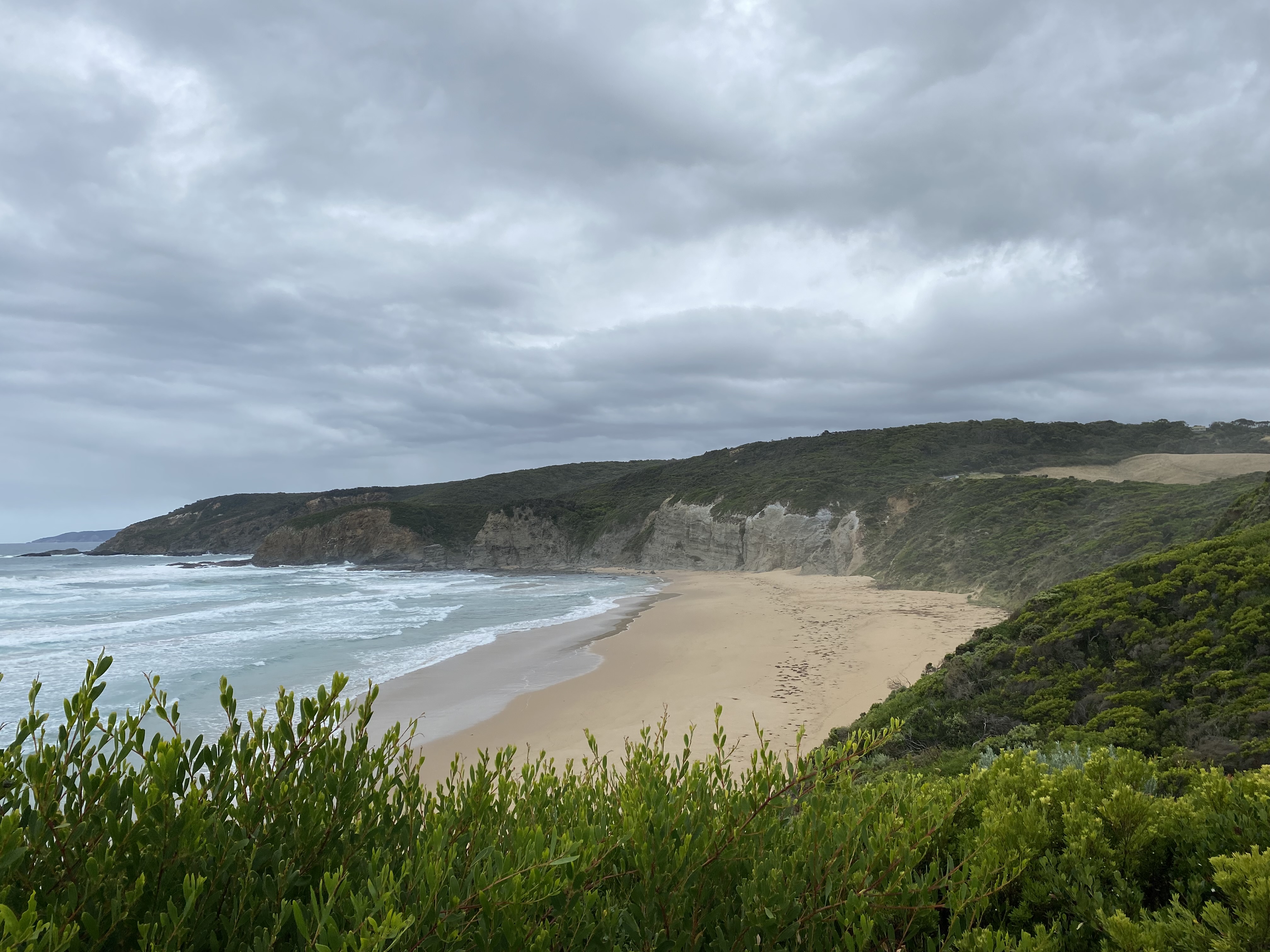
As I rounded the corner, the wide beach stretched out ahead of me. Hiking in the soft sand for 2km was not easy, with boots and a heavy pack sinking me further into the sand. I should have taken my boots off as this might have helped, but I was worried I wouldn’t be able to get them off – or back on again with my pack on.
I identified the trail marker from the beach back to the inland route pretty easily. The formal path started in a deep ravine through the sand dunes. Getting onto it required a very high initial step-up (possibly 75cm). There was a rope to help, but by that stage, I hadn’t been able to avoid removing my boots to wade through another inlet nearby, and it was a massive kerfuffle to try to get boots on, pack off, and climb up this very steep ravine and then get my pack back on.
I felt a bit bothered and grumpy when… about 15 minutes later, I finally emerged at the main Johanna Beach 4WD campsite. The sun was beating down by then and, in my imagination, I was nearly there.
I couldn’t find the GOW campsite. My map was in my pack. It might as well have been in Timbuktu at that stage. It took about 20 minutes of walking around aimlessly, till I finally figured out I still had another 800m to go. Uphill. It was incredibly beautiful and green and there were happy cows grazing in the meadow…. but still… uphill.
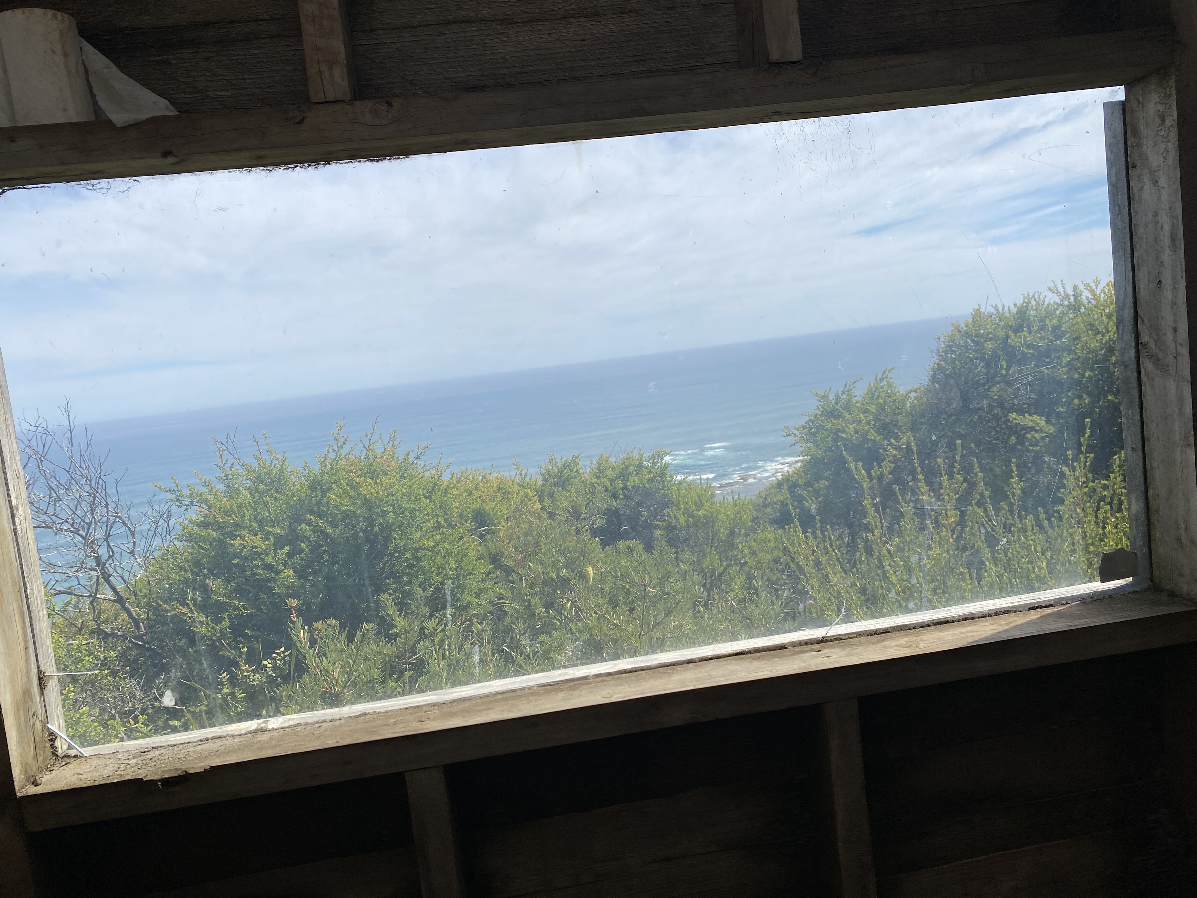
It was worth it though! The Johanna GOW campsite was the best campsite of them all. It was situated high above the cliffs, with a spectacular view of the ocean. The campsite itself was wide and open, with so many beautiful spots to choose from.
After washing some clothes and trying to rehydrate from the day, I sat on a hikers platform in the sun for as long as I could. It was such a peaceful place.
Every night, I forced myself to eat my allocated portion of food for the day. Funnily enough, I was not ever actually hungry, so I ate because I knew I needed every calorie, but also because I wanted to lighten my pack. Weird not being hungry when you are expending a lot of energy.
By the way, I was the ‘fool’ who thought I’d be smart and avoid spending unnecessary money on dehydrated food. Don’t be like me. That was a big mistake. 7kg of the contents of my pack was food. Crazy stuff.
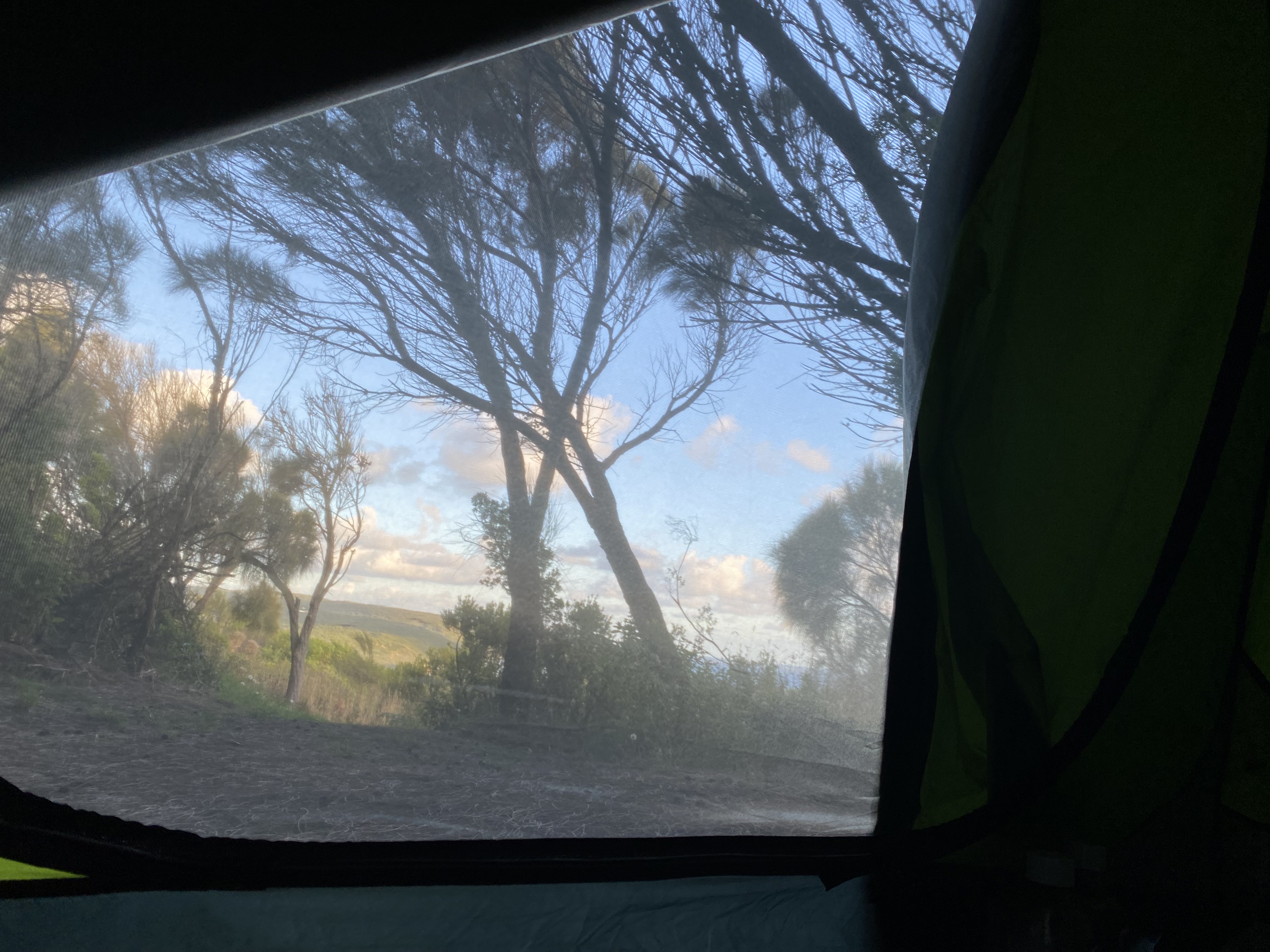
I stayed out till I got cold, and finally watched the sunset through the flyscreen in my tent. It was a spectacular view to go to sleep to.


Day 6. Johanna Beach to Ryans’ Den. Guidebook distance: 14km. Smartwatch distance: 19.1km. Elevation 630m. 8.30am to 2.30pm.
The sunrise did not disappoint either.
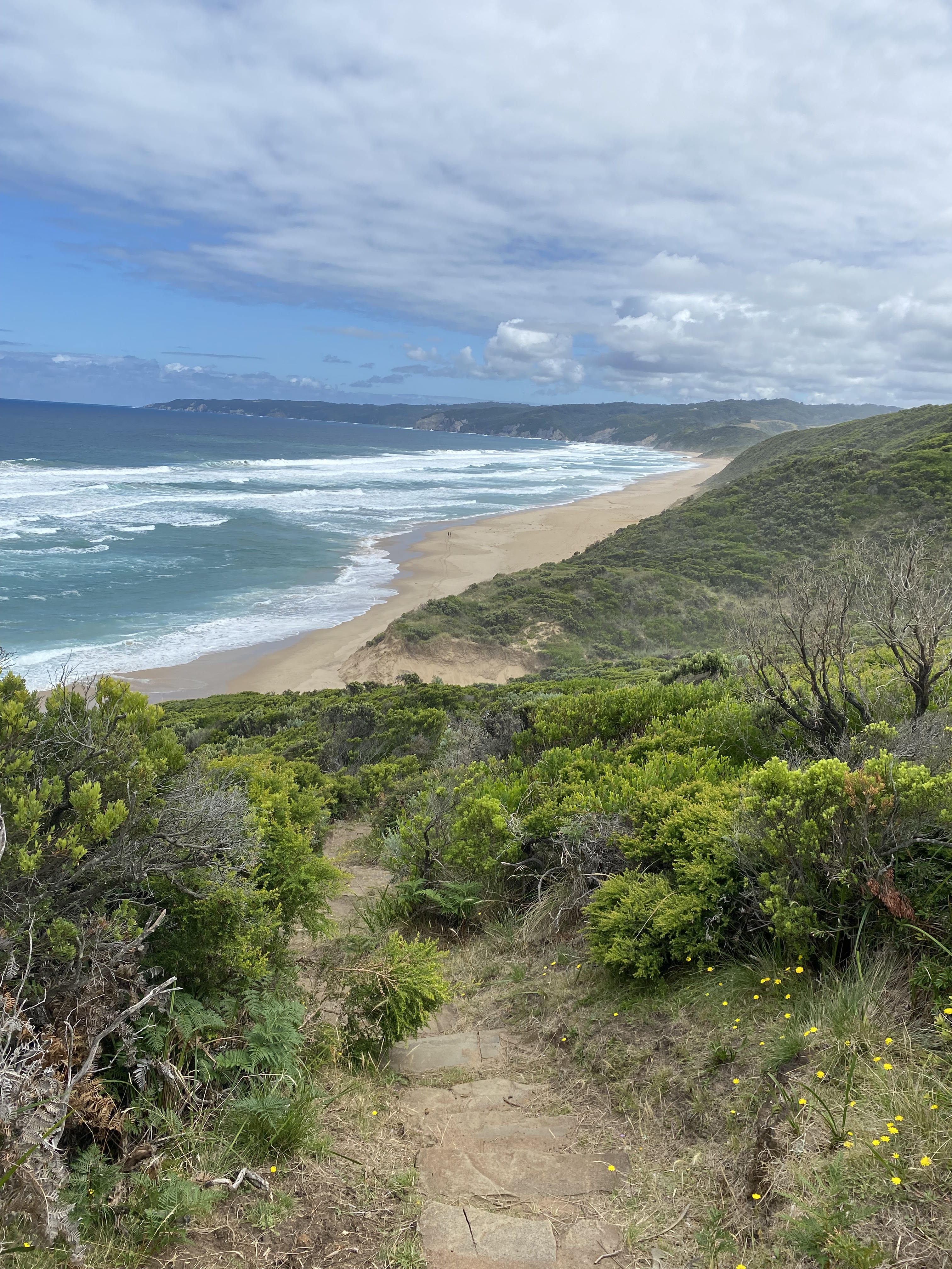
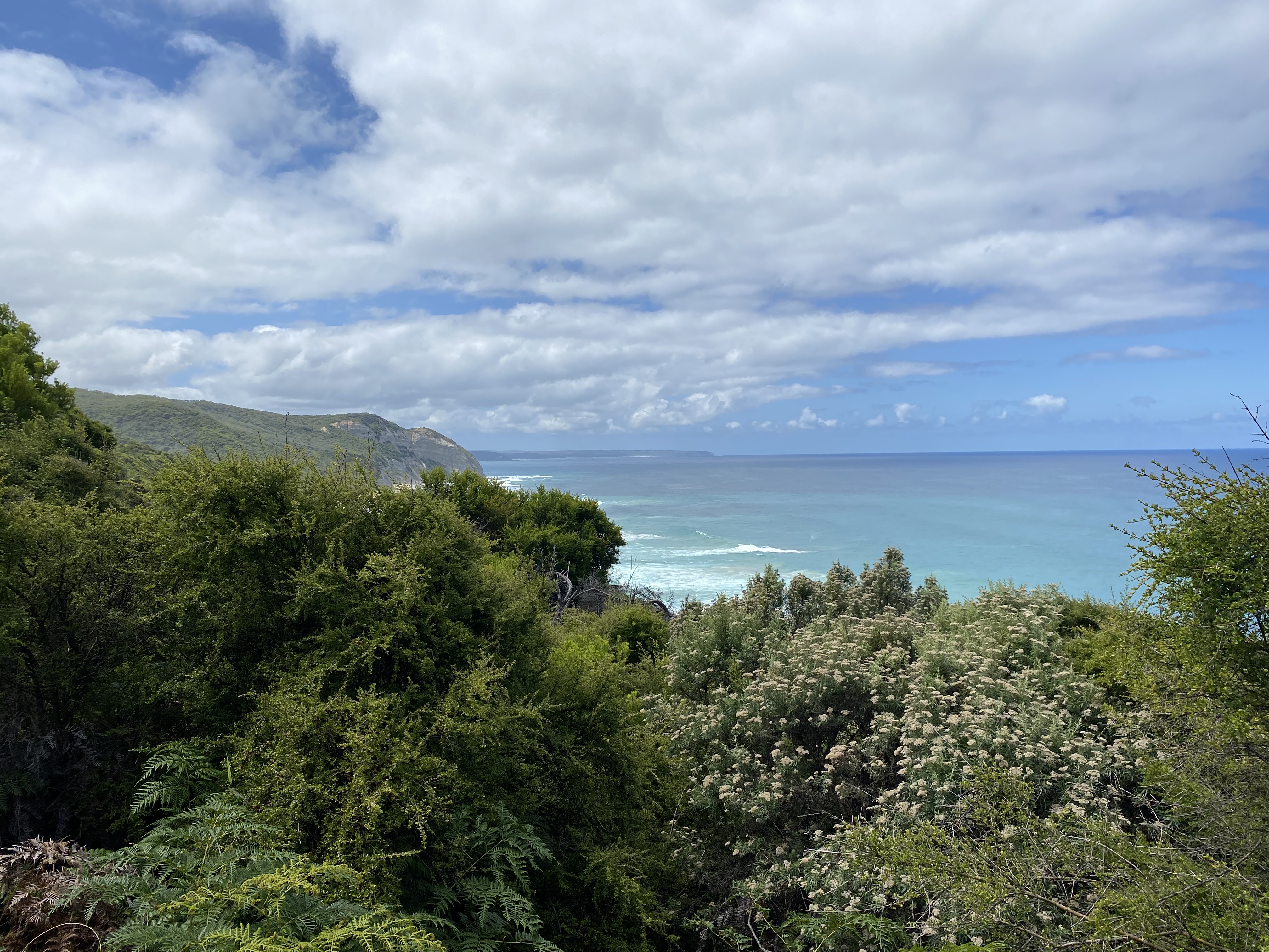
It was the start of an absolutely amazing day! No words can do justice to the first half of the walk from Johanna Beach.
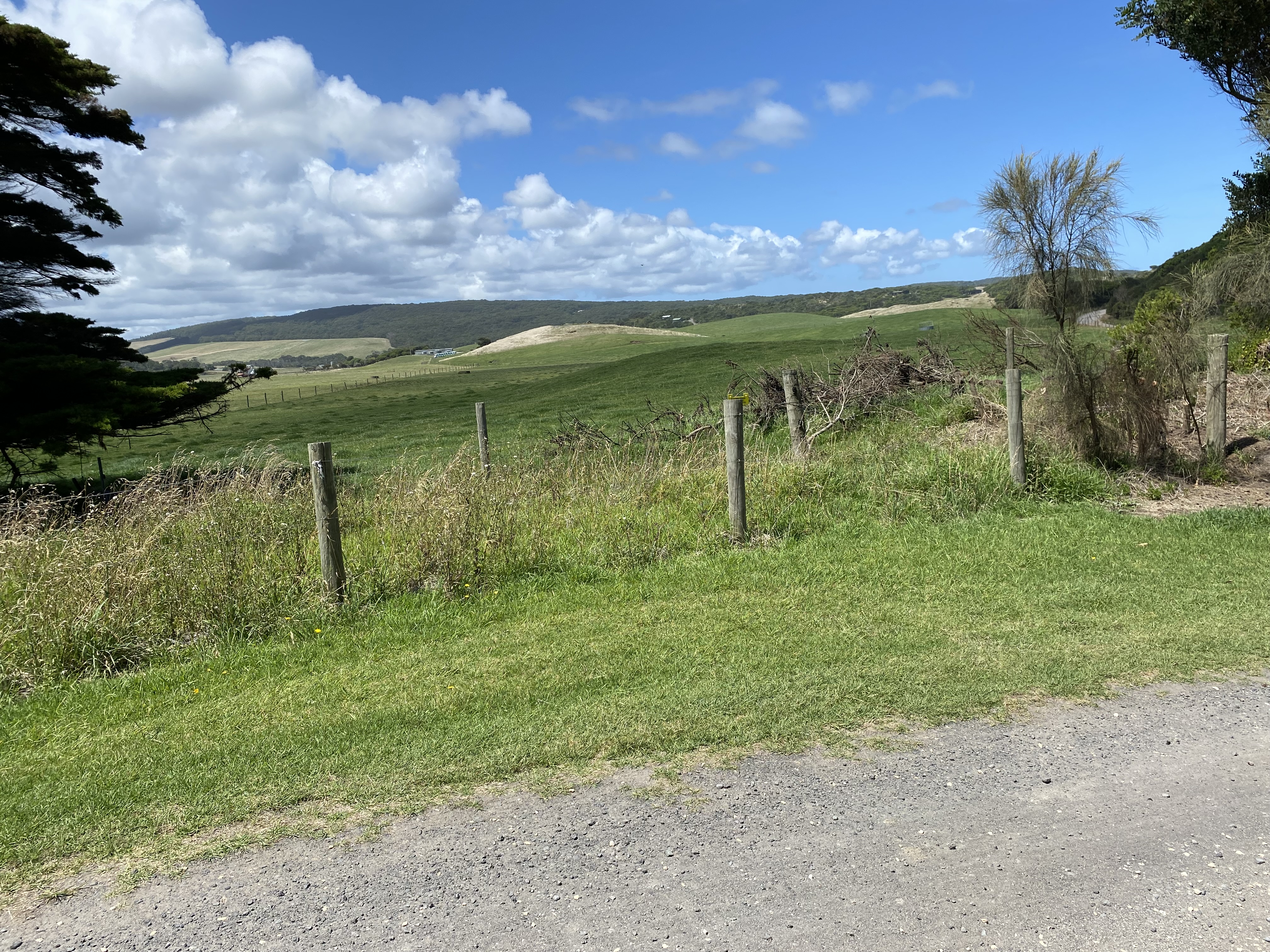
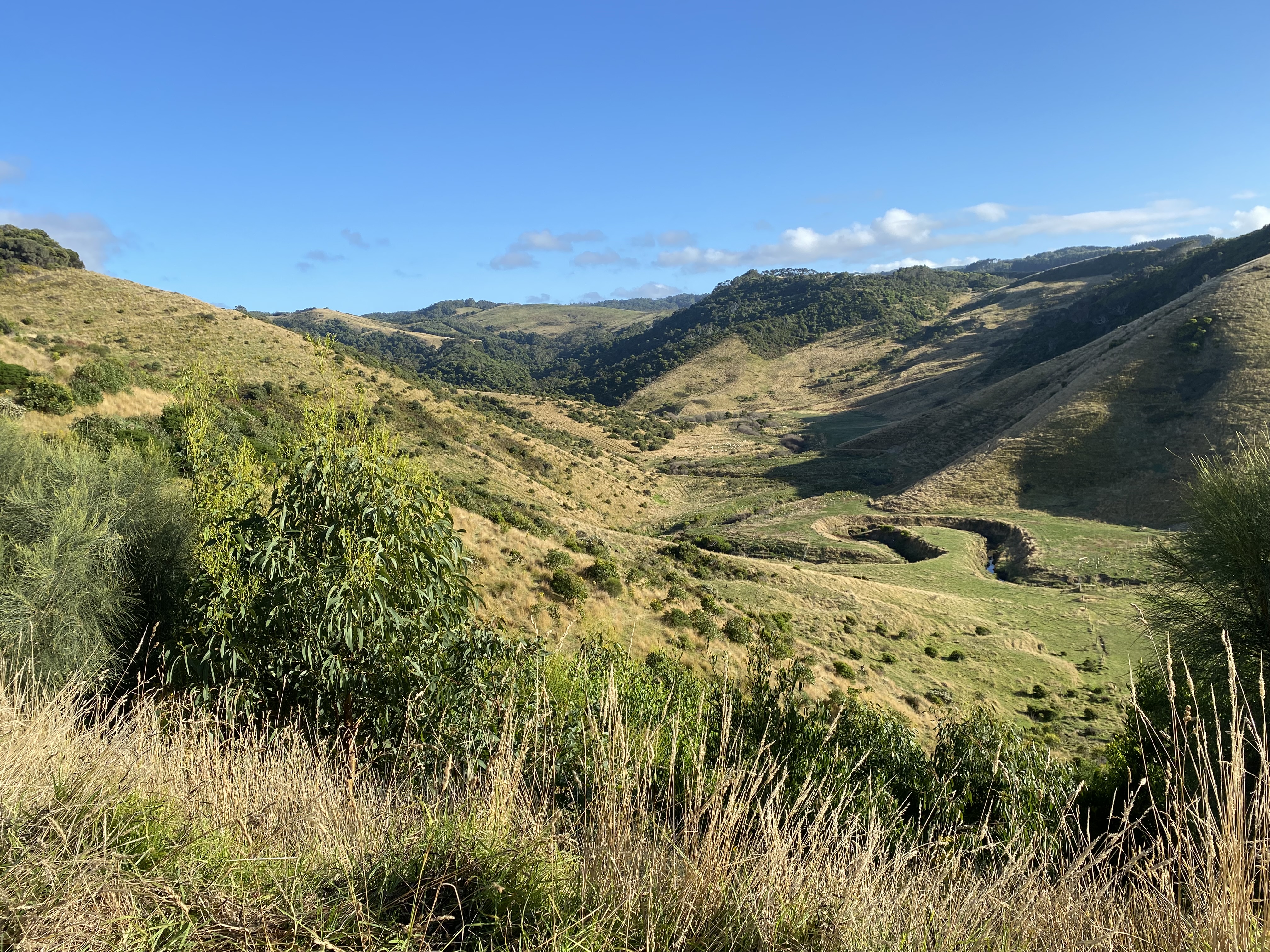
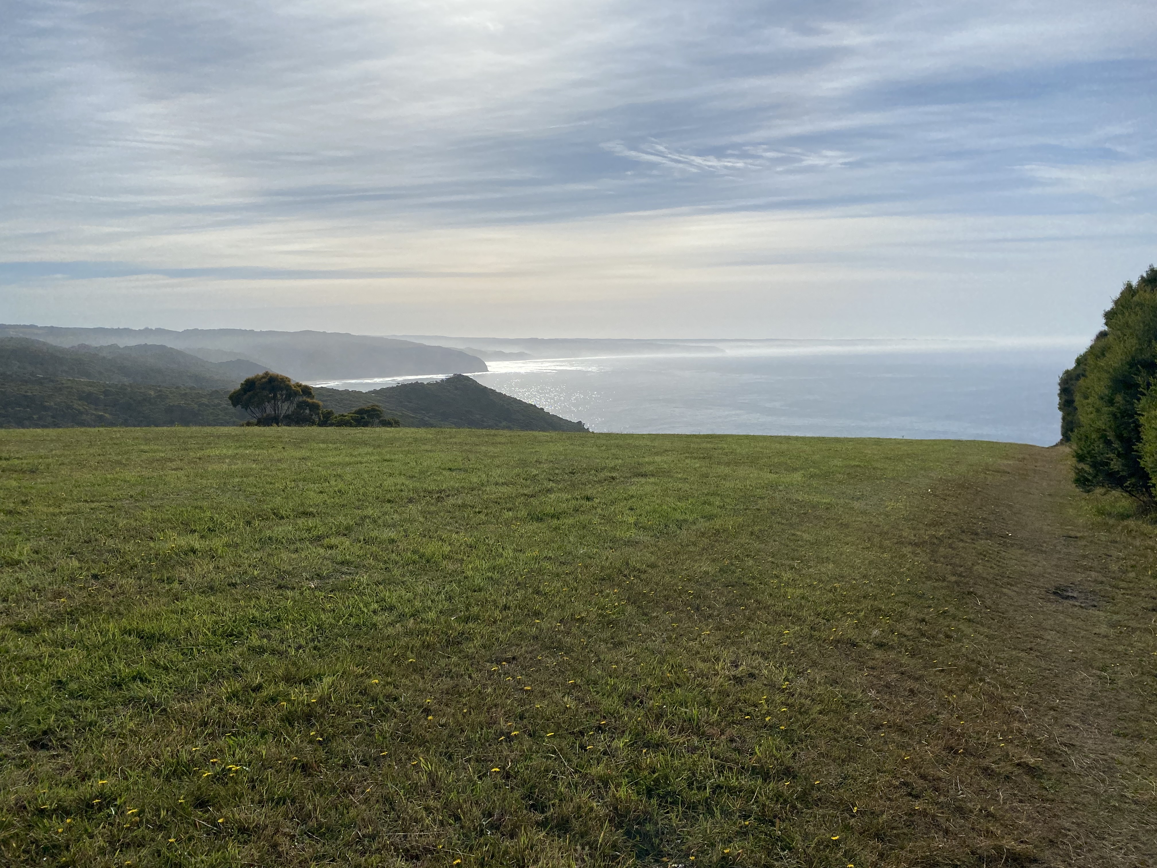
I had a surely, once-in-a-lifetime moment, where I looked around as I was walking and thought – seriously – this is what heaven must look like – followed by a genuine split second where I wondered if I had actually died. Reality quickly rushed in when I scanned my body for aches and pains and felt plenty. But what a moment! Rolling hills, frolicking sheep, beautiful flowers swaying in the wind, blue sky, shimmering ocean in the distance. The photos do NOT do it justice. There was a farmhouse in the midst of all that beauty and I wondered if the people who lived there, realized how fortunate they were.
There were more farmhouses along the way that morning. One, in particular, stood out for the little hutch with an effigy of a sailor (I think), a drink station, and a little esky with marmalade for sale. There was also a little logbook for hikers to write their names in. The owner of the farm – Bryan – was mowing his lawns when I passed, and we stopped to have a long chat.
I kept walking and saw more kangaroos and wallabies that day than all the other days combined. The track spat me out onto a shared road with cars, though I didn’t see a single car. There were no good places for me to stop, and after I’d walked 4km without a drink, I decided that I needed to test out my ‘getting up’ abilities again because it was very hot and I was surely getting dehydrated by that stage. I sat by the side of the road and, of course, I managed to get back up again. My pack was becoming almost manageable.
I decided to continue walking with my water bottle in my hand though. I was putting some Hydralyte in my water every morning and that really helped me, I think, despite the fact that I was probably bathing my teeth in sugar. Hard to get it all right, all the time. My first toilet stop of that day was not until 4.30pm. Not great. I promised myself I would carry my bottle from then onwards, and drink more. The sky shone blue and clear all day, and I was coated in a layer of sweat the whole time.
My right hip was becoming more painful and I was having trouble focusing on anything else, so at around midday, I gave in and took my first painkiller of the trip. Within half an hour, the pain was almost gone, and that was the only painkiller I needed on the whole hike. My hip remained happy after that, and my knee had stopped clicking by then. My toes continued to cause pain, but I think everyone else on a multi-day hike has the same problem, so I wasn’t worried.
I must have been bitten by another sandfly at the camp because my hand had swollen up and rather resembled a claw if I looked at it a certain way. It was itchy to the very core of it, and it took about three days to go back to normal. It still functioned so I tried to ignore the monstrous appendage as much as I could. My special ointment was my saving grace again.
I saw quite a lot of snakes that day, but all of them were on the way into the bushes when I came across them, so no real concerns there.
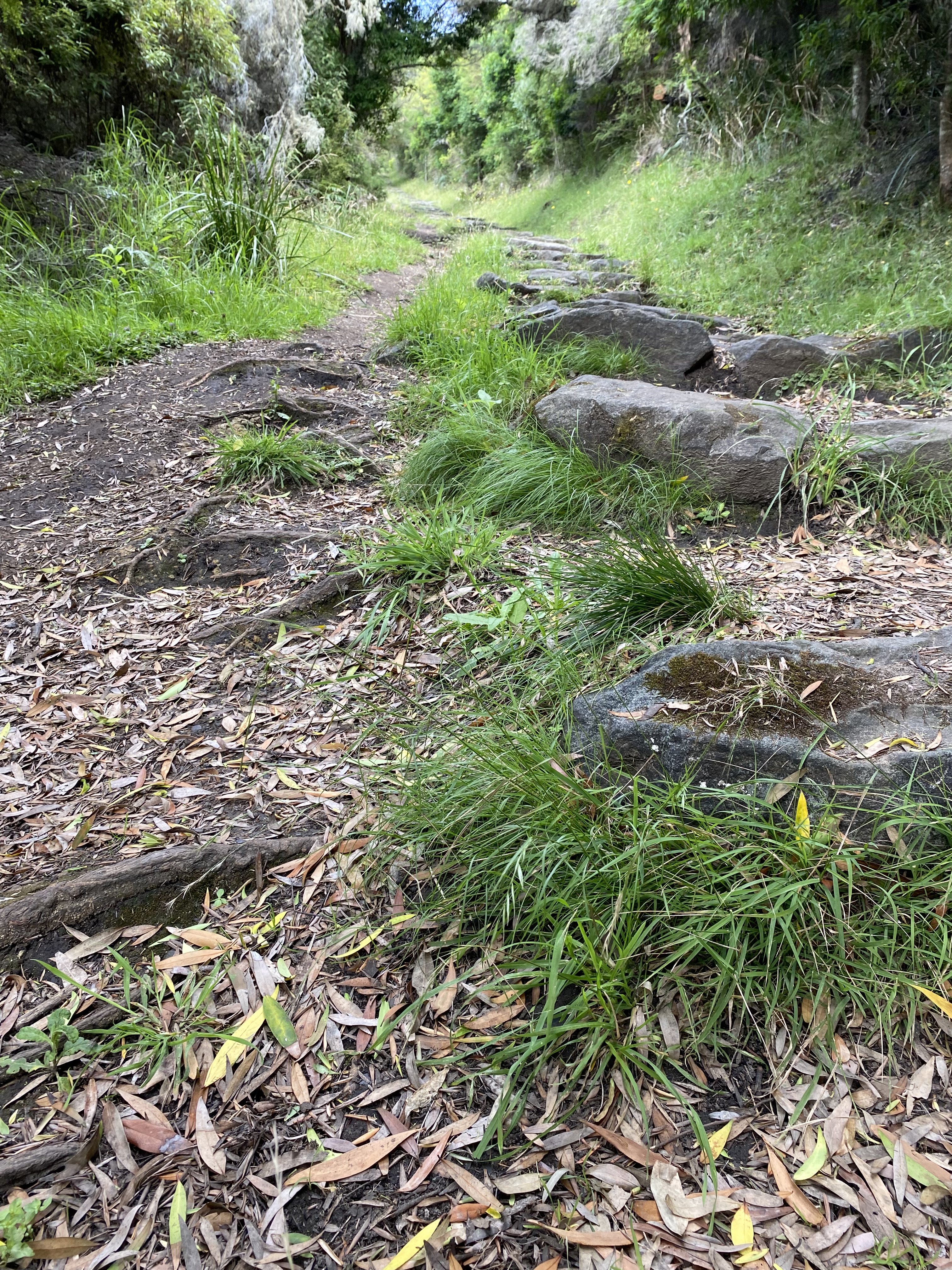
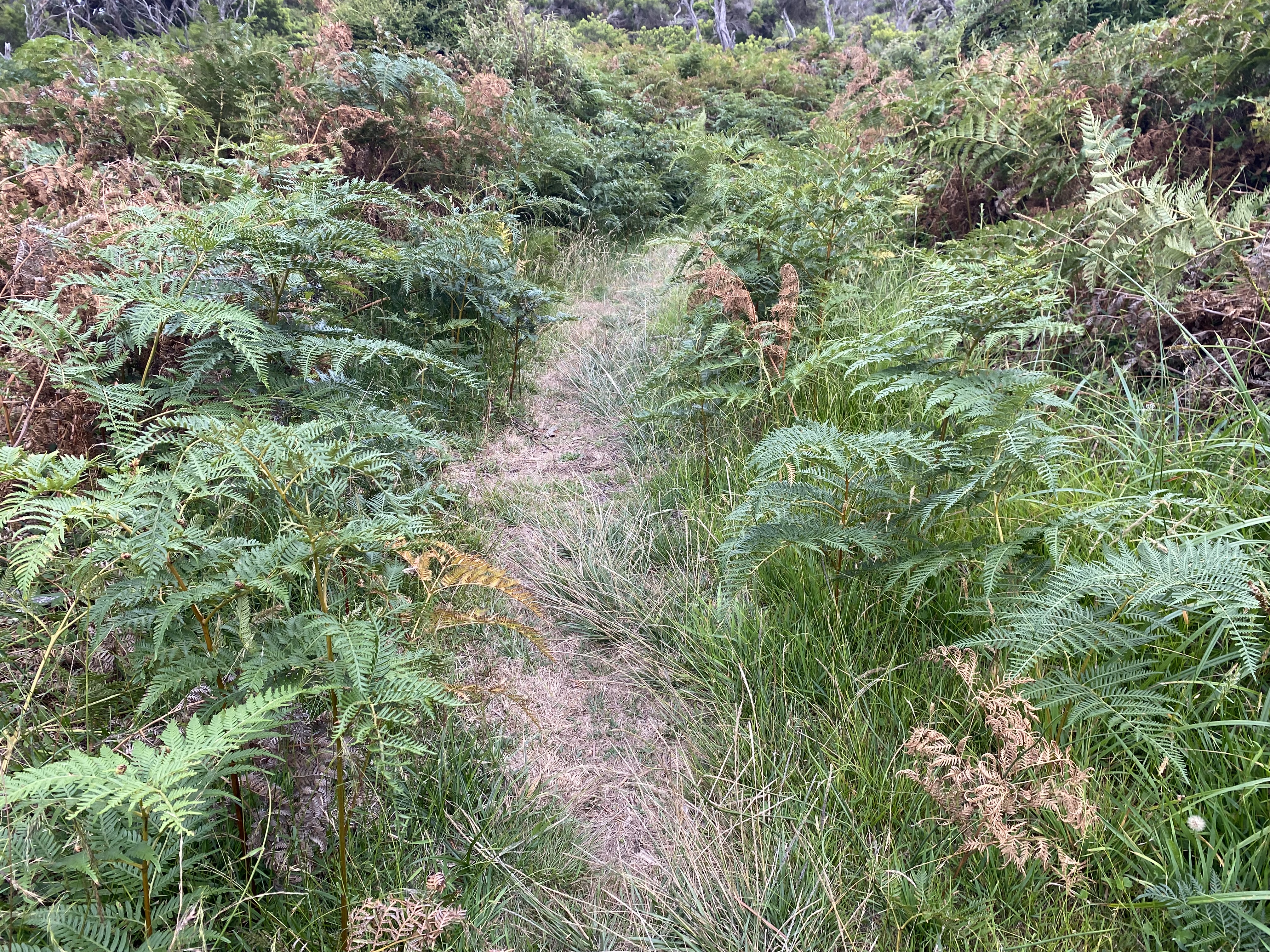
After crossing Milanesia Beach at low tide, I started climbing. And climbing. The path was quite overgrown with brambles and ferns, with thorny vines hanging down over the path. They would have made a mess of your face if you’d walked into them. The guidebook had said there were stairs, and there were… though some of them were more ‘suggestions’ of where to put your feet, compared to ‘built’ stairs. I actually found that easier to climb than actual stairs.
It felt like the GOW camp was imminent around every corner for the last few km I walked that day. It was a massive relief when I finally got there. The camp was perched amongst the tall trees. There was a lovely lookout at the top, and I hung out in the sunshine there for quite a while. Again, I had the whole place all to myself.
That was, until about 6pm when two young French men aged about 23 or so, wandered in… chatting happily and still very bouncy on their toes. They had joined two sections and so had walked 30+km, starting out from Otway that morning. I couldn’t have imagined walking that far and then ending it with that rather difficult, interminable last climb.
At 7pm, two more hikers walked in. They were 25-year-old best friends who had also joined two sections together. They had not enjoyed the last 5km or so either. They headed up to camp near the boys. I didn’t see them until about 10pm when I was woken by one of the girls asking for help for her friend. It seemed she had become severely dehydrated, and her blood sugars must have dropped after their massive day. She hadn’t eaten all day which hadn’t helped. She was shivering terribly and slightly confused. The French boys had given her an Up and Go, and I gave her some Hydrolyte with instructions to please come and get me if it got any worse. The girl who’d woken me also had her brother on the phone, (we had good internet reception at that camp), so they had been ready to call for emergency assistance if needed.
About an hour after the initial request for help, I unzipped my sleeping bag about to head up there. As I was about to go, I heard laughter from one of the boys, so assumed everything must have been alright and re-zipped. I didn’t sleep well, worrying if she was alright.


Day 7. Ryans’ Den to Devil’s Kitchens. Guidebook distance: 13km. Smartwatch distance: 17.1km. Elevation 560m. 8.45am to 1.30pm.
By morning, the girl was much better thankfully. She said she ‘felt like she’d been hit by a truck’ but she was good to walk again. They would hang around camp for a slow start and meet me at Devil’s Kitchens that afternoon. The boys were going to join the next two sections again, planning to complete the whole thing in 3.5 days. Us ‘girls’ decided that they were professional athletes. They were all ‘muscle’ and had not a bit of fat on them. I took off first that morning, but the boys overtook me after about 20 minutes and the last time I saw them, they were heading off into the distance at a very good speed.
The first half of this day was much like the last half of the day before. Uphill, lots of stairs; the path narrow, and overgrown. I wasn’t really enjoying myself for the first time on the whole trek.
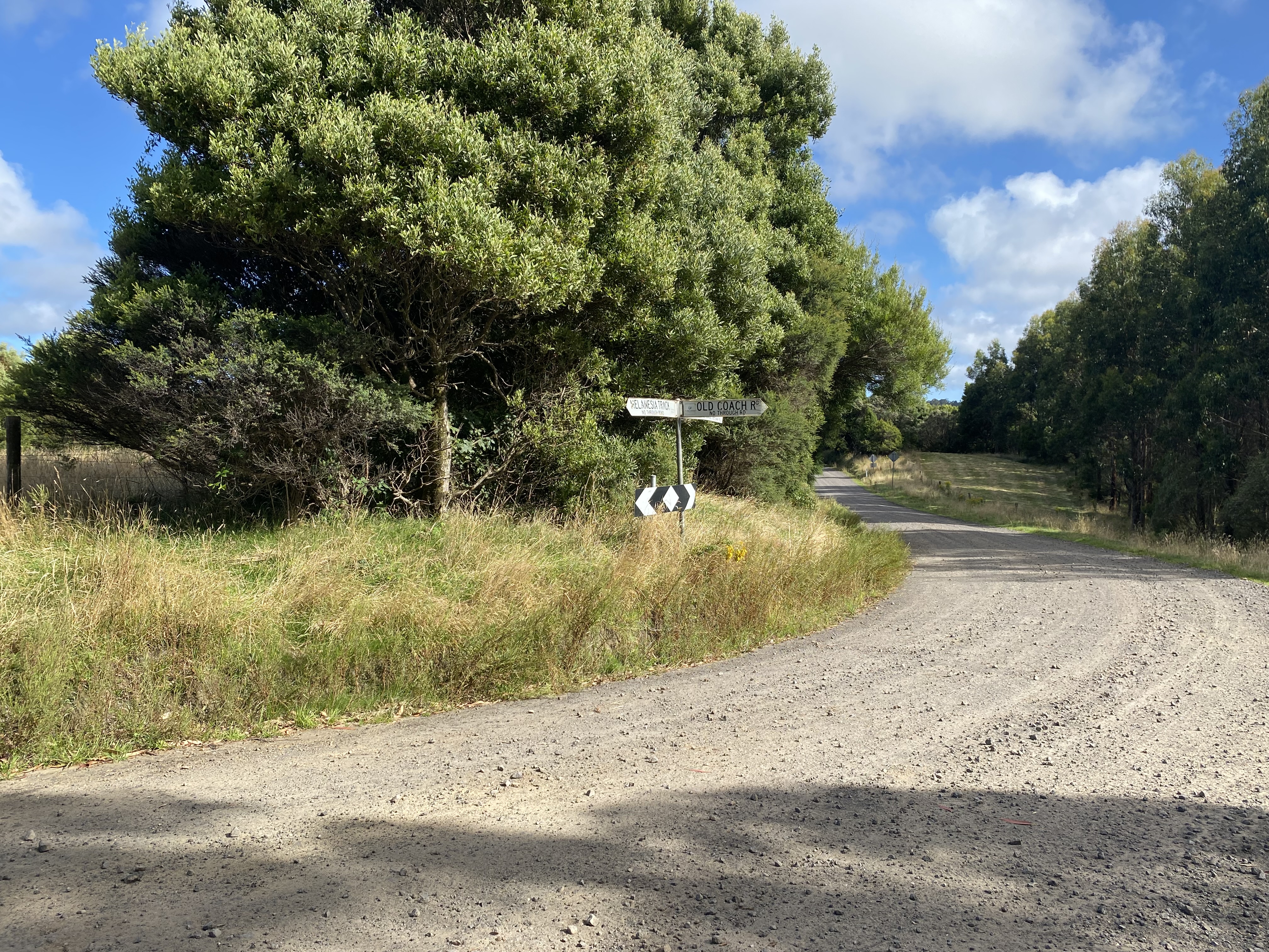
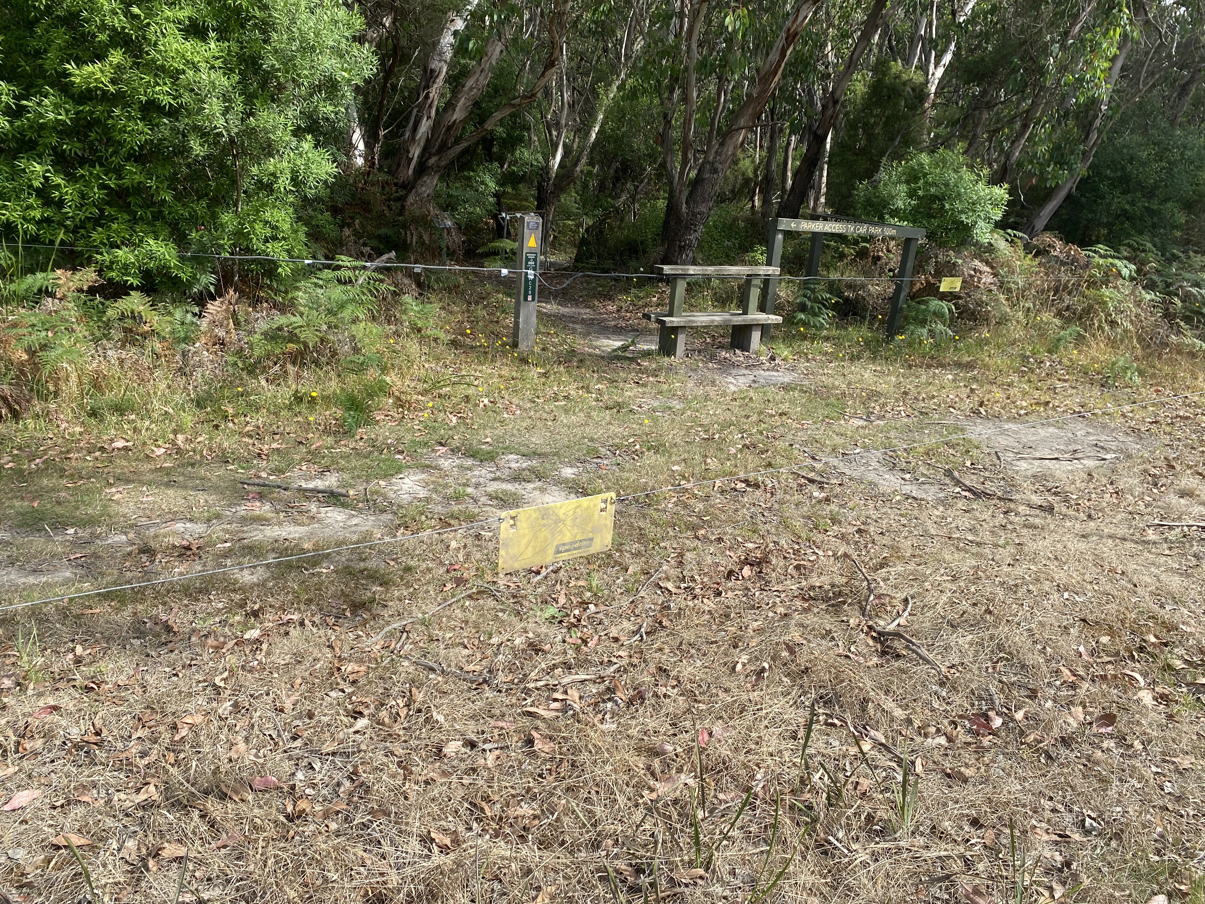
The terrain changed completely once I reached Parker Road. The Guidebook directed me to “walk along the road until the track led into the forest again”. I saw the forest entrance coming up but noticed a wire at a mid-thigh height which separated me – on the road – from it. Luckily I decided to wait to cross it till I got a bit further along because I thought it looked like an electric fence and I could see there was a little sign hanging off it. It was an electric fence. Apparently, I’d missed a track marker directing me nearer the farm at the top of the road and I was on the wrong side of the electric fence. I couldn’t go over or under it with my pack. So I took my pack off, pushed it underneath, and then rolled under it like I was in the Special Forces or something. I was quite glad no one was watching.
I was back in the forest again, but the terrain had thankfully leveled out. The path transformed into a long section of raised planks (this went on for about 1km) which lifted me off the forest floor.
I felt that I could let my guard down a little for snakes, being off the ground. Big mistake. I hadn’t seen it, till it moved. I’d barely missed stepping on a massive brown snake. My right boot missed it by less than 5cm. It was sunning itself … stretched out, its tail on the planks; its head facing into the forest. If someone had been watching, they would have had a good laugh as I Harry-high-stepped my way away.
No less than 3 minutes later (I am not exaggerating) a heavy snake fell onto my left boot. I jumped backward for that one. It must have been sitting in a tree and I’d given it a fright as I neared it. It was black (no idea what sort) and was also not happy with me. I couldn’t get it to move off the path, so I eventually had no choice but to walk past it.
That was not my favorite part of the trek. My senses were all attuned to keeping an eye out for more snakes until I finally reached Devil’s Kitchen.
This GOW was very similar to Ryan’s Den minus the nice lookout. Its redeeming feature was the toilet which had its own majestic view. There were so many big black flies buzzing around in that camp, it was a little tiring for the senses.
I’d arrived at 1.30pm and I was getting worried when, by 4.30pm, the girls had not yet arrived. I thought maybe they’d aborted the trek and diverted to Gable Carpark. I didn’t have their number (big regret at the time) or any way to know if I should call for help or assume they were alright.
They thankfully did eventually arrive, and in very good spirits too. They’d taken their time and had stopped frequently to eat and drink along the way. We spent a very enjoyable afternoon chatting about our lives and our motivations for doing the trek. It was so nice to have a proper conversation again.
I was really wishing for a shower and some fresh clothes by that stage but was doing my best to keep myself and my clothes as clean as possible. (Wet Ones were my savior).

Day 8. Devil’s Kitchen to the 12 Apostles. Guidebook distance: 16km. Smartwatch distance: 20.5km. Elevation gained 380m. 7.30am to 12pm.
Knowing we had quite a distance to cover and a shuttle bus to meet at 2pm, we all started early the next morning.
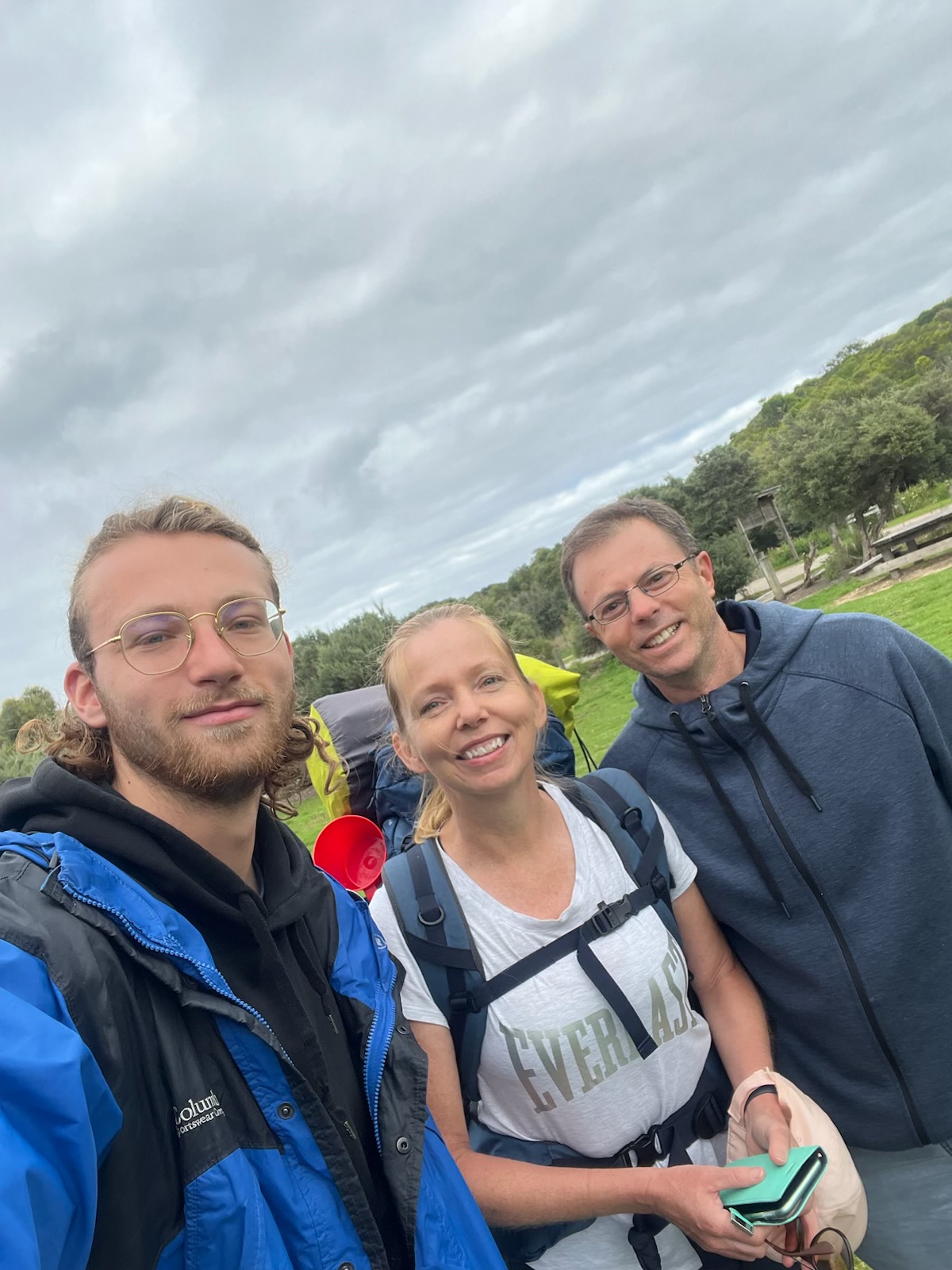
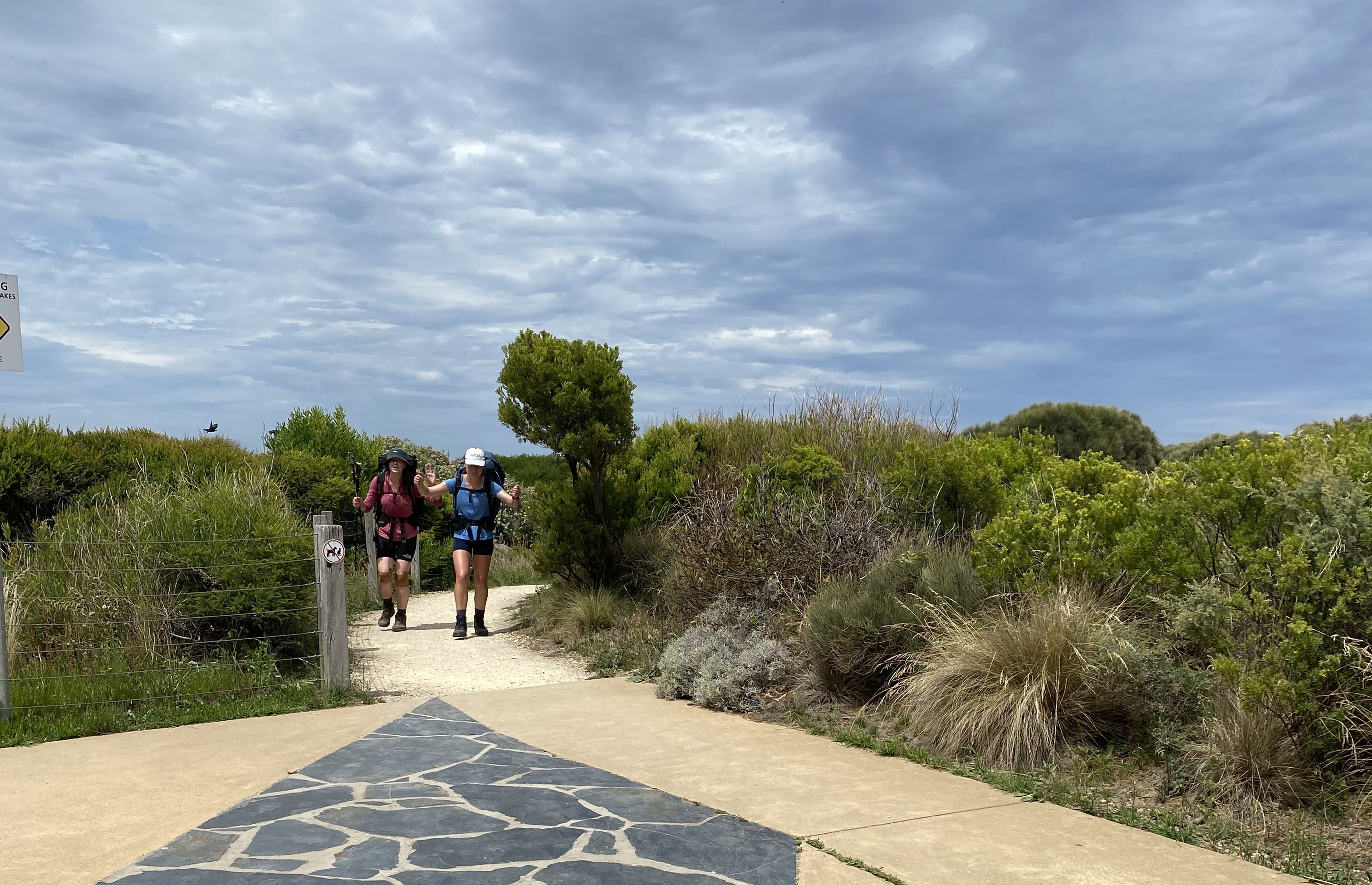
Since there was no public transportation available on Thursdays, I had no solid plan in place after my arrival at the 12 Apostles. The girls were much more organized than me and had a shuttle bus booked in advance. (*Shout-out to the loveliest taxi driver on the planet: Lindsay from RideWithUs). It turned out that they were heading to Camperdown, which was on the same train line as my planned destination. We ultimately ended up sharing the cost of the bus, and it felt like such a relief to know that there was transportation waiting at the end of the hike.
I was incredibly grateful for having met these girls and sharing the final stage of this amazing hike with them.
Dismantling my tent, I found a massive huntsman crawling underneath my fly sheet. I’m afraid he didn’t make it.
The fact that I managed to get ready to leave by 7.30am that morning, felt like an achievement. I’d finally become quite efficient at this camping business.
As I was making my last cup of coffee of the trip, my gas bottle fizzled out. I drank my coffee cold but didn’t mind. I was so grateful that it had lasted the perfect amount of time.
Happiest to walk on my own, I left first, telling the girls they’d probably catch me soon enough, though that never did happen.
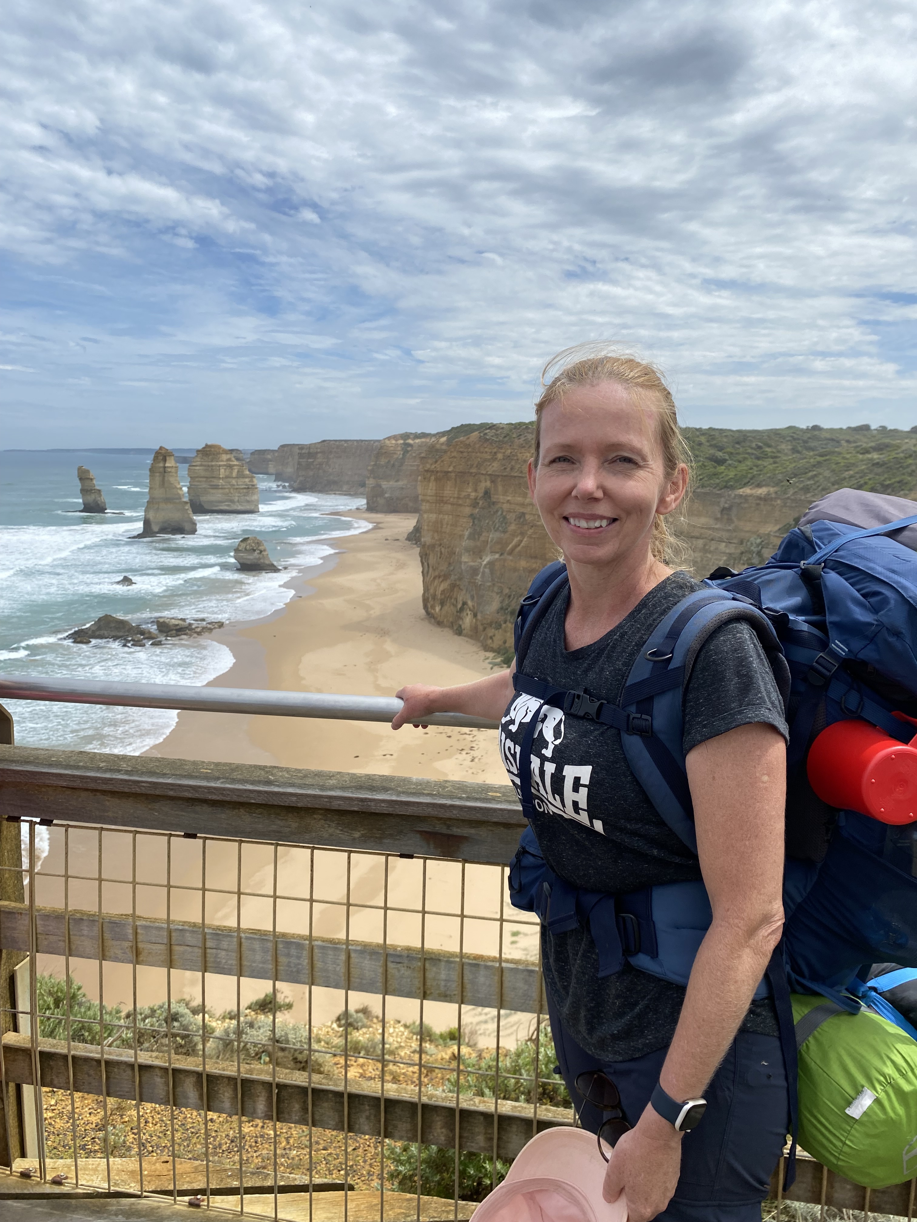
It was such a lovely walk. The path mostly meandered along the cliff top in coastal scrub. There were many intended viewpoints but the shrubs were quite high so it was hard to see over them. I did though, jump up onto any benches I came across and was finally rewarded with a single Apostle poking its head above a bluff. I was getting nearer my destination.
The sun was relentless, and the flies were something out of this world. The closer I got to the end, the worse those flies became. I had to constantly fan myself, or they would have been landing in my eyes and nose. I was worried they would find their way into my ears, but I ran out of hands to wave. I tried to ignore them as best I could, and just focus on how amazing the walk was.
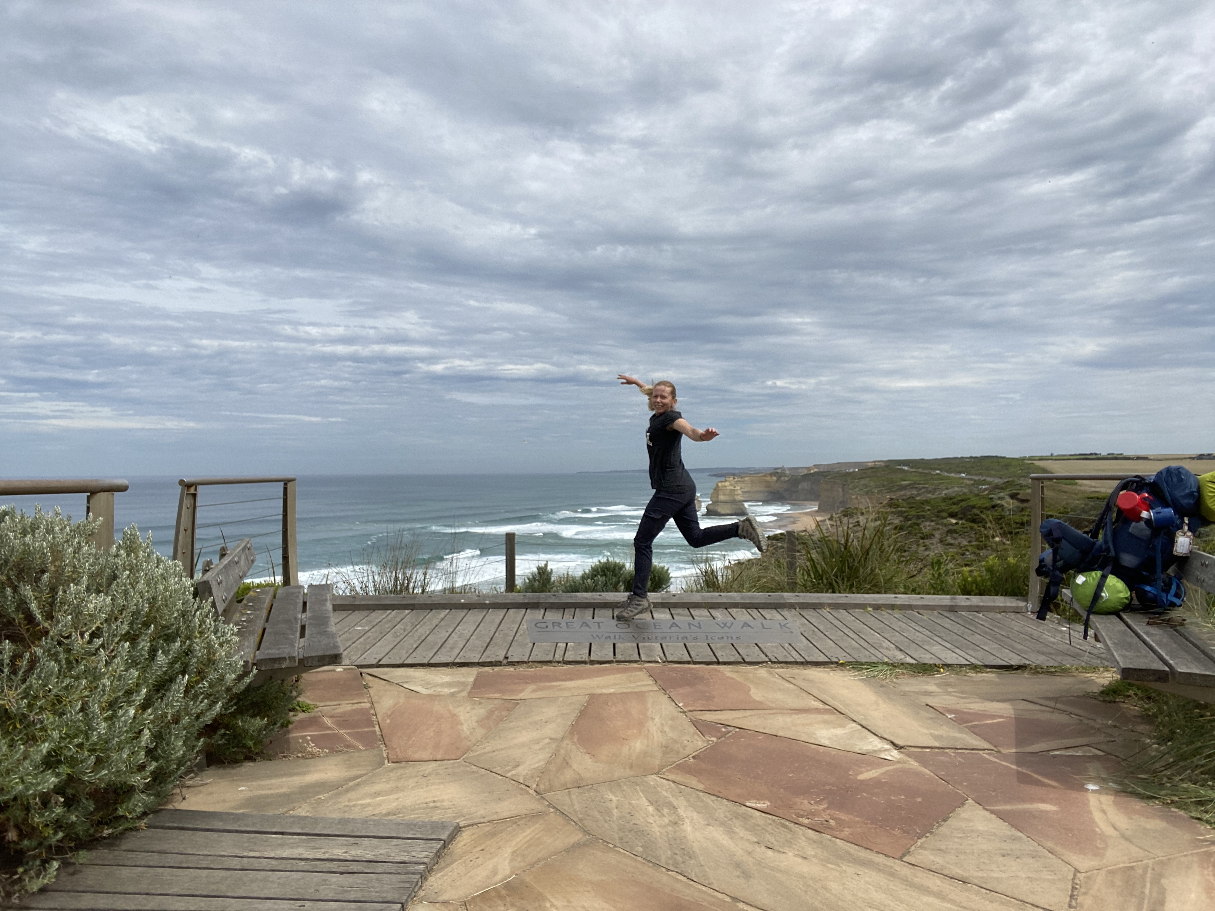
I stopped at the official GOW lookout, called the Walk Victoria’s Icons Lookout. I was on my own and spent a good half an hour posing and making a fool of myself jumping around like a crazy person. Talk about feeling pretty freakin’ happy with life.
The walk continued another 3km or so, getting closer and closer to the Visitors Centre and the official 12 Apostles viewing station.
When I finally crossed into the open area at the back of the Centre, there were a number of uncomfortable-looking tourists standing around, waving little leafy branches around for the flies.
No one was particularly interested in me. I paused for a moment and inadvertently made eye contact with a couple of friendly-looking men in high-viz shirts. I could see that they knew what I was doing there. I couldn’t help myself – I raised my hands in the air (like the champion I felt like I was) and they started clapping and cheering for me. Everyone joined in and it was hilarious.
I smiled the widest smile of my life. I walked over and had a little conversation with the men, who worked for Vic Parks. They were so impressed that I had done the walk on my own.
A tourist walked past me and said ‘God, you’re a tough chick’ and I called back ‘I’m not tough, I’m just crazy.’
In hindsight, I’m not either of those things.
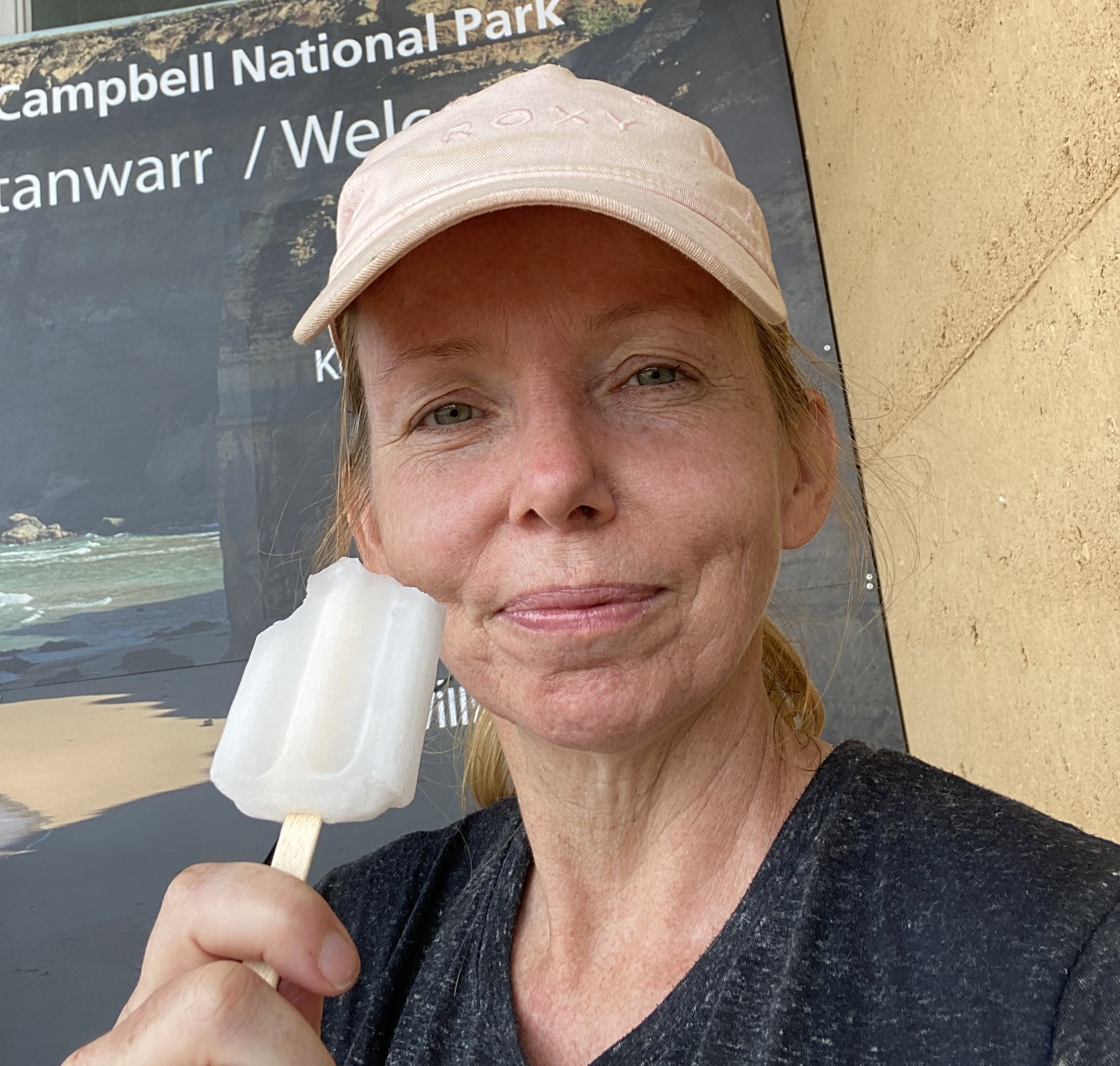
I went in to buy a $1.50 ice block from the kiosk, and – as I went to pay, the nice man slipped his bankcard underneath mine and said, “I’ve got this”. I have to admit… I teared up. I couldn’t say thank you enough. At the time it felt like the nicest possible gesture from a perfect stranger.
The two girls walked in at about 1.30pm. I was able to film their ‘arrival’ and cheered for them as loudly as I could. They had done the walk in a lot less time than me overall and were absolute legends.
We continued to travel together till I got off the train in Colac. I wished them all of the goodness that life had to offer.


A couple of final thoughts about this hike… after getting back home:
- I lost 3kgs and two toenails
- Even though I was not doing a lot of deep thinking as I walked, my mind got a proper ‘re-set’ by being able to switch off
- Ten days later, I’m still on a high
Five things I’ve learned:
- I’ve decided that my spirit animal is a packhorse
- Eight days, without a shower, would probably be my upper limit
- Every gram counts when you are carrying it on your back
- I’m so capable on my own.
- I love solitude but I also love people. These things are not mutually exclusive.
Hiking the Great Ocean Walk was EVERYTHING I had hoped for… and so much more!!
If you like this post, please consider leaving a comment or following my blog. Your support is greatly appreciated. Happy hiking!!!

Such an incredible achievement! Is there nothing you can’t do?
LikeLiked by 1 person
Loved reading about this epic solo achievement Laila. It is truly amazing all the things you can do in Australia.
Well done & thank you
LikeLiked by 1 person
Wow, thats amazing. I’d love to do a solo hike, but I am just so scared of what could happen re: other people and no one would know
LikeLiked by 1 person
What a beautifully-written and utterly inspiring adventure and story! As a single 48-year-old woman, this had me grinning from ear to ear. Your determination, mindset and strength is incredible. Well done!
LikeLike
Looks wonderful! Thank you for sharing xo
LikeLike
I truly loved your honesty, the mistakes you made along the way and how you learned from them. Makes me think I could do this too. Thanks for sharing your story.
LikeLike
Loved this detailed description of your hike. Can I ask what sleeping bag you used, and did you have a mat as well?
LikeLike
Wow! Well done. I’ve always wanted to do the Great Ocean Walk but there is no way I could do it alone.
LikeLike
Thoroughly enjoyed reading your blog.
A very descriptive account.
Boy, that looked a very big snake!
You’re a pretty brave woman achieving this on your own. I think, I know, I would’ve been scared, sleeping under canvas, on my own, that very first night!
Well done Laila, you are inspirational!
LikeLike
What an epic adventure & story, Leila! I thoroughly enjoyed reading this- very inspiring!
LikeLike
I enjoyed your fb post and therefore read your blog. I have hiked about 200 miles this year, but haven’t ever done a backpacking trip, but have been seriously contemplating it for some time. I think I want to do a 3 day trip with someone to start, since I have been married for almost 42 years and will be 60 y.o. this year, so I am not very self sufficient, but am very independent and hike by myself. I thoroughly enjoyed reading your blog. It was very inspiring. It would be soo cool to be brave enough to succeed in doing a solo backpacking trip. Of course, being American and now living in the Arizona desert, it would certainly be awesome to do your Australian ocean hike. Anyway, kudos to you. Very cool.
LikeLike
Awesome narrative! I was able to envision the trek throughout the 8 days. And inspiring! I’m actually considering journaling beginning today, as I prepare for my upcoming adventures. Thank you for sharing!
LikeLike
Reblogged this on michaels camera video digital.
LikeLike
Hi Laila, thanks for the “step by step” very detailed description of your trek, where you went and your feelings along the way. I suspect that this took a long time to write too. Thank you very much for sharing, very inspiring.
LikeLike