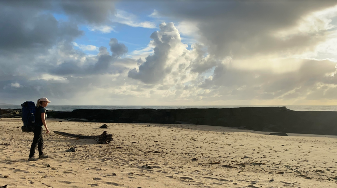
It was gobsmackingly beautiful and had just the right amount of ‘challenge’ to be a proper adventure. I knew it would be good, but I had no idea it would be this good!
I’ve just returned from a 4-day solo hike following the Coastal Emu Footprint from Angourie to Red Rock in NSW, Australia. It’s only my 2nd solo multi-day hike so I still consider myself a novice.
In the planning phase of this walk, I discovered some fears I hadn’t thought about for a long time. Doing this walk, I faced them head-on. In the aftermath, I am basking in the knowledge that I have gained so much from doing it.
Why is hiking this walk alone a little different from hiking other walks alone? Hiking alone at any time pushes you to be more alert for obvious reasons. The planning of the Yuragir Coastal Walk is especially important to get right as things can go properly wrong if you make a mistake. I had an overriding awareness that I needed to ‘get it right’ to avoid getting trapped by an incoming tide. It was all up to me.
This walk challenged my preference for wanting to be super-organized and in control of every situation. It forced me to think about how I manage that low-level hum of anxiety that creeps into many aspects of my life where I can’t have that control.
In hindsight, I wasn’t wrong to have wanted to be as prepared as I could be.
Based on my experience some of the information I wanted, was very hard (impossible?) to find through the usual channels. I hope this account will help anyone else planning to do it.
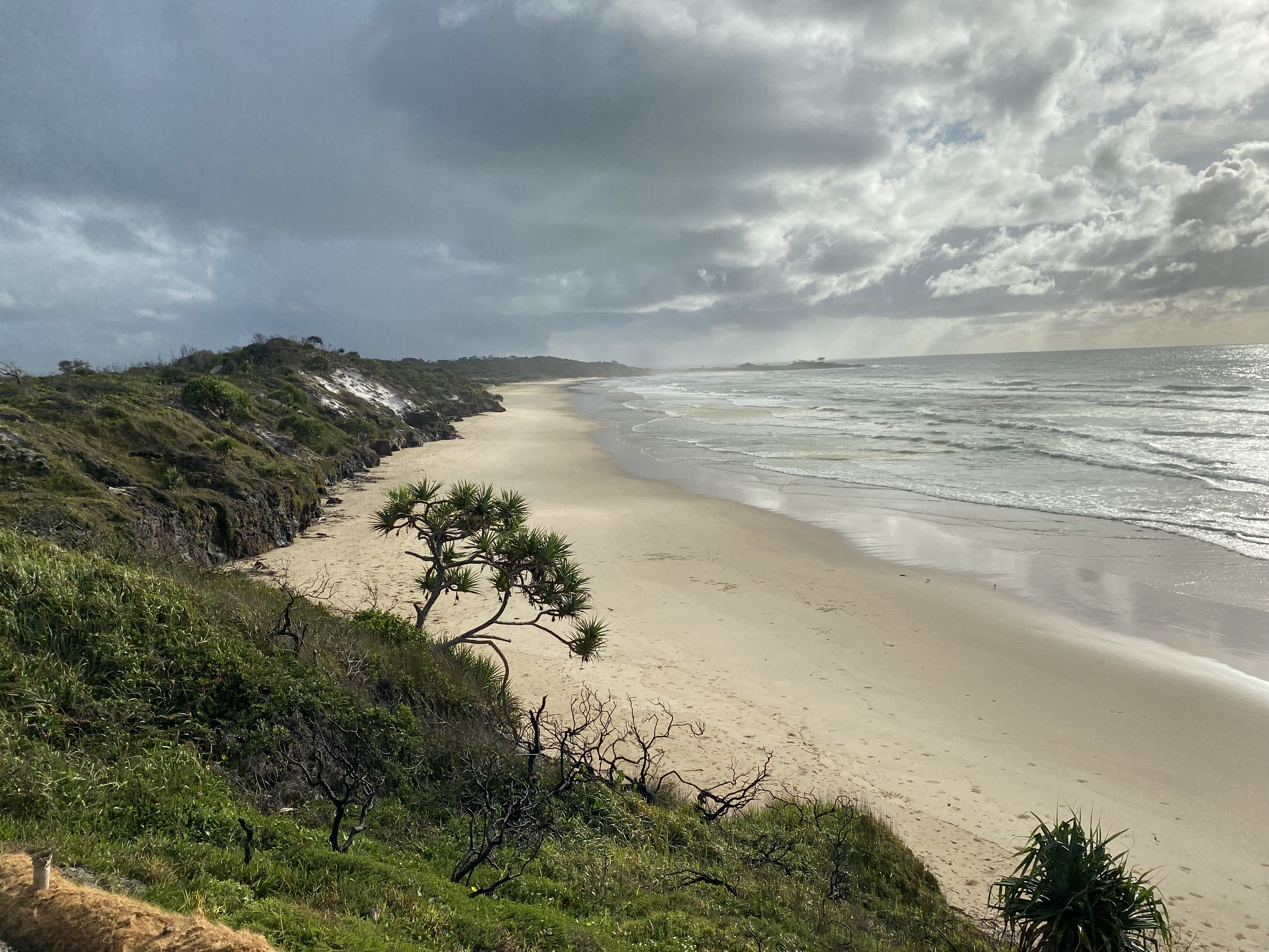
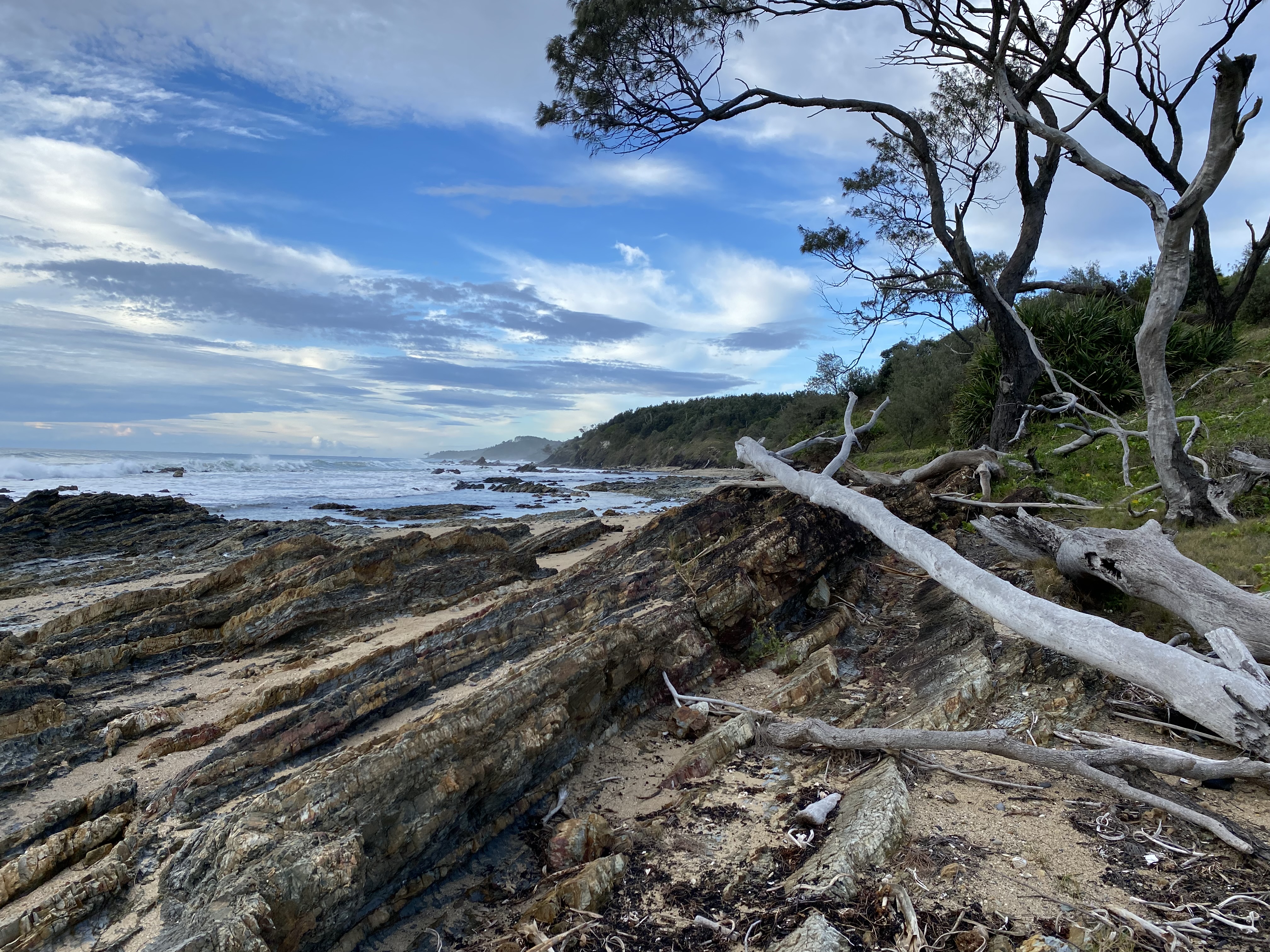
A quick overview: There were some tricky scrambling sections as well as long stretches of monotonous beach walking. The scenery changed constantly and it was spectacularly beautiful.
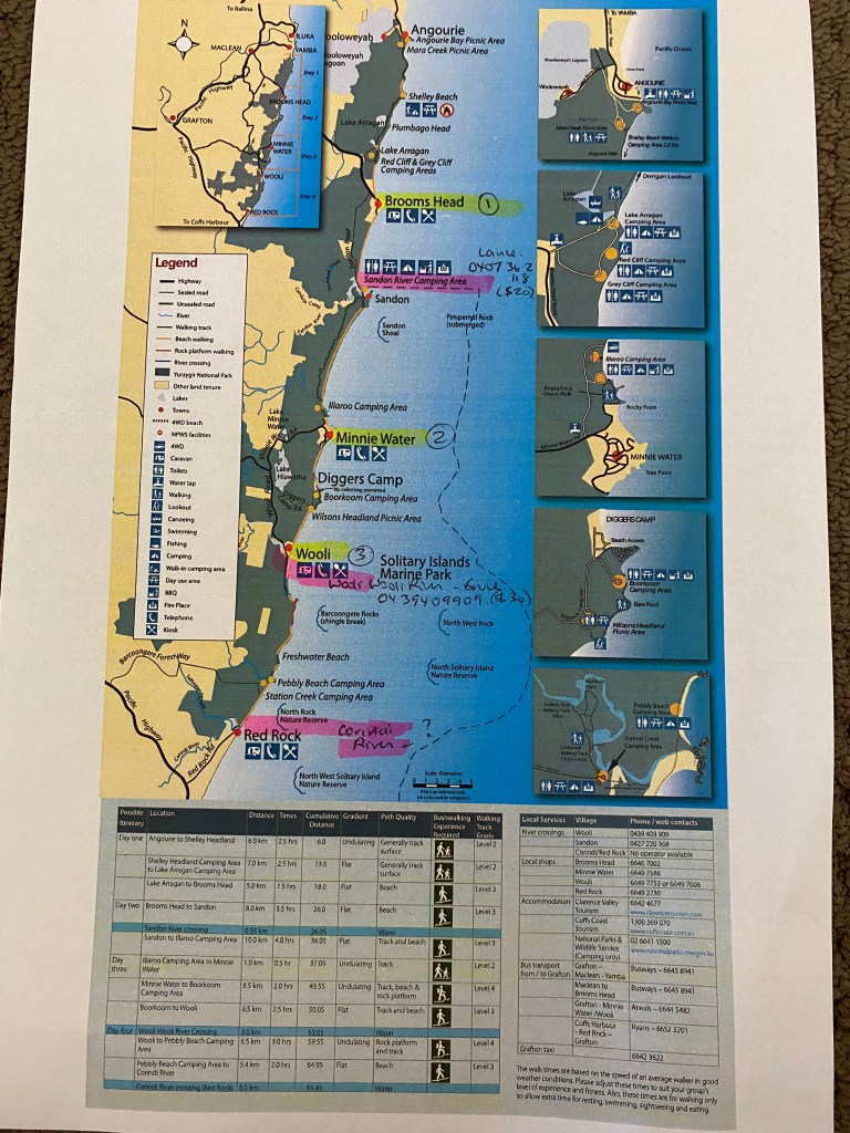
Day-by-day summary (27th to 30th of April 2023 ):
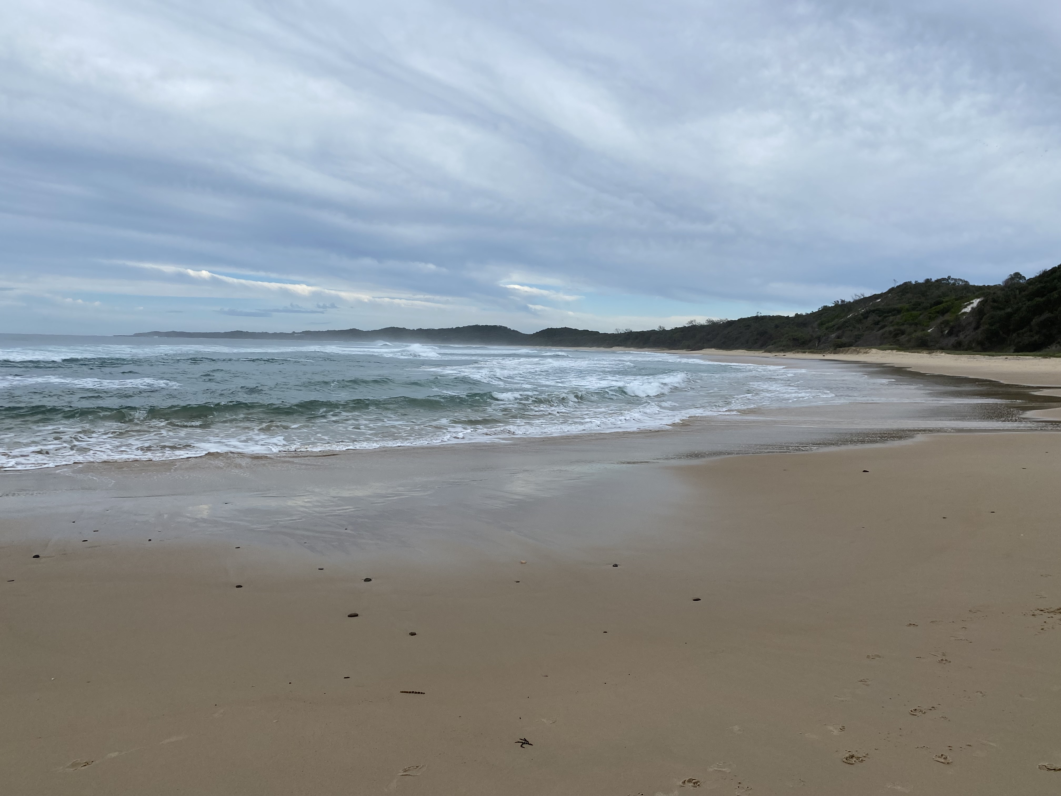
Day 1. Angourie to Brooms Head: Trail info says 17km (iWatch says I walked 22.1km) *Grade 2 – 3 walking track
Day 2. Brooms Head – crossing Sandon River (via boat) to Minnie Water: Trail info says 17km (iWatch says I walked 24.7km) *Grade 3 walking track
Day 3. Minne Water to Wooli: Trail info says 17km (iWatch says 23.8km *I had walked an additional 5km in Wooli) *Grade 2 – 4 walking track
Day 4. Wooli – crossing Wooli River (via boat), and crossing Station Creek (wading across) and crossing Corinda River (swimming) to Red Rock: Trail info says 17km (iWatch says 16.5km) *Grade 3 – 4 walking track
Tips for those thinking about doing this walk:
- Days 1-3 are pretty straight-forward, and you could just finish at Wooli if you prefer
- Day 4 – you need to be sure you can do this. Once you commit, it is hard to back out. Once you’ve crossed Wooli River, you must complete 5 km of fairly gnarly rock scrambling. Then at the very end, at Corinda River at Red Rock, you will need to swim about 15-20 meters with your pack. At rare times, you can wade across, but conditions change quickly so don’t count on it. Be prepared to swim with your pack. I’ll describe how I did it, for those interested.
- I recommend you plan your whole trip around the tide times on the 4th day. If the low tide had been much earlier on my 4th day, the day would have been a lot more risky. I hadn’t even thought of that being a ‘thing’ when I was booking everything at the very beginning.
- Wear grippy boots for scrambling.
- Consider leaving your heavy pack at Wooli, and pick it up later in the day. Best ‘lucky’ decision I made.
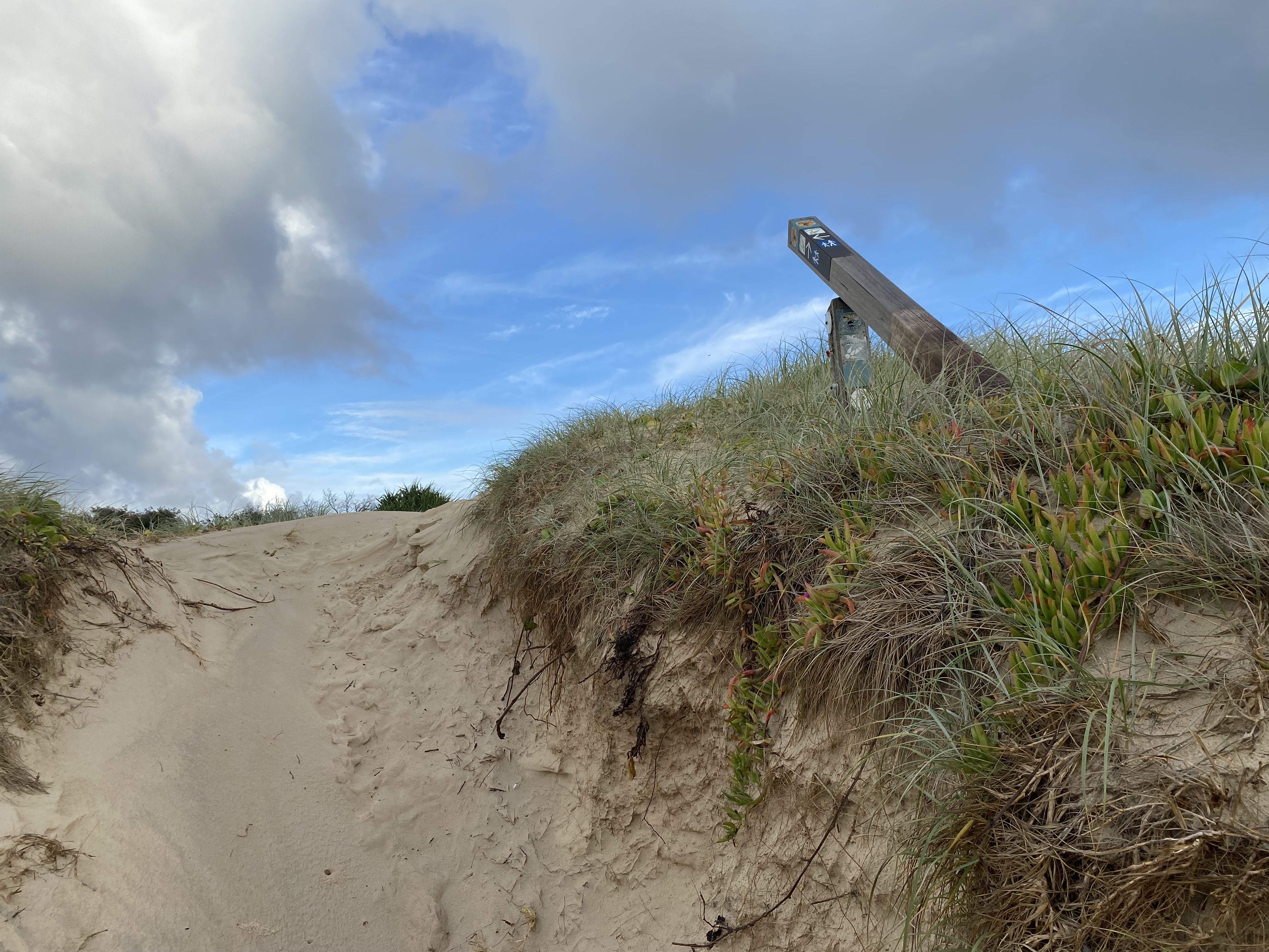
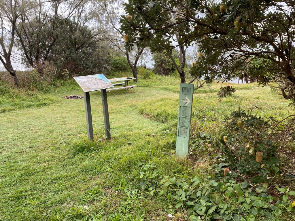
- Don’t expect many signs along the way to direct you. Really – don’t.
Preparation:
I found this walk on the internet while looking specifically for a 4-day hike. It looked like the kind of walk I’d like… wide open spaces, beautiful scenery, and access to drinking water. I realized at the outset that it might be a bit complicated, considering there were several river crossings to arrange. I also had to plan how I would get there and home again, considering it was a north-to-south walk. I booked accommodation at various camping sites about three weeks beforehand, and once I’d done that, I was committed.
I already had the equipment I needed for multi-day hikes, so the whole trip was on the very cheap side. Accommodation for three nights – $117, two river crossings – $40, and dehydrated food – $50. Of course, there was petrol as well, but that was it.
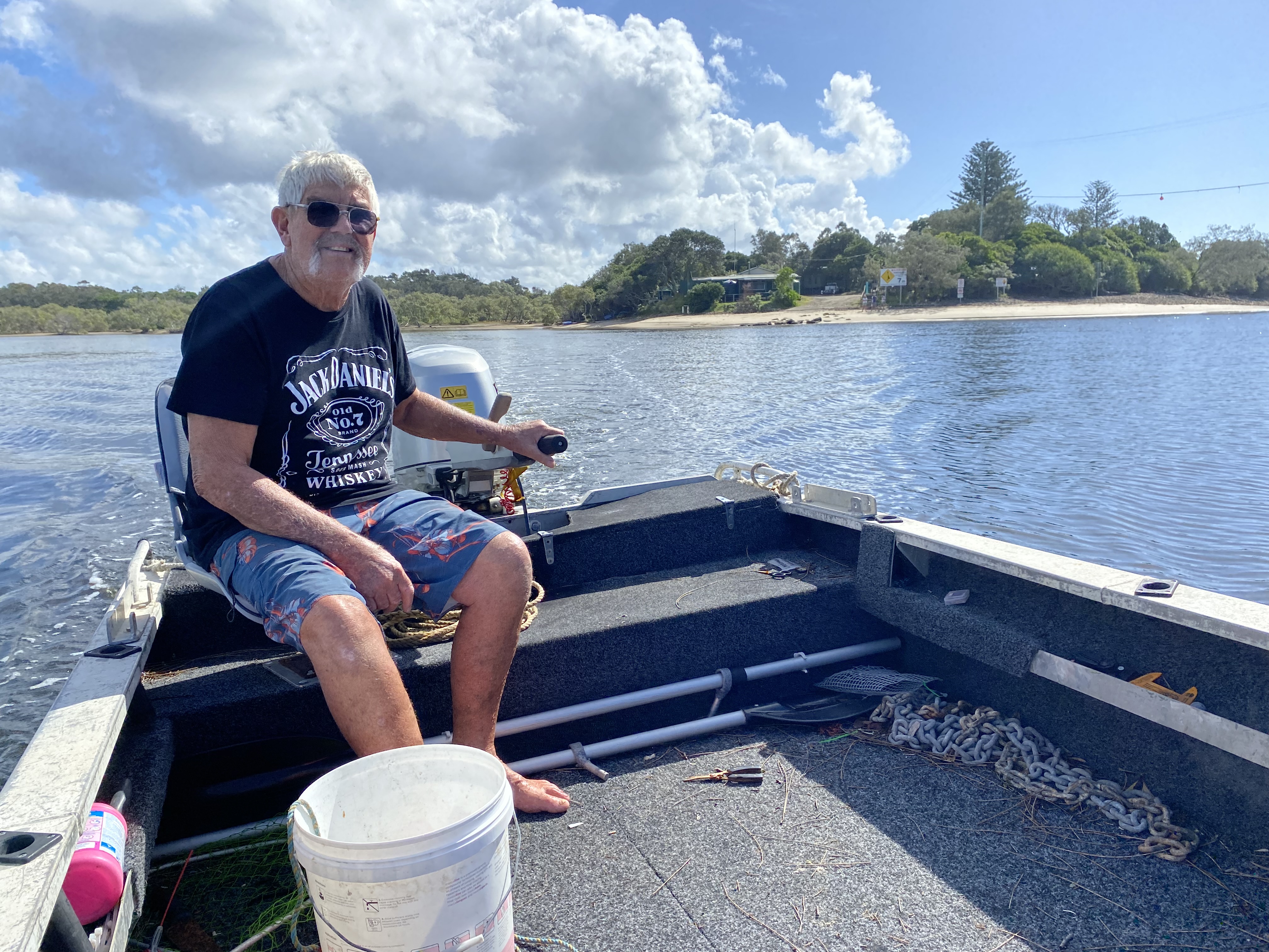
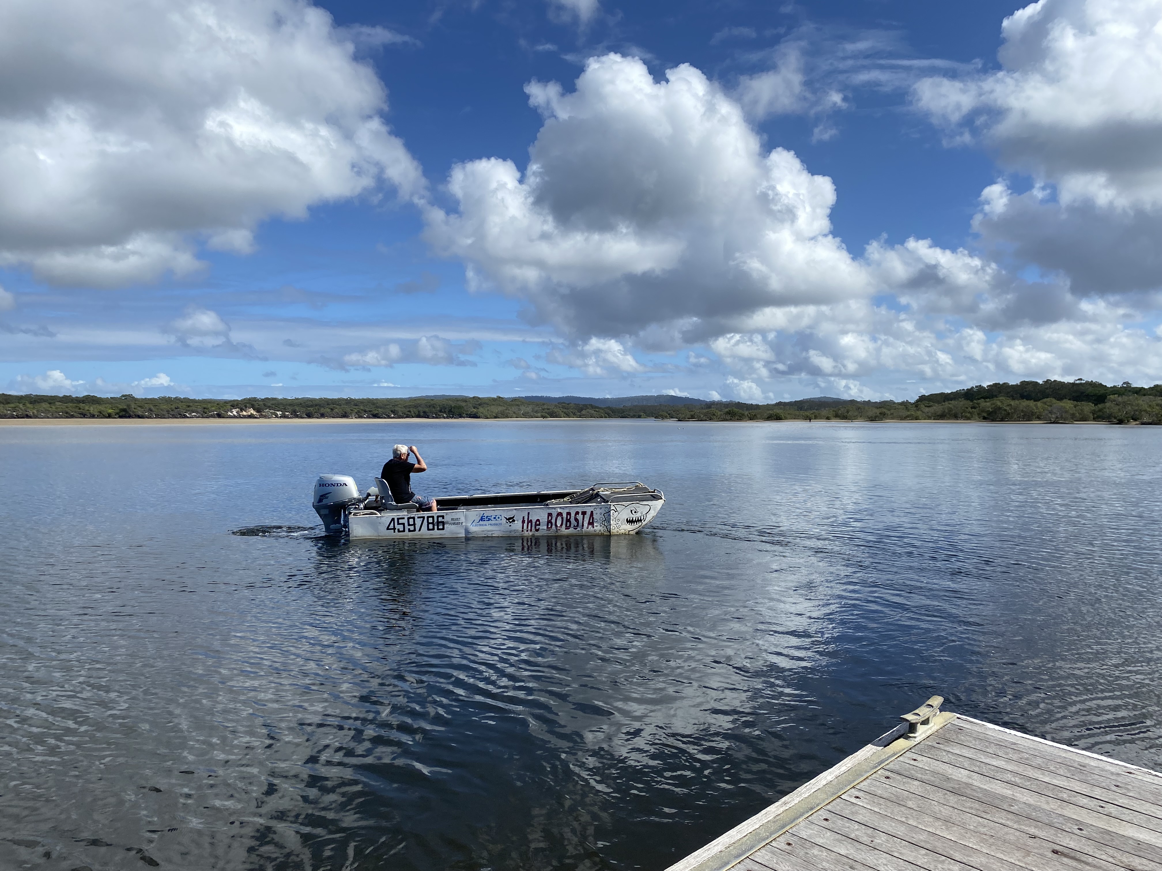
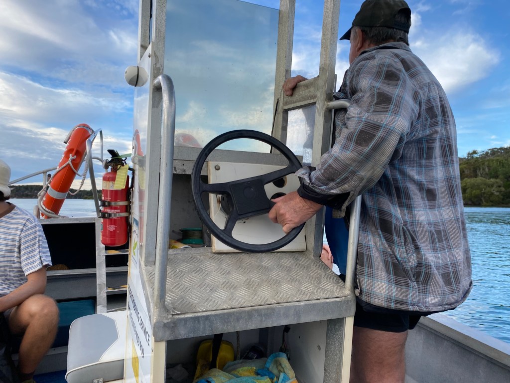
To cross Sandon River on day 2, I booked with Lance in the Bobsta – 0407 362 118.
To cross Wooli River on day 4, I booked with Bruce – 0439 409 909.
To cross Corinda River, I spoke to the Red Rock Surf Life Saving Club and the nearby Reflections Holiday Park. They both told me there had been a boat to hire several years ago, but there wasn’t one any longer (citing insurance and cost as the reasons). You have to swim. You may be able to flag down a passing boat if you’re lucky.
I called the Grafton National Parks and Wildlife Service to check that there was nothing I needed to know (planned backburns, park closures, etc.) and they were very helpful. They told me that I didn’t need to worry about Aragon Lake (which on the map looked like it connected directly with the ocean) or Brooms Head River (same) as neither went all the way out at that time. Their details are: 02 66411500 or 1300 072 757 (Mon-Fri, 8.30-4.30)
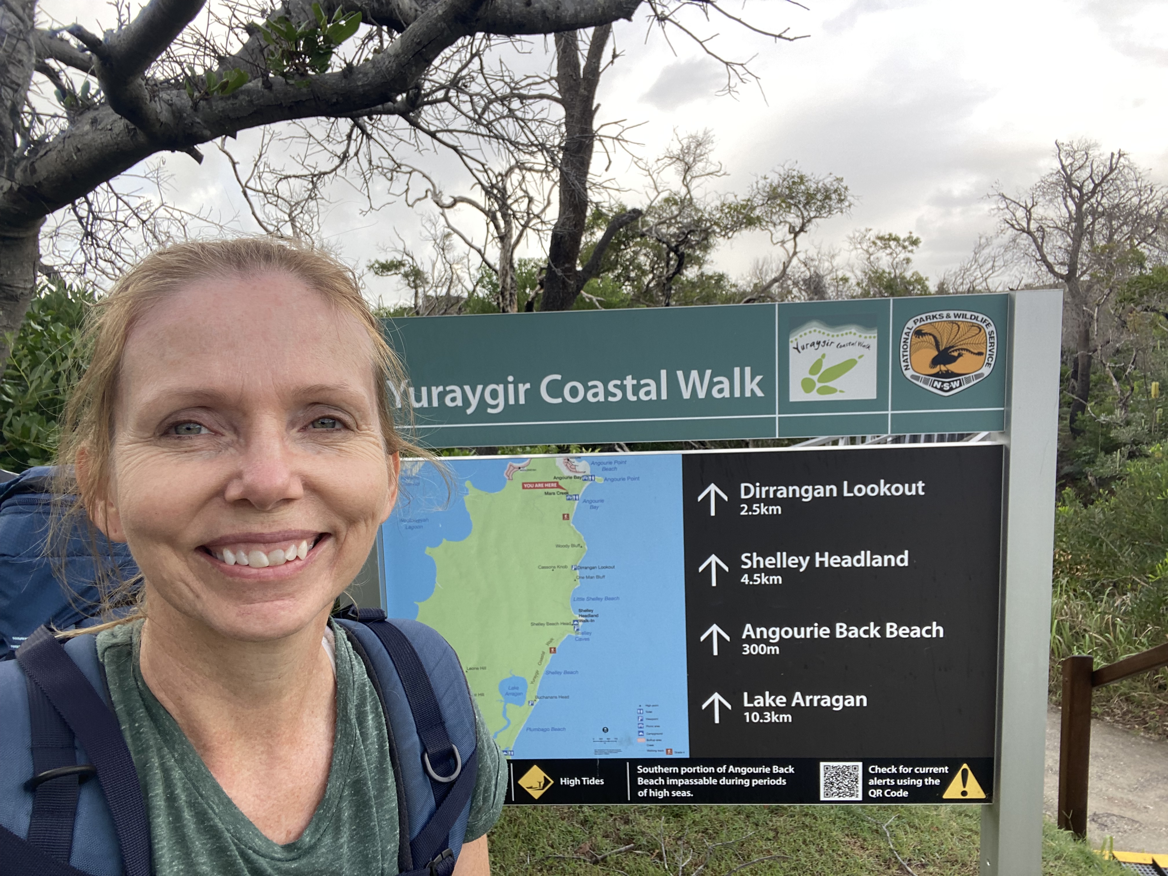
Day 1: Angourie to Brooms Head.
I woke at 3am, leaving home at 3.30am to drive to Angourie. I was still a little uncertain about ‘crossing’ the beach at Angora Lake and Brooms Head River, so I wanted to try to get there at the lowest tide I could manage, hence the early start.
Arriving at Spooky Beach in Angourie just south of Yamba at 6.30am, I ‘pinned’ the location of my car to my beautiful parents who were going to come and pick it up in 2 days’ time. They were kindly going to relocate it to my final destination at Red Rock. Did I mention I have the best parents in the world?
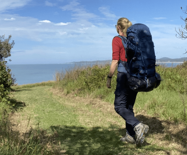
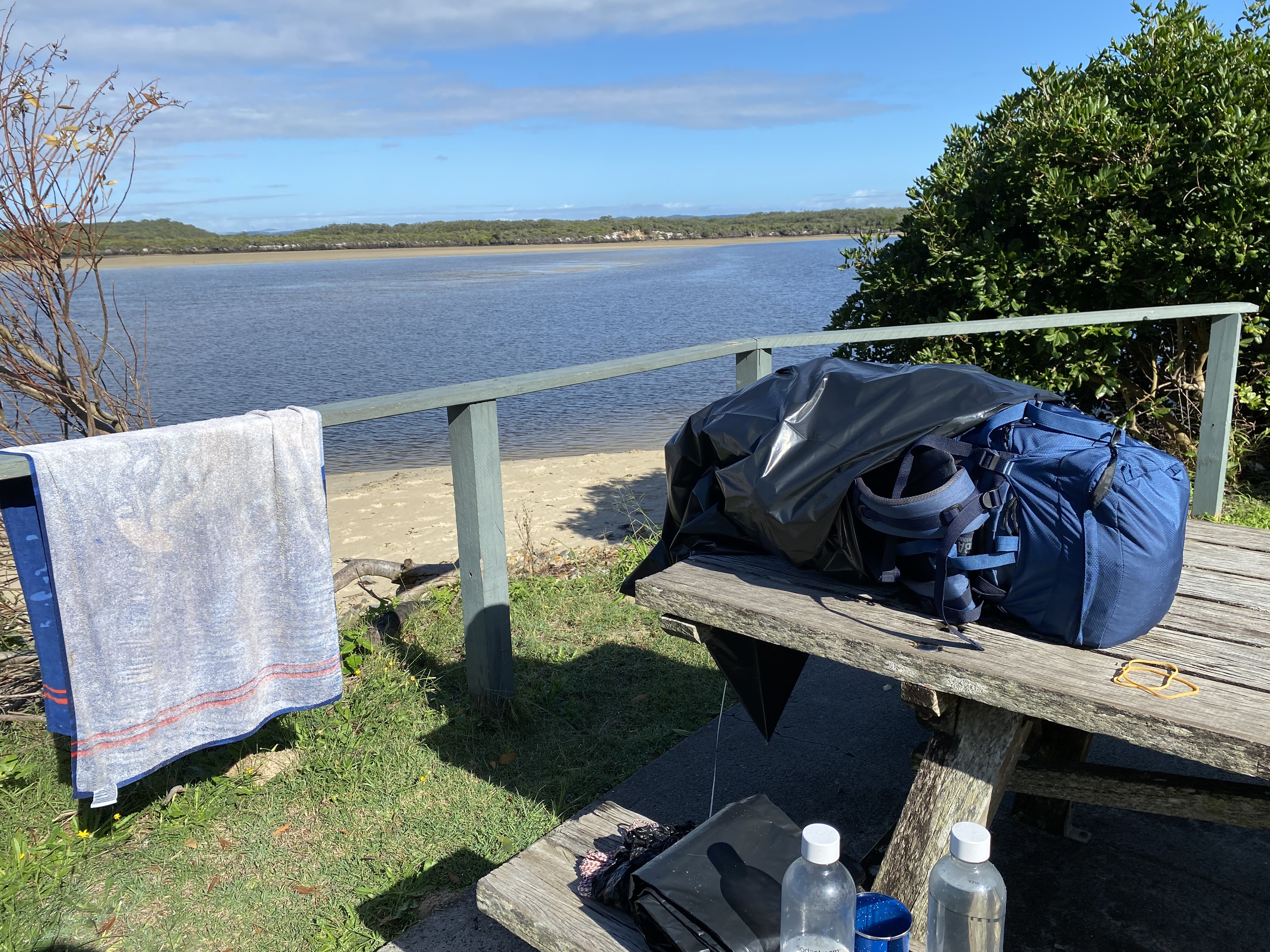
My pack weighed about 18kg, which was very manageable (given I’d been lugging 25kg around on my multi-day hike on the Great Ocean Road just three months earlier). I could actually pick this pack up off the ground.
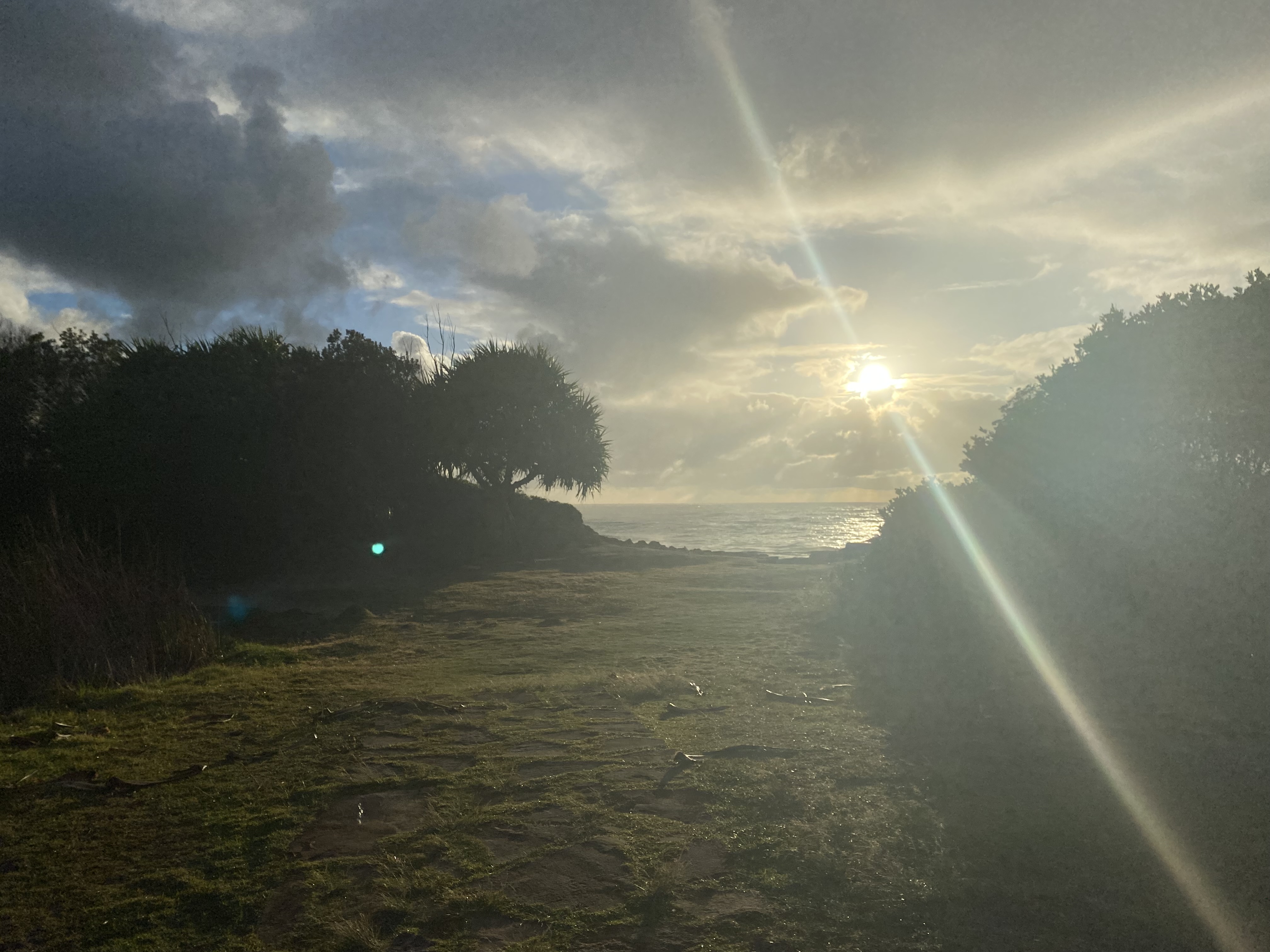
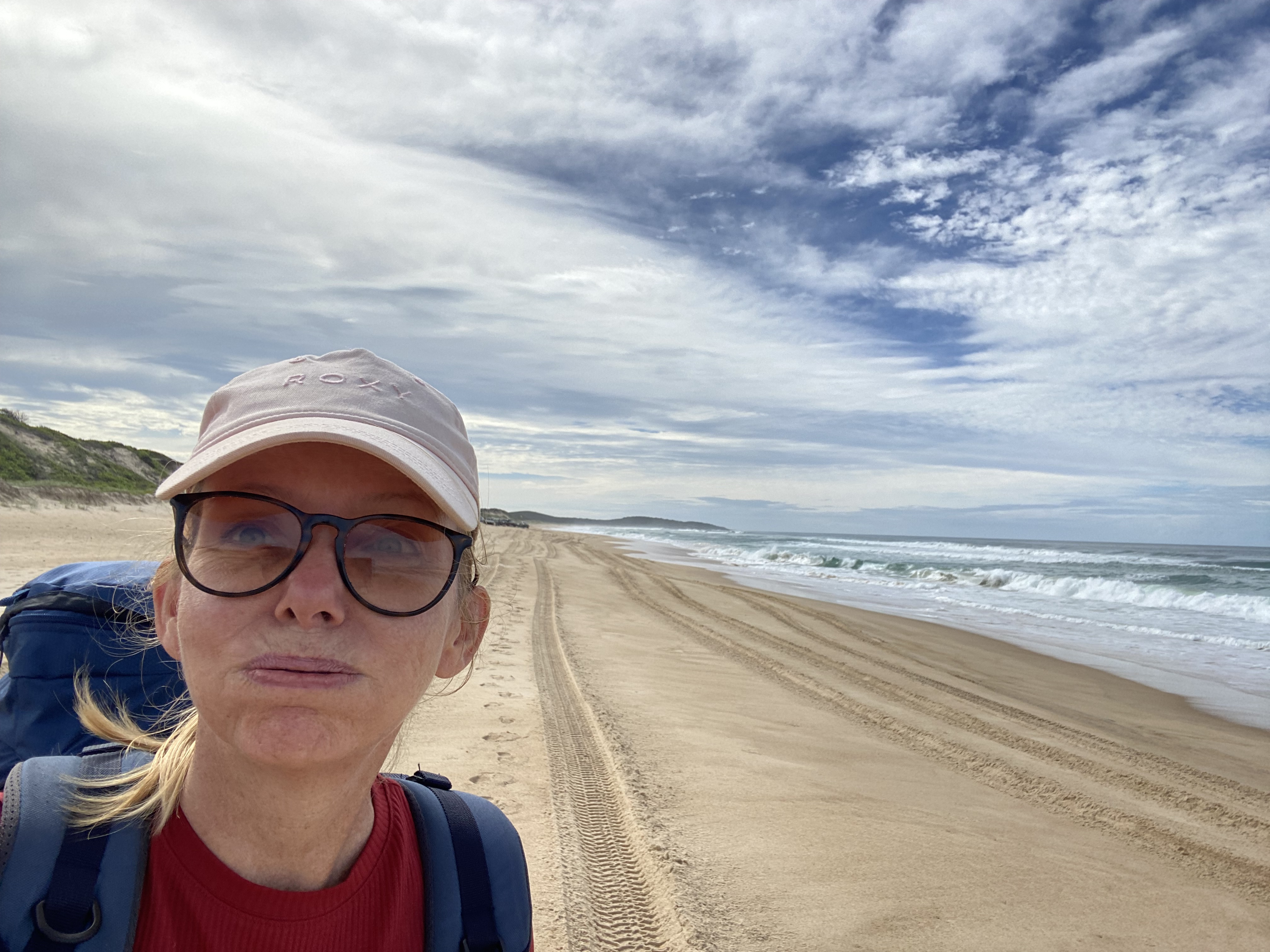
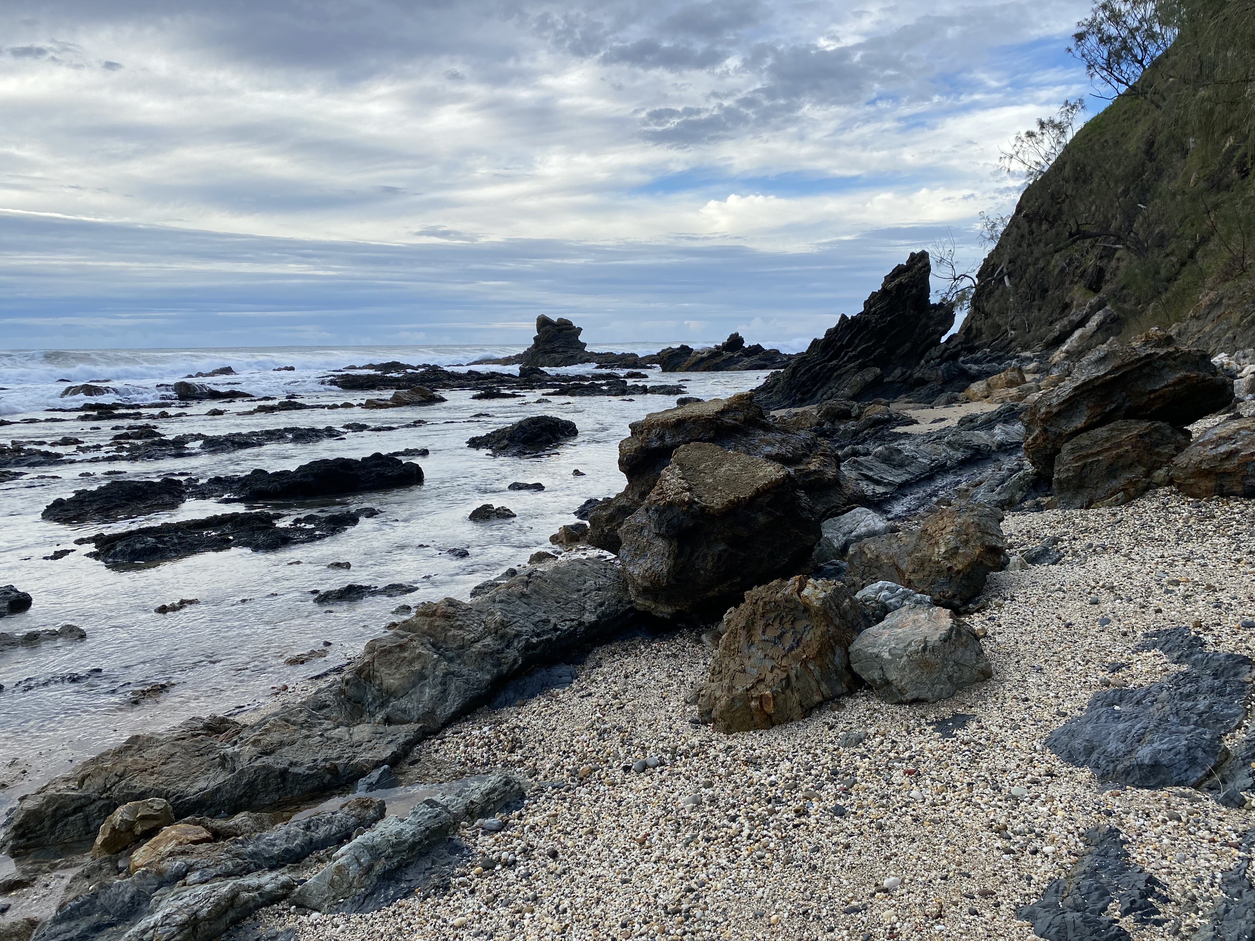
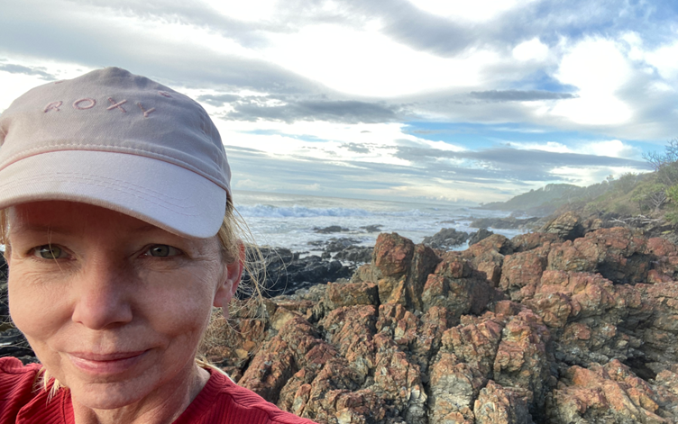
Angourie Point Beach looks like something out of a storybook; rock pools, black boulders, and an impressive rock shelf that curves around the bay. I took my ‘obligatory’ selfie with no one around. There was a little bit of scrambling to do to get around the point and the rocks were quite slippery. I got a little taste of what scrambling with a heavy pack is like. Basically, if you start to lean too far in any direction, it is not as easy to right yourself again. I may have landed on my backside at least once.
Once I made it onto the beach, I was looking for signs to direct me where to go. So far I hadn’t found a single one. I could see that at the end of that beach, there appeared to be an impassable cliff. Walking along the beach, I was looking for a path to take me inland.
The National Parks brochure mentioned something about starting the walk at Back Beach at Angourie, but that did not show up on google maps. I just hoped I’d be able to find my way onto the elusive inland track at some point.
After walking for a while, I saw a stick sticking out of the sand. I wondered if this might be the ‘tall post’ the pamphlet was talking about. Surely not. It was only a stick that anyone could move. I looked for a path into the dunes for a few hundred meters but couldn’t find anything. I checked All Trails but it kept leading me along the beach. Finally, I thought that I must have missed it and turned around.
Luckily, a single walker was heading up the beach toward me. When we met up, he asked ‘are you lost?’ well… I kind of was. Already. That didn’t take long.
He walked with me about twenty meters further up and showed me where the track was. You really couldn’t see it from the beach. There was a sign, but it had been pushed over in a flood some time ago.


Great! Back on track.
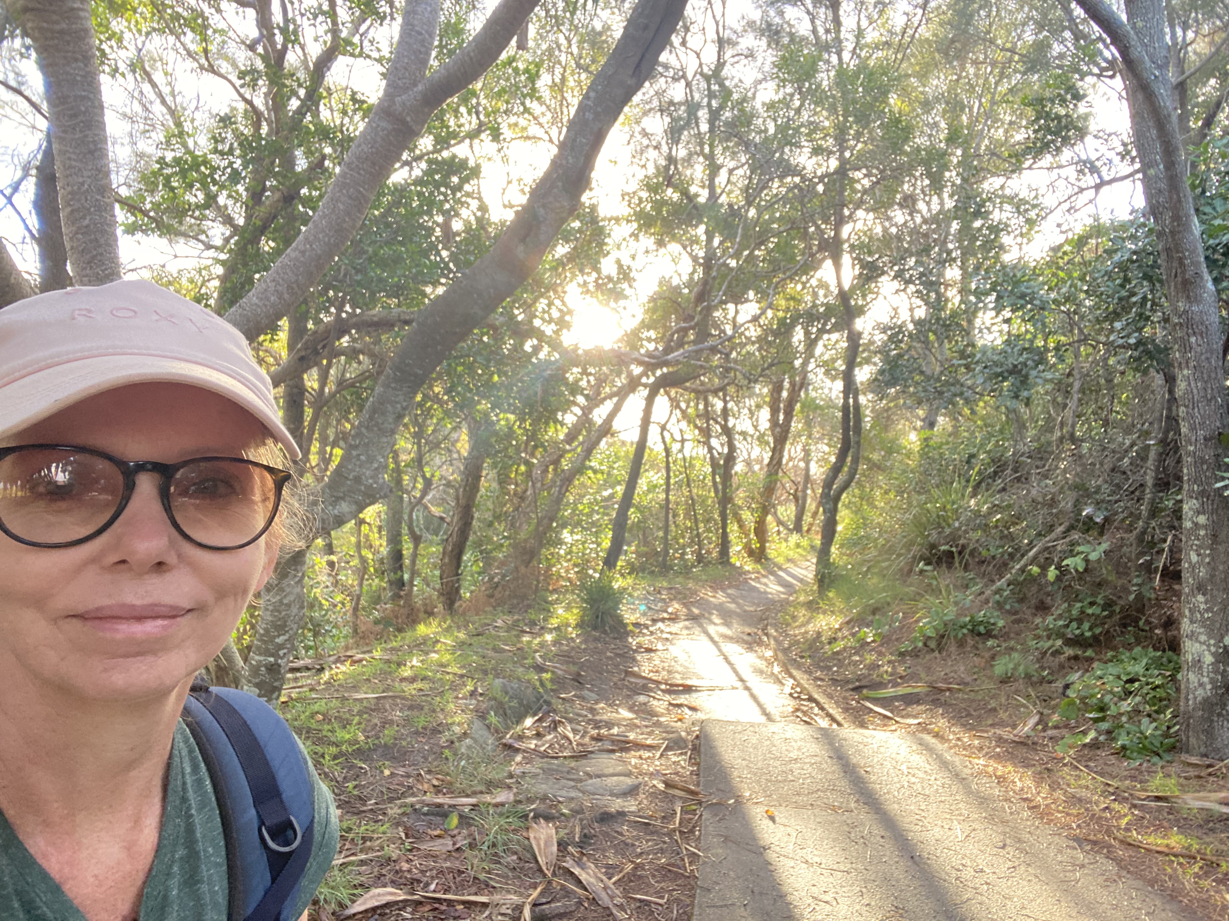
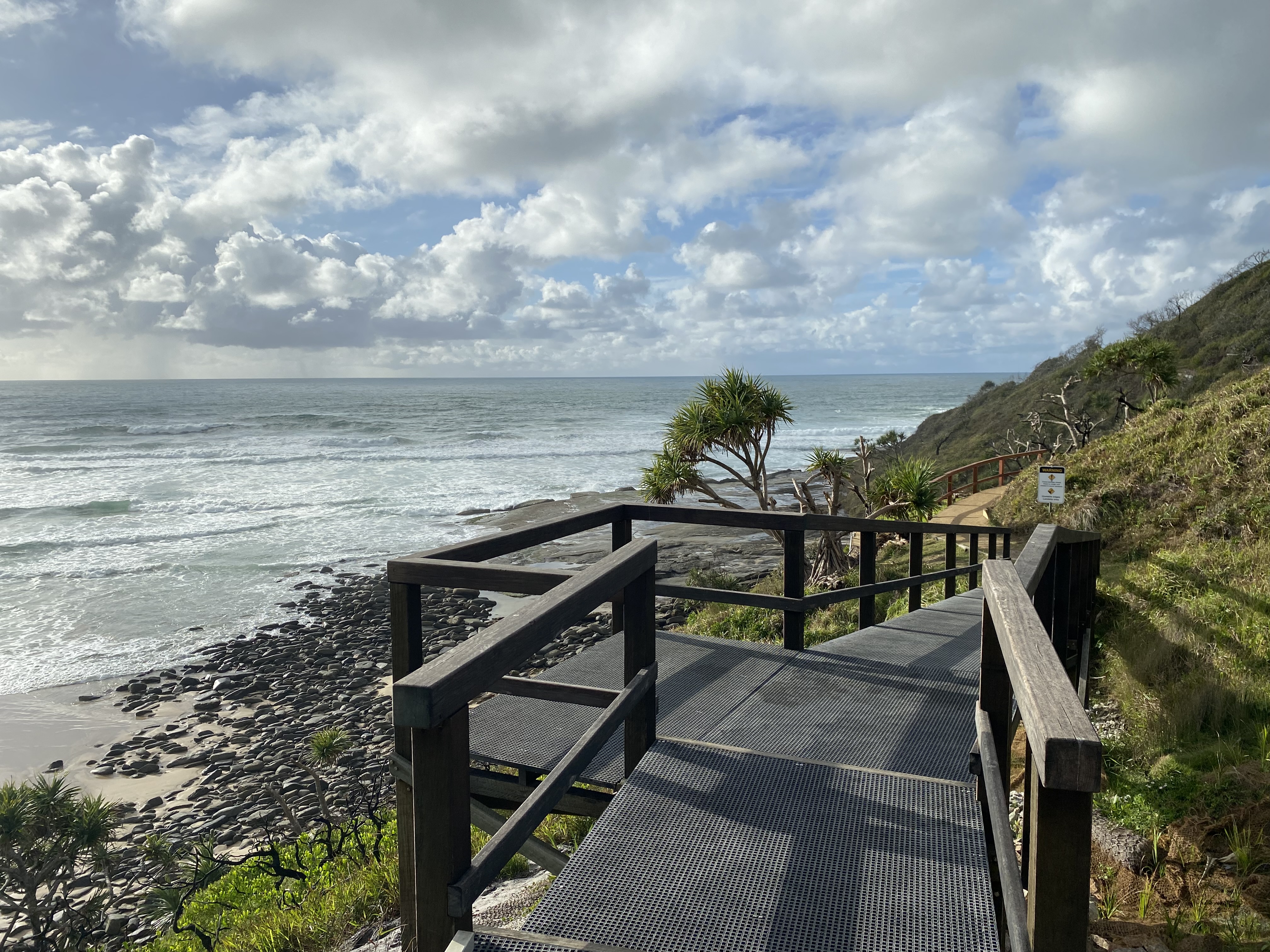
Turns out I could have kept going along the beach since there was a staircase leading upwards much further along. But the inland track was such a treat. Alive with nature. Flowers, wallabies and birds galore. Still felt like something out of a Disney movie. I felt like skipping but couldn’t… due to my pack.
It rained on and off, and I got to test out my backpack cover and my raincoat. All worked swimmingly.
This section then spat me out on Shelly Beach and after 7km of walking – most of it on the soft sand, I spotted a sign in the bush that said Shelly Beach Camp.
I thought about continuing onwards, but the very nice Eco toilet beckoned me. As I walked through the dunes, I noticed a sign that led to the south, which was the next inland route.
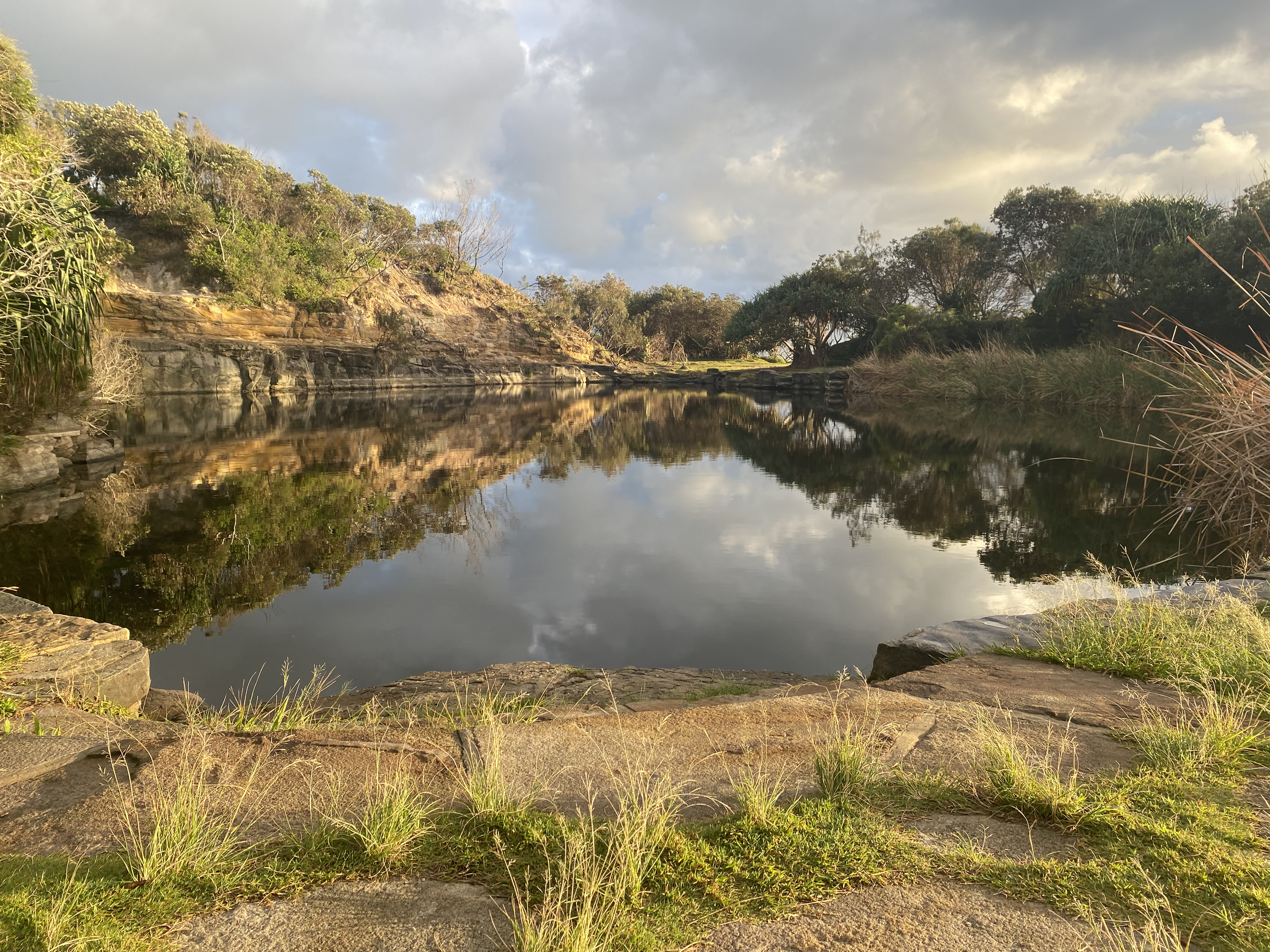
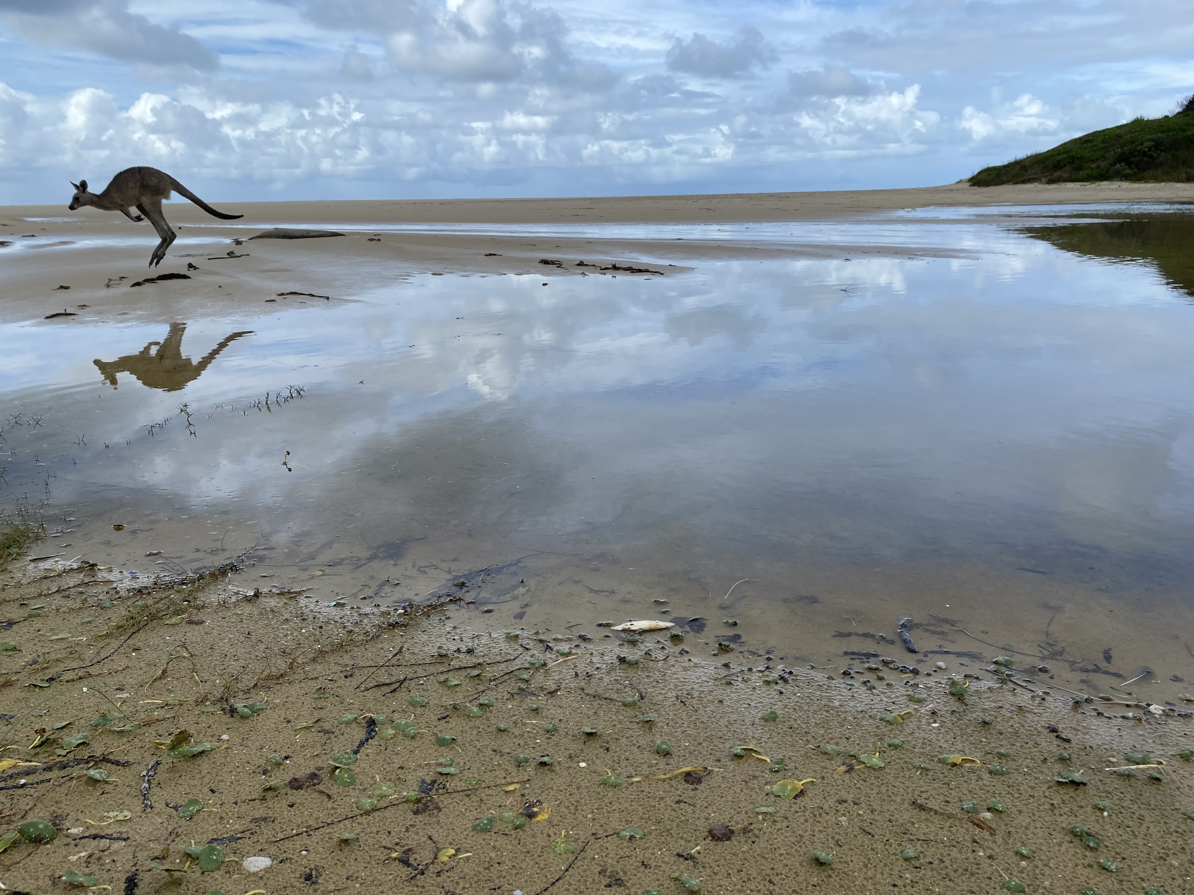
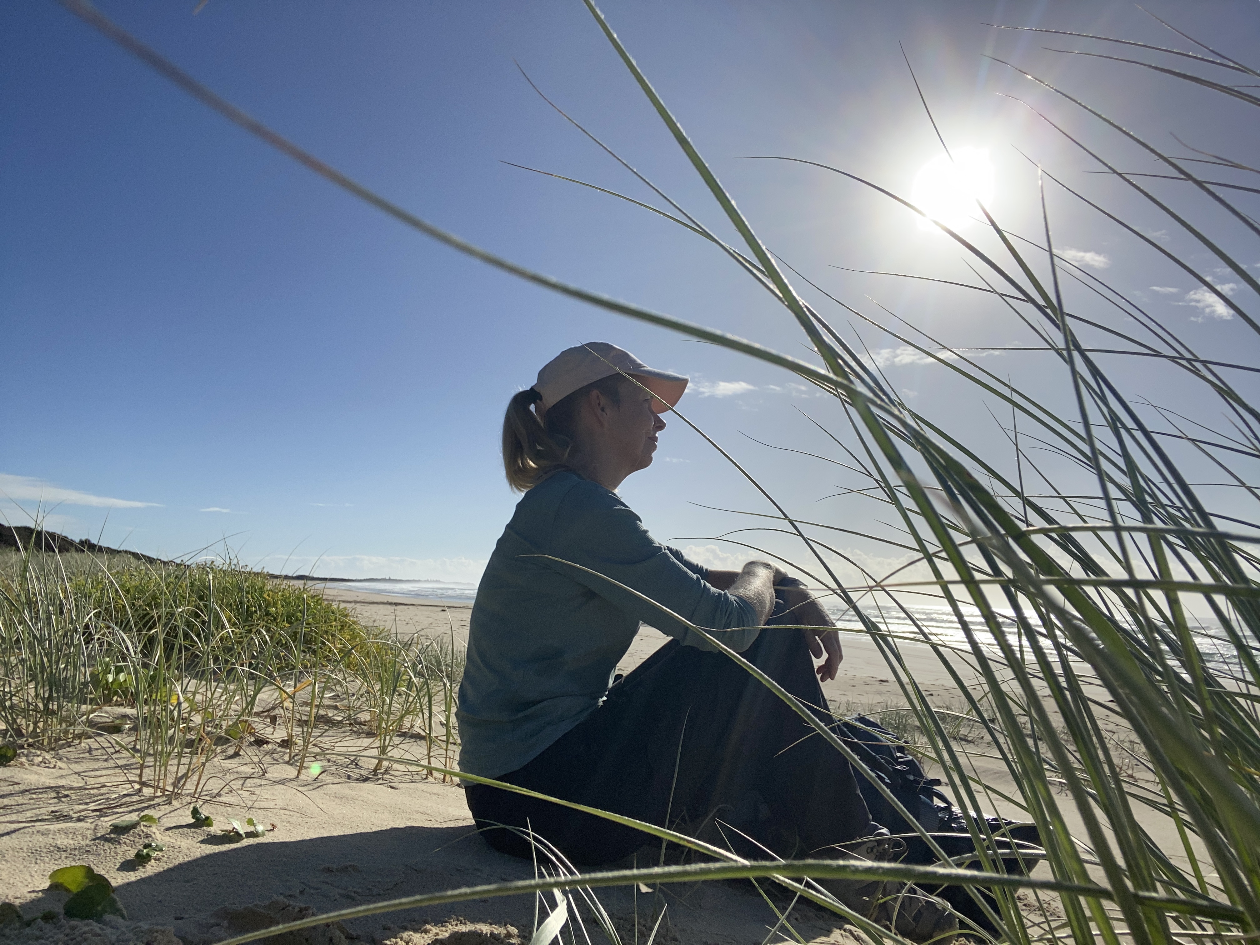
I followed this, mostly inland for 7km till I reached Lake Aragon. I was very happy to discover that there was plenty of beach here. No swimming was required. There were several kangaroos along this stretch, and I sat for a while enjoying the peaceful place.
There was a small path leading upwards, on the other side of the lake. I wasn’t sure if I should go there or along the beach but chose inland again. I had read something about getting onto Brooms Head Beach at the Greycliff stairs at the southern end of the campground, so I kept going.
After quite a lot of walking, I thought I’d missed it. However, it turns out that the Aragon campground is massive. I mean massive. Perhaps a km long.
I could see the beach below but knew it was impassable a little further south. I did end up back onto it though as I could see two people who might be able to give me directions. They told me to go back up, and that I should just keep walking along the headland. There weren’t any signs. “Just keep going south”.
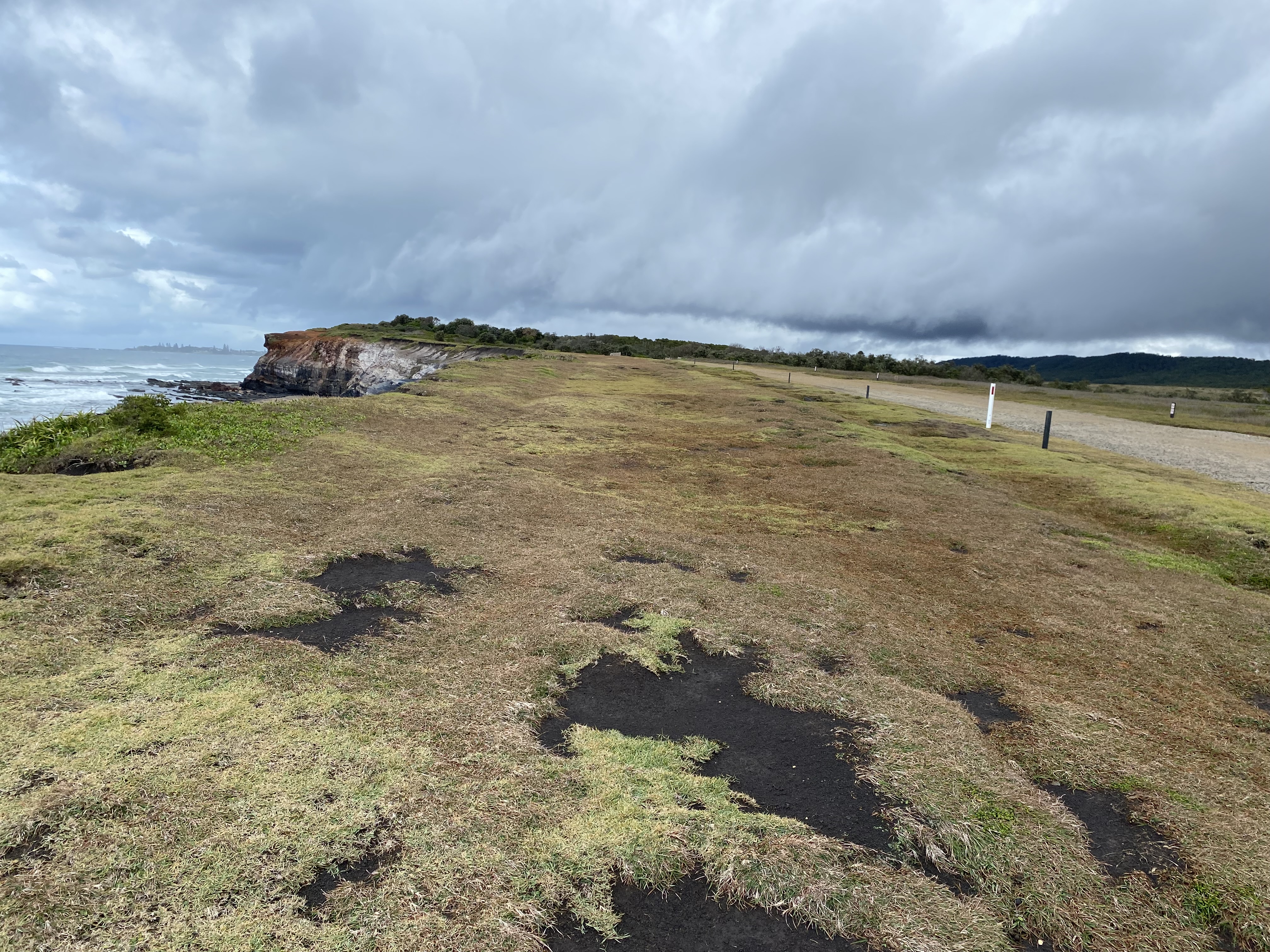
Making sure not to get too close to the edge, I did enjoy the view when I reached an area called Redcliffe, aptly named for its (sticky) red mud. Then I headed back to the campground because… I realized, Redcliff was not the right way.
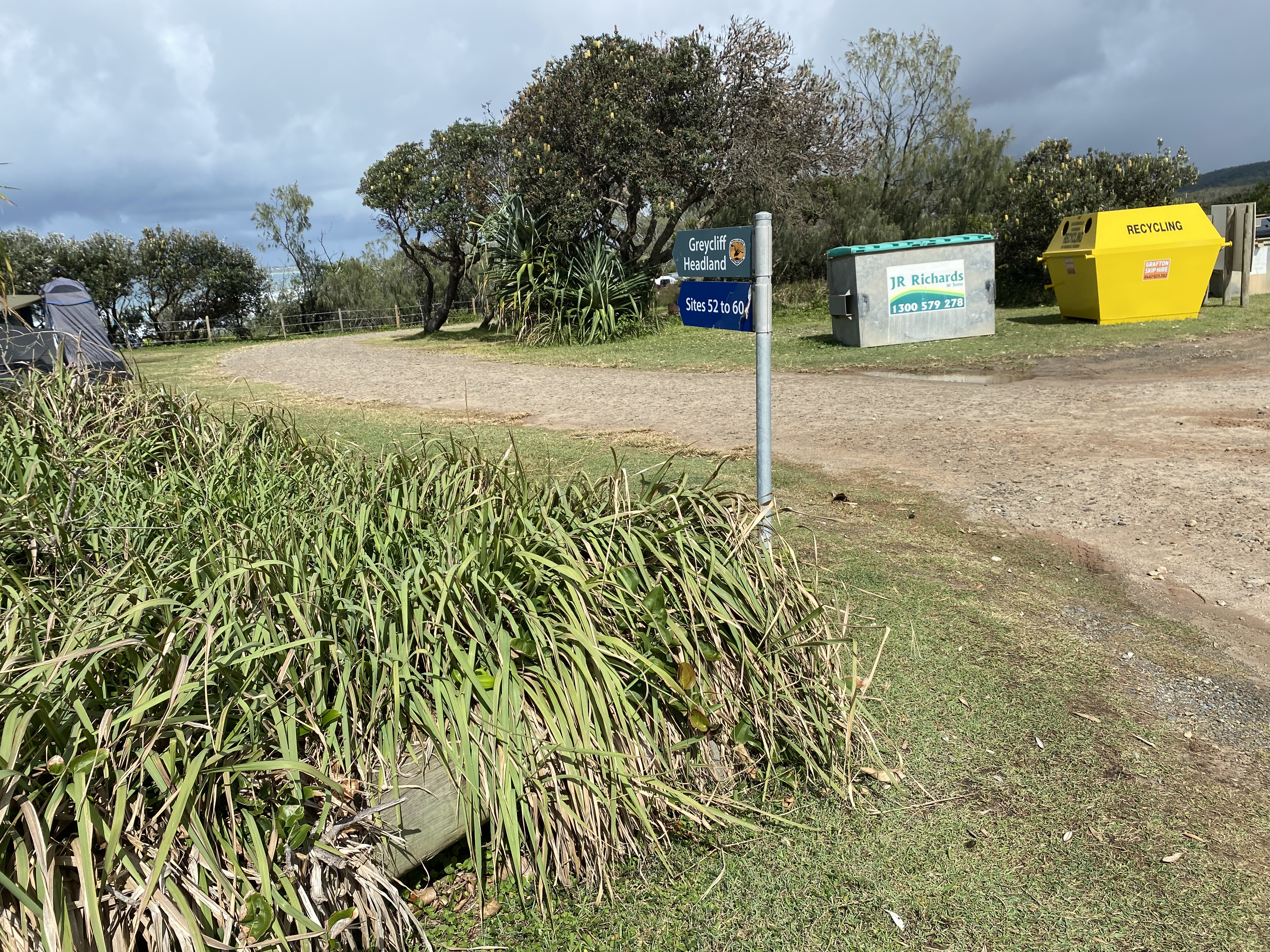
Tip: When you see a sign saying Greycliff Headland Sites 52 to 60, then you are on the right path. Go that way.
I finally found the stairs down to the beach. I knew I had plenty of time, so I practiced my cartwheels in the sand.
Another 5km to Brooms Head, raining a bit of the time but not heavily.
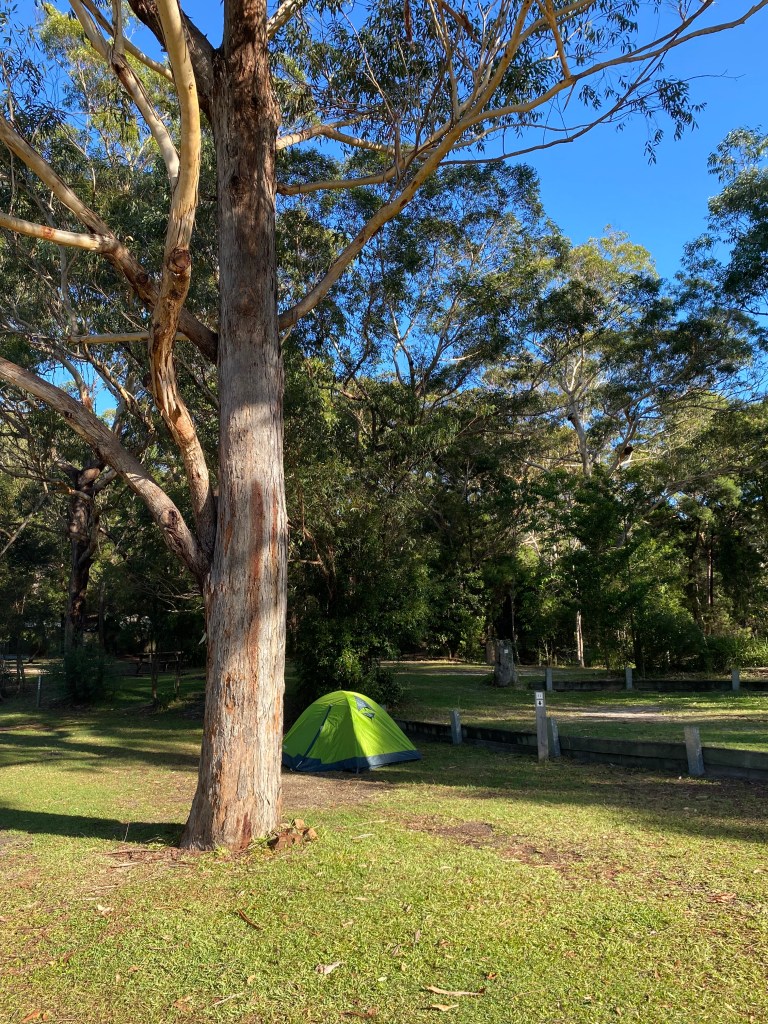
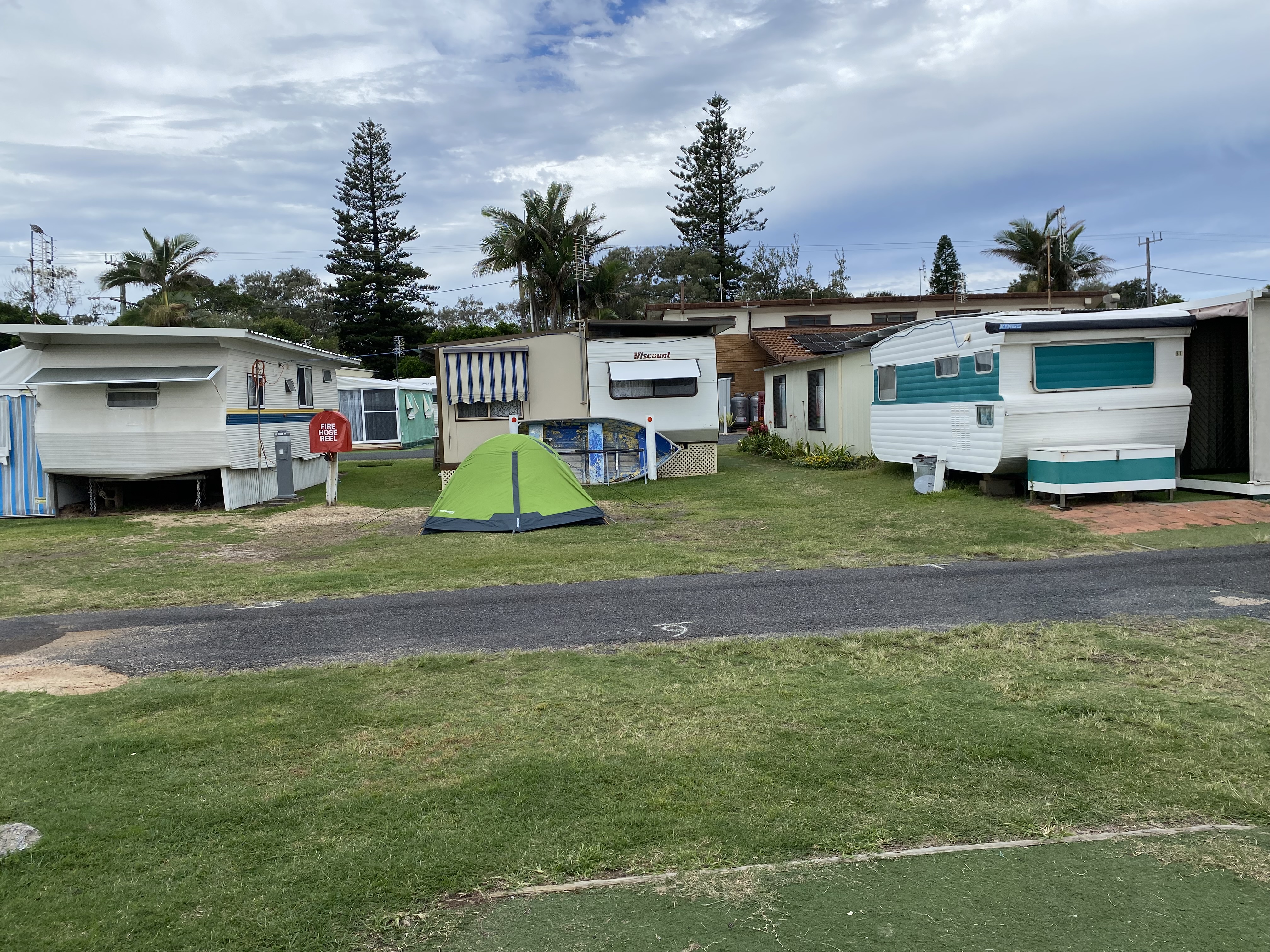
I got to Brooms Head Holiday Park where I was allocated a lovely spot right along the beach. I only had my hiking boots with me, and didn’t feel like wearing them anymore, so gingerly made my way barefoot over the pine nuts (they’re about as bad as Lego, in my opinion) and had a hot shower.
I spoke to my ‘neighbours’ who told me that the night before, a hail storm had come through. Glad I missed that bit of excitement.
Since it was raining lightly and there was no other undercover place, I sat inside the laundry room to boil my water for my dehydrated meal. I sat inside my tent to eat it and read a book till I was too tired to keep my eyes open.

Day 2: Brooms Head to Minnie Water
I slept well. A lot of rain had fallen during the night, but it was a beautiful morning. The sun was well and truly shining and there was a gorgeous rainbow in the direction I was going.
My tent was soaking wet so I sacrificed my towel to dry it as much as I could. I tucked the towel into the straps on my pack so it could dry as I walked.
A set of stairs at the southern end of the camp took me up to the bluff of Brooms Head Lookout where the view wasn’t too shabby. I followed the lovely, compacted earth of the path as far as I could till it led me back down to the beach.


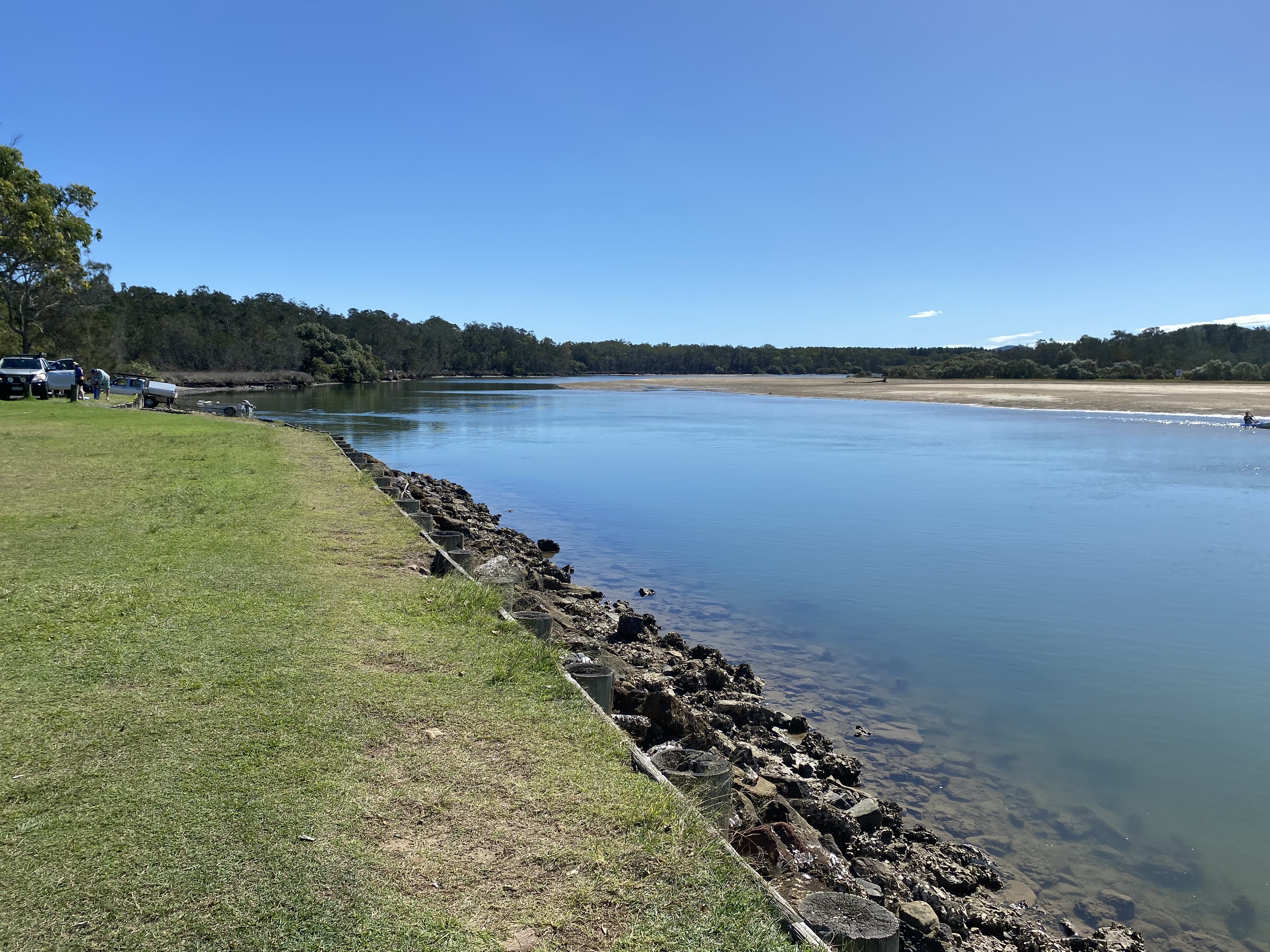
I’d covered about 8km by the time I reached Sandon. The whole time, I could see how far I had to go as the beach arced around, and I walked as fast as I could despite the sinking sand. I hoped to get there early to practice ‘floating my pack’ before my meeting time with Lance at 10.30am. I got there by 9am. As I passed around the point, I stumbled onto the boat ramp (didn’t know I was there till I was on it, but there was a sign!!!)
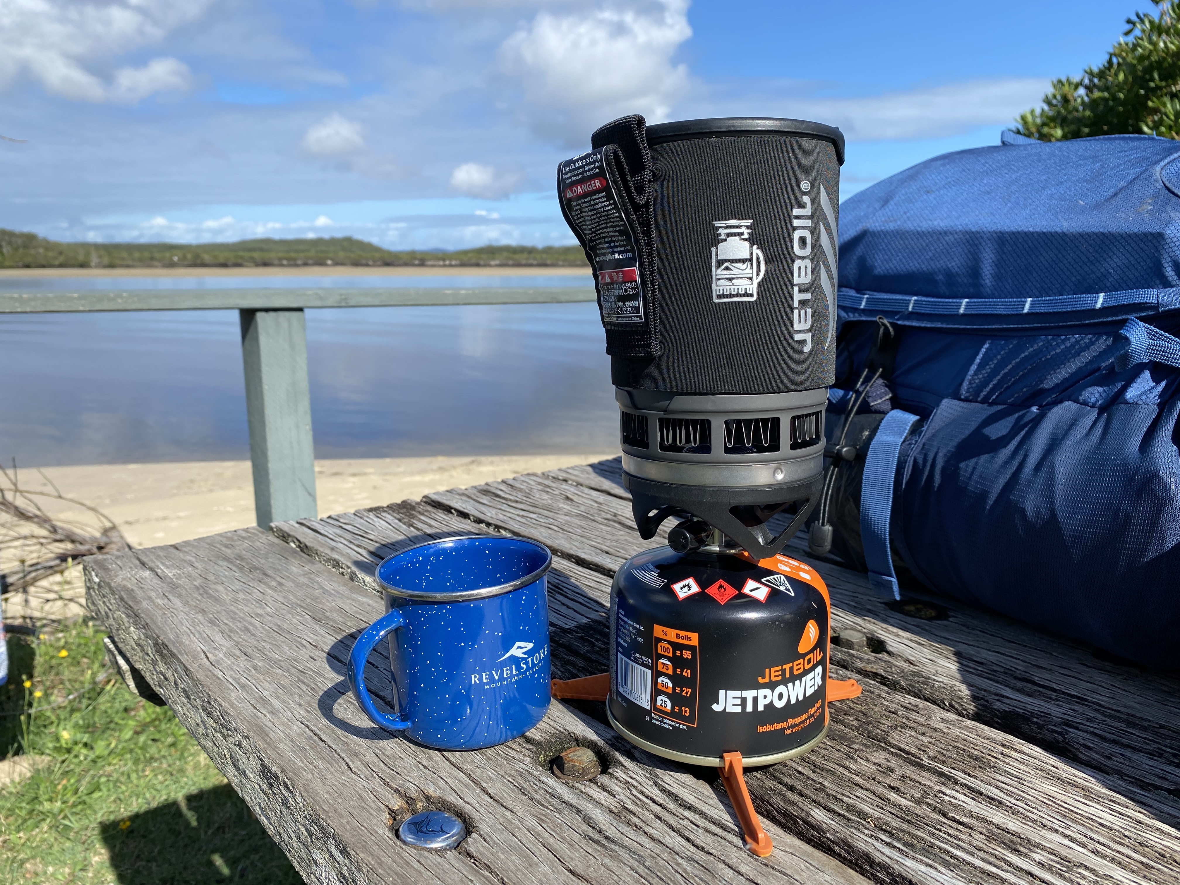
I found myself a really nice spot to relax and wait for Lance. I made a hot drink with my JetBoil and got to work on trialing my floatation system.
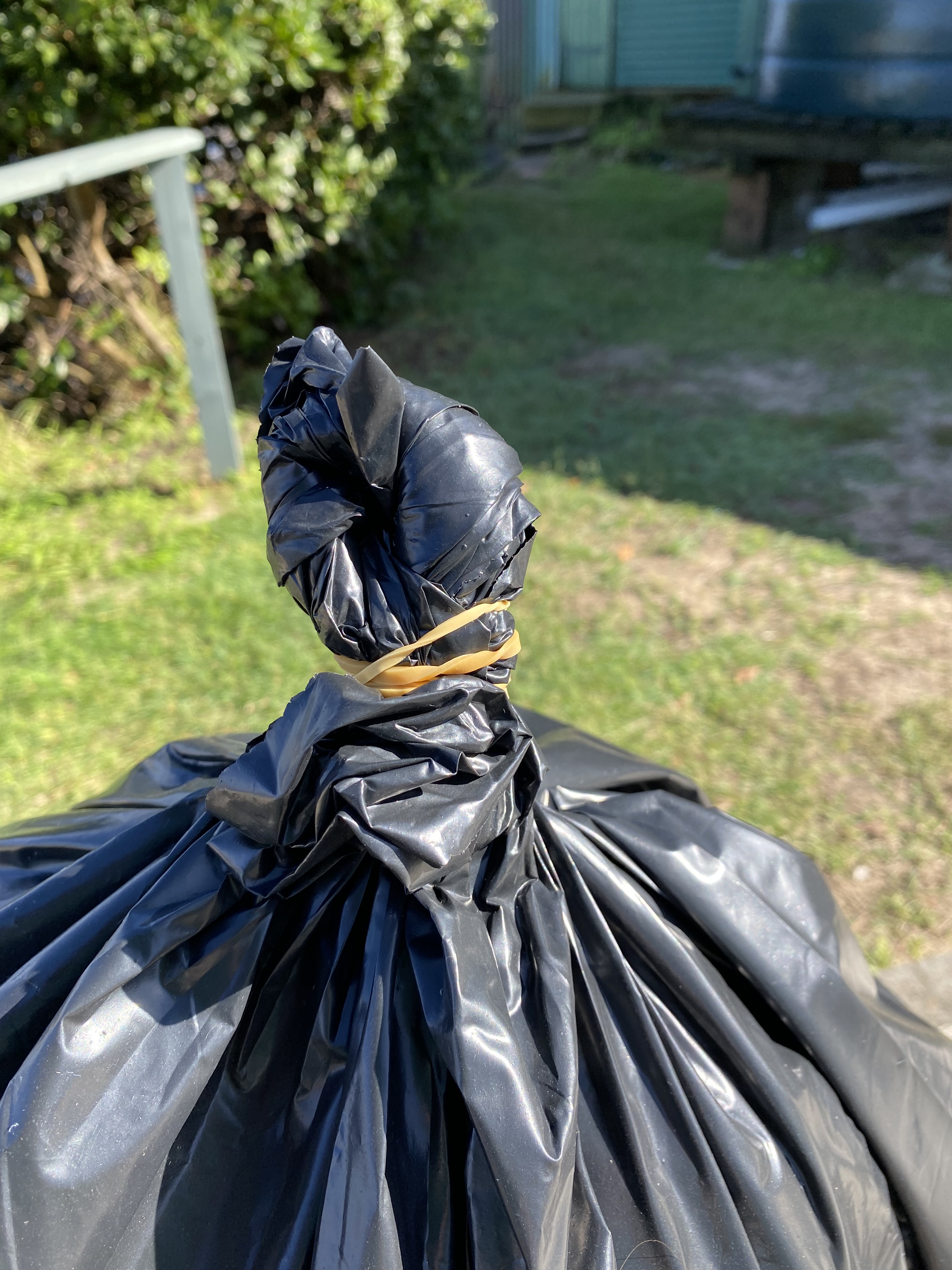
How to float your backpack (if interested):
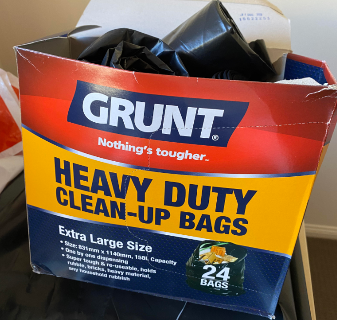
- Buy solid heavy-duty bags. Not the flimsy shopping bags you get at the supermarket. You’ll need at least 2 for each bag you plan to float. I suggest having at least one extra, just in case.
- Get some rubber bands – long ones.
- Get some thin rope.
- Gingerly put your pack inside the bag being very careful not to tear the plastic bag on any straps or buckles.
- Sit the pack up and twist it around at the top. Make sure there is air in your pack.
- Put it into another bag and grab the top of the inner bag and outer bag and twist them around tightly. Tie a rubber band around it. Twist that then back on itself so you form a loop. Tie another rubber band around it. Go crazy with the rubber bands if you want to.
- Use the string and tie that around the base of all those rubber bands and make a large loop big enough to put your arm through.
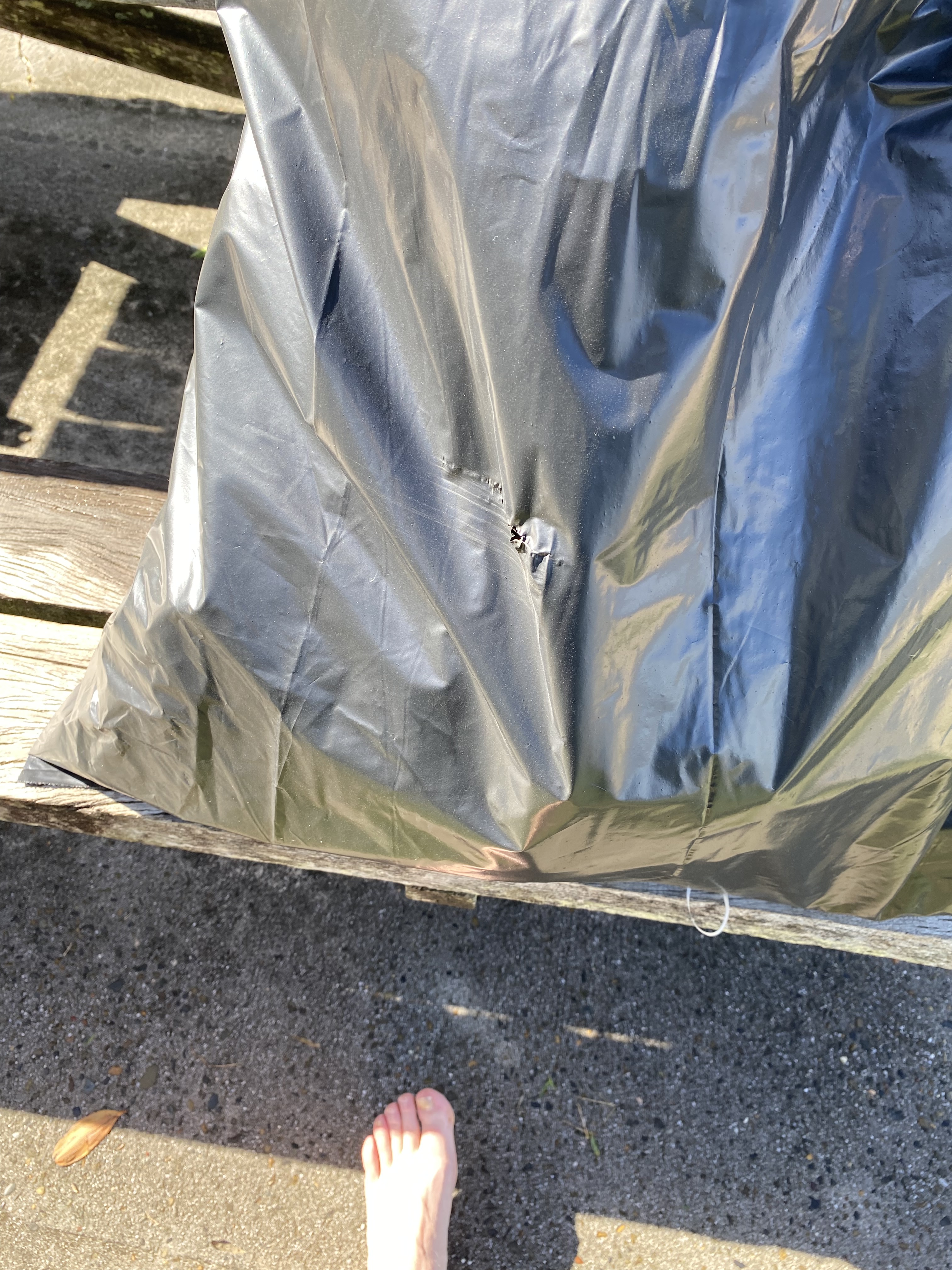
- Lift the bag carefully and don’t scrape it against the side of the table so you put a hole in the whole thing.
- Do it again (if you’re an idiot like me)
- Wallah!!! You have a floating bag.
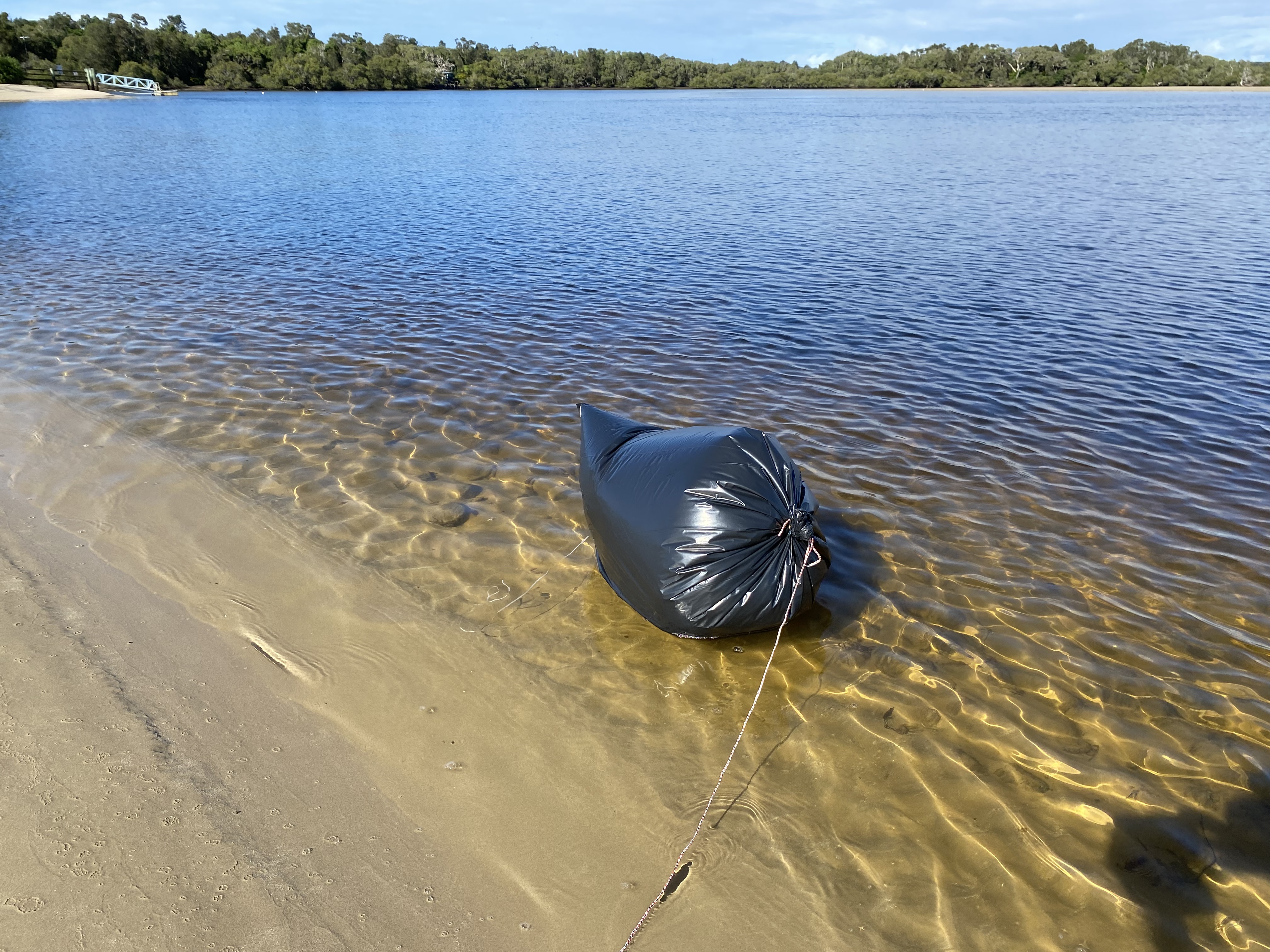
I felt really darned happy that it worked, and it helped to ease some of the low-level anxiety about the last day’s river crossing. Now I knew I could do it… in theory.
Lance turned up, and he got me across the narrow river in no time. I had no idea where to go next, so I asked him. He said, “just follow the road. When you get to the last house, turn right into the bush”. Sounded easy enough. No signs anywhere so I’m glad I had asked him.
The road turned a sharp right and I could see there were no more houses in that direction, but there were houses continuing straight which were not on the road. Right? Did he mean, go straight, and go past the last house – or turn right along the road, but there is no path to turn right onto at the end of that? I chose the former. Walking up that way led to a sign that said: Residents Only! Backtrack. Walked back onto the road and followed it as it veered right. At the end of that, it veered sharply left. More houses. Oh! Could have told me that the road zigzagged like that. Kept going and really couldn’t tell anyone where to go. I have no idea what I did.
Finally found a way down to the beach again. Here I could see that there was a cliff face at the end of it and the rocks below it looked to be unpassable (I was right). I kept peering into the scrub as I walked, hoping for a way in.
I spotted a small opening in the dense foliage and thought it might be there. The path soon started to veer towards the northwest and I thought this must be wrong… but kept going anyway. Finally, it came to a larger road. I went left.
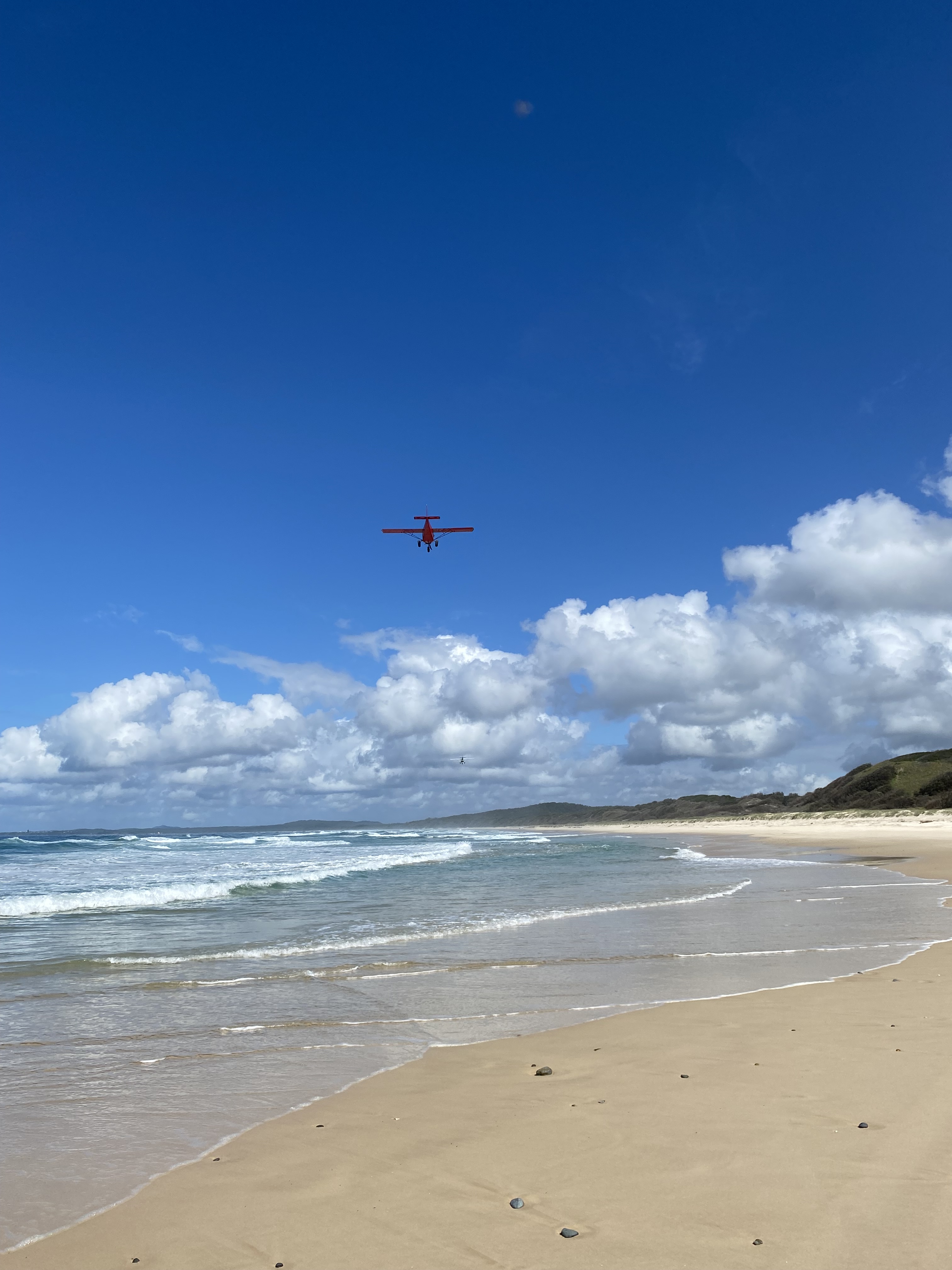
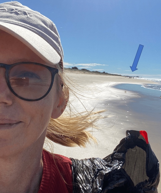
I could hear the beach getting closer so realized this must the the ‘road’ for 4WDs to come into Sandon. I saw no cars but lots of tracks. Almost as soon as I came out onto the beach again, I heard this loud roaring machine sound, and within seconds a large shadow passed directly overhead. A small plane passed above me, and I whooped like a happy banshee. Another one followed straight after it. I took a late photo. That moment was such a treat.
It was a long walk along this stretch of beach. About 14km in total. The tide was coming in so I had to walk in the dry sand to avoid getting caught by a wave. I was starting to ration my water and wished I’d started out with more than 2 litres that day.
I passed a group of families with their 4WDs fishing along the beach and they told me to keep an eye out for a sign that led inland ‘before’ the bend in the beach. Good to know.
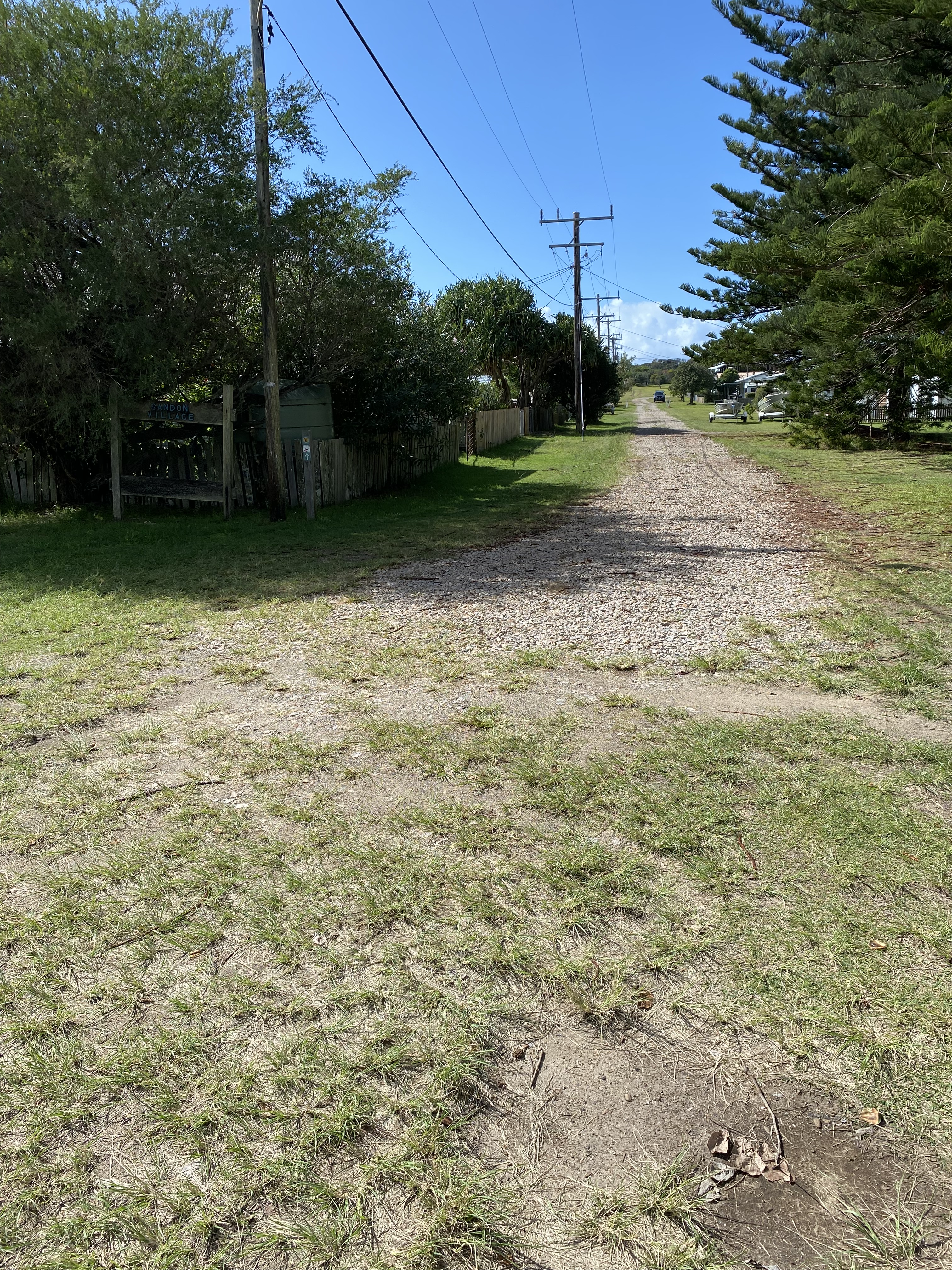
This path led me to Illaroo Campground. I should have booked to stay there as this is actually what is recommended on the little map I had to follow. I don’t know how I missed it. There is a path behind the manager’s caravan that leads onto the inland trail that you take to continue the walk the next day. I had a long chat with David, the manager who was quite keen that I just stay at Ilaroo – he had some spots left, but I was pretty committed at the Minnie Waters Campground, so I kept going.
I had another 2km of walking to do along the bitumen road to get there. David drove past me as I was about 1km in, asking if I wanted a lift, but I politely declined, explaining that it was an ‘honour’ thing. I wanted to be able to say I walked the whole thing.
I got to the campground fairly late in the day (for me) and set up my tent. They’d put me just underneath a big tree with heavy branches. I placed myself in a spot that looked like no branches would fall on me but in hindsight, I should have just asked for a completely different spot. (Not my smartest move). I was so close to a boom gate that squealed like a stuck pig when it opened, and the amenities block was a little close for comfort.
Day 3: Minnie Water to Wooli.
That night was a bit rough. Mostly because of all the noise. There were ‘loud laughers’, frequent boom gate openings, but also an overpowering sewerage smell wafting periodically in my direction which actually woke me up as it was so strong.
In the morning, I felt a bit discombobulated. My phone hadn’t charged. I had so much trouble fitting my sleeping bag and mattress into their respective bags. Even my tent wouldn’t fit and I had to lengthen the straps.
When I was finally ready to go, I stood up with my pack on, and did my pre-take-off checks…tapped my right pocket – yep there’s my phone, tapped my left pocket – no glasses. Shit! Where were they? Last I saw them they were lying on top of my hat which was now on my head. I walked back to my tent site and spent a good 5 minutes combing the grass for them. They were my prescription sunglasses and I really needed them. I wouldn’t be able to see any of those non-existing signs without them. Finally, thought that they must be caught up in something inside my pack and I would just have to hope they would turn up when I unpacked at the other end. I turned around to start walking and felt something weird underfoot. Yep – my glasses. Far out. They didn’t break. I kissed those glasses and thought again how lucky I was.
How I found the path again was a mystery to me. I made three wrong turns that morning. I’d turned All Trails on, but it kept telling me to go straight down to the beach, but I could see there were parts that were unpassable, so I didn’t trust it.
There was one sign, but it was not in good condition. I reflected on something that Lance had said. He’d mentioned that prior to Covid, many people were doing this walk daily, usually in one of 3 tour groups that took people on the route. Since Covid, however, nothing had started up again. He only had a few couples come through now each week.
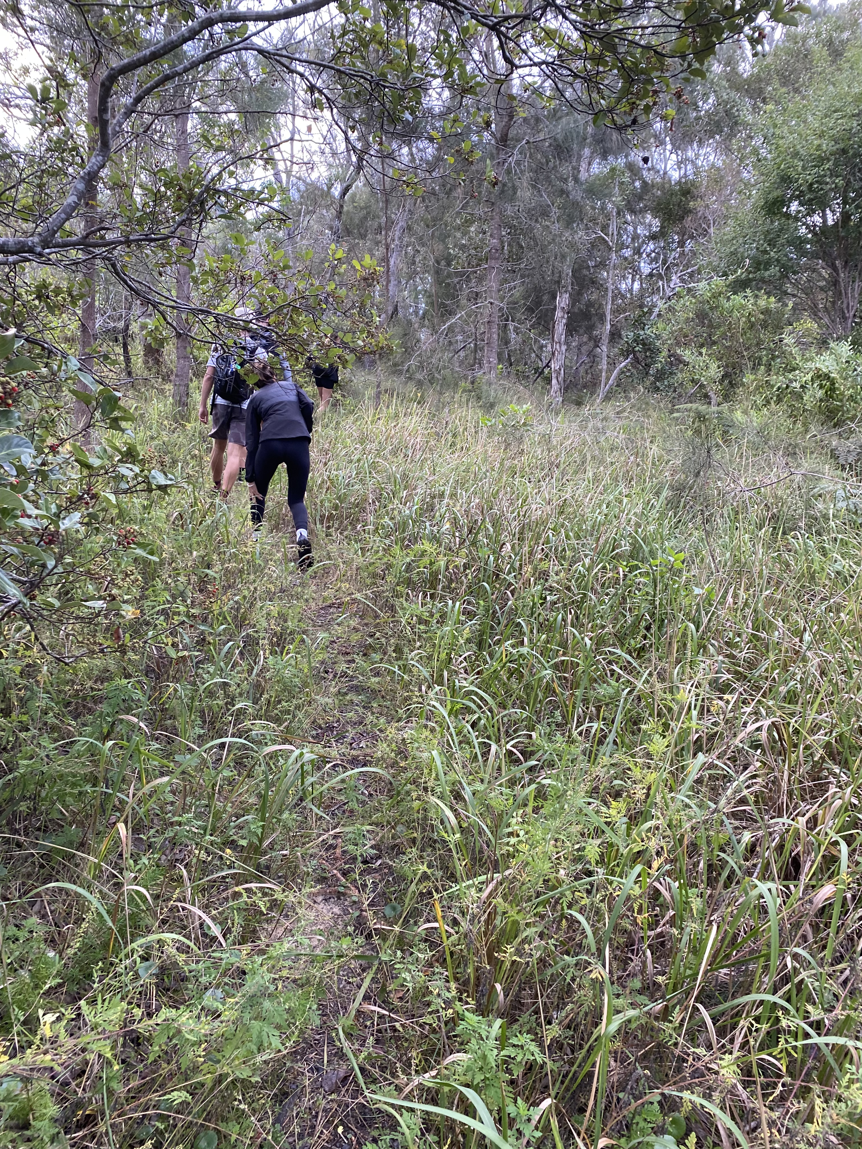
The inland paths were well-mowed and maintained despite the lack of signage.
I do hope they get these guided walks back up again, but there is nothing wrong with doing it on your own either. If I can figure it out, anyone can.
It was another morning of going in and out of back trails and onto the beach. I had to focus on what I was doing because a lot of beach sections were indeed unpassable, and I needed to get off at the right places. I just kept thinking, ‘…just head south(ish)… if I make a mistake, just backtrack.’ It was such a good test of my ability to cope with uncertainty and my ‘fear’ of getting lost. (Seriously can’t get lost on a coastal track… but still… fear is fear).
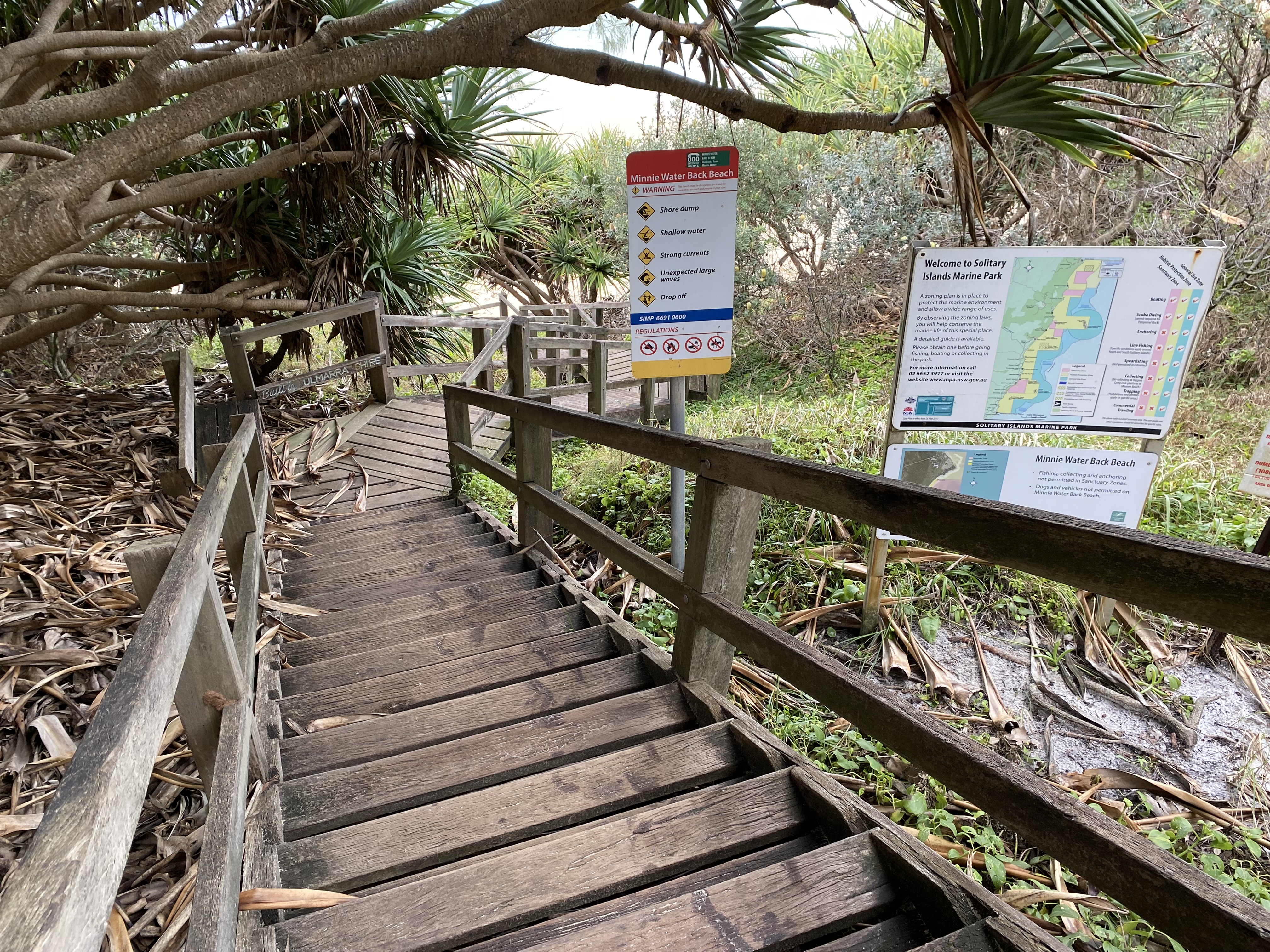
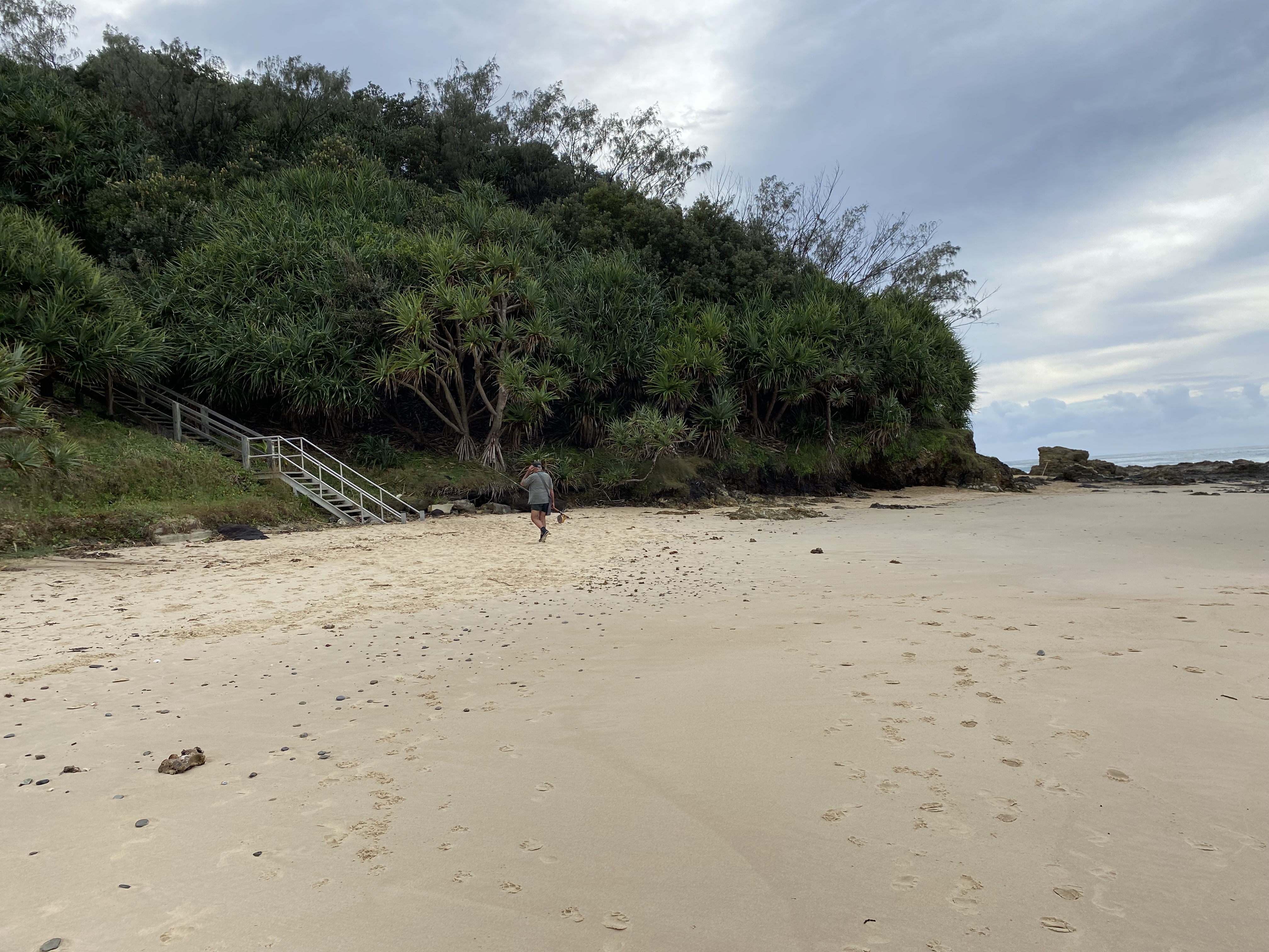
Eventually made it to Back Beach, which was signposted far down the staircase. This staircase was out of sight of the muddy car park above it as I passed through it. Prior to finding it, I had continued on the inland trail for 25 metres or so beyond the car park, till it reached a dead end, so had backtracked (again).
Back on the beach. I could see the beach curved around to a point far off in the distance. I asked a lone fisherman if I’d be able to walk around that point and he told me that I could walk around to Diggers Beach with “no problem”. I was happy to set off again with a long stretch of no-thinking walking before me.
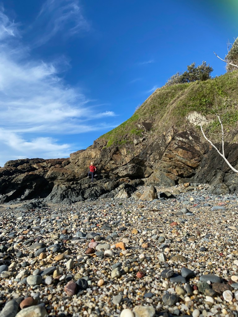
After a little bit of scrambling to get around the point, I got to the next stretch which led to Boorkoom. I went up the beach at a little entrance to get to Diggers Hippy Camp. Then back down to the beach for another short hike to get to Boorkoom Camping Area.
I’d planned to have a little stop there to make a cup of coffee, but the camp was full and it was not quite the serenity I was after so I kept going along the inland path here. Gorgeous views and it was another Disney episode for sure.
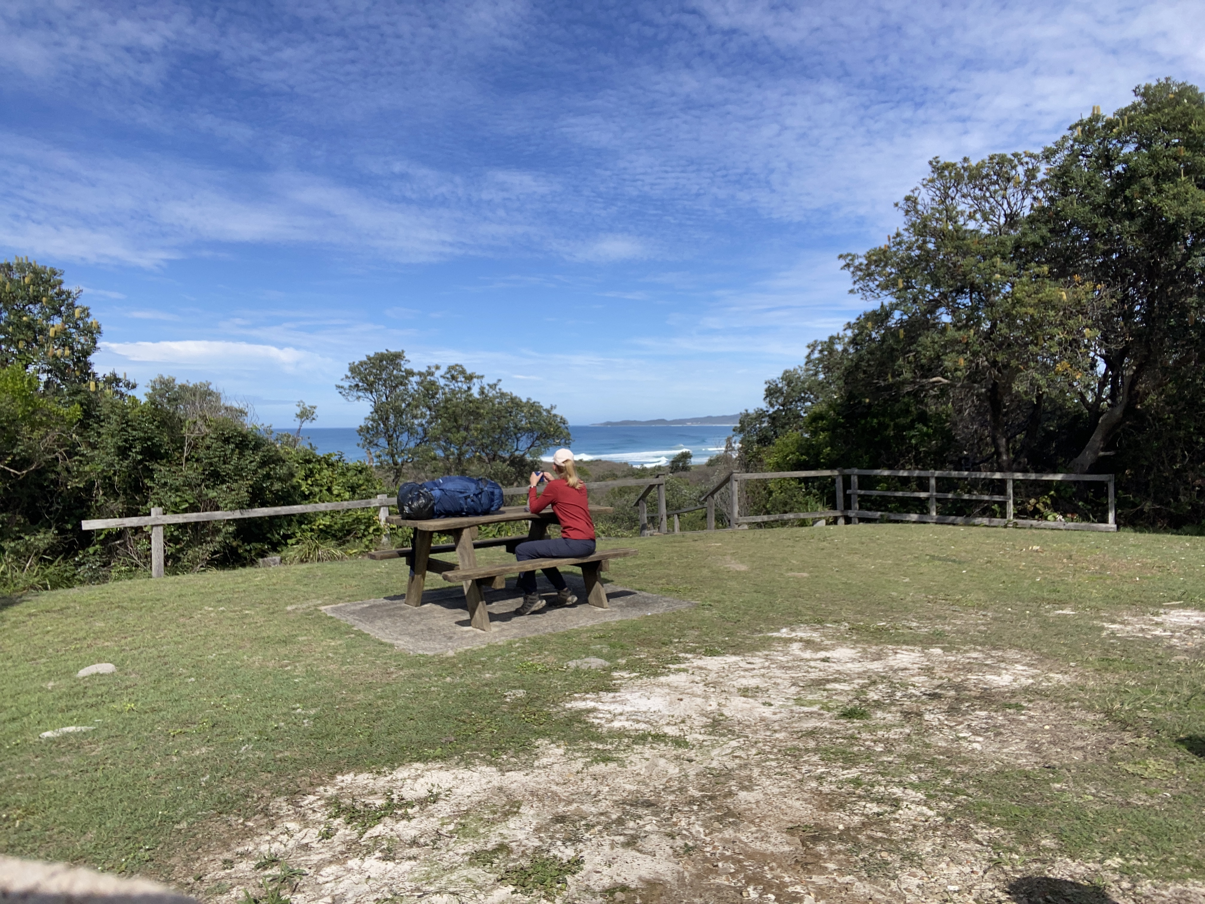
Wilson’s Head appeared before long, and there were people surfing on the southern side. I noticed the staircase going down to Wooli Beach but really felt like a rest before hitting the sand again. I knew there was a picnic area a bit further up, so I climbed less than a km before finding another staircase to the picnic area. Had a nice rest at a table all to myself and felt energized for the last stretch.

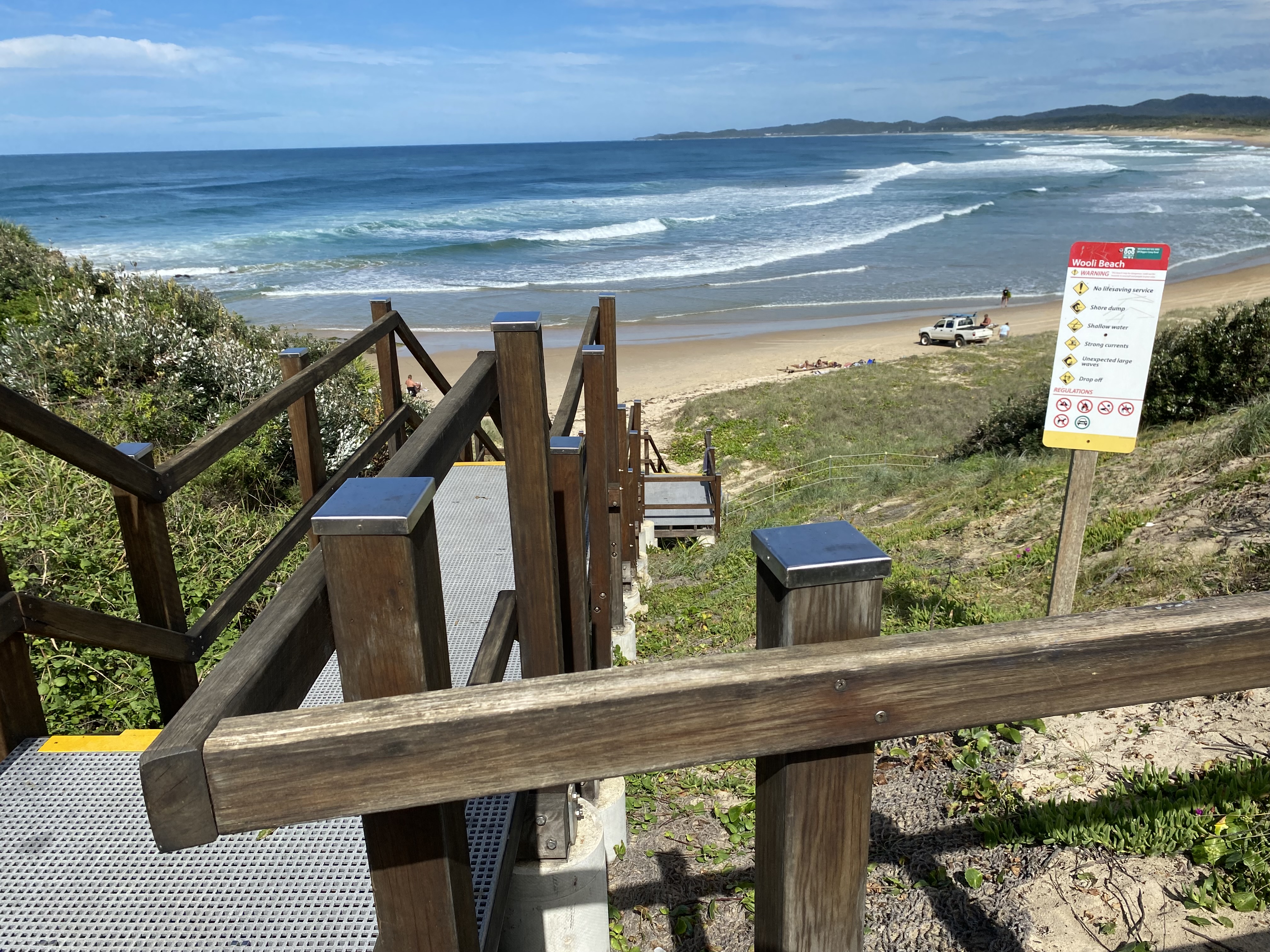
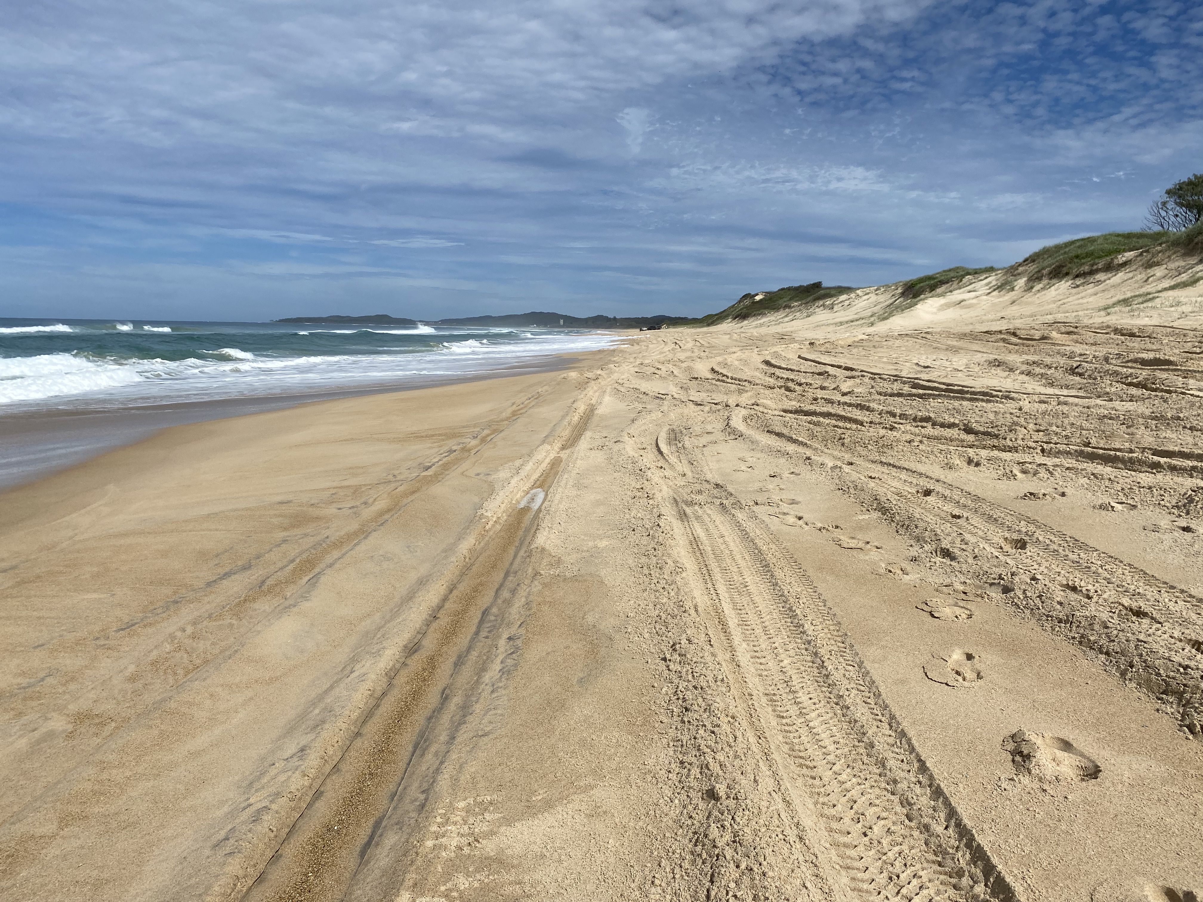
That stretch consisted of about 6.5km of the hardest beach walking so far. The tide was in, and the sand was super-soft. There were loads of 4WD tracks and I had to get out of the way whenever one came by. I was pretty keen to get off that beach as soon as possible.
If you ever do this walk, take the 4th exit off the beach. Take my word for it.
The last home-stretch, heading towards the Wooli Caravan Park was along a narrow street adorned with some lovely small homes. I got a few curious looks, and one man came out to talk to me for ages, telling me he’d lost his wife 4.5 years ago and she was the love of his life.
I finally made it to the caravan park. Despite that beach walk, it had been the easiest and shortest day of walking so far.
Heather, the very helpful ‘office lady’, as she called herself, let me choose between three spots that were left. The best of those were between two permanent sites. I may have looked like the ‘odd one out’ with my little tent.
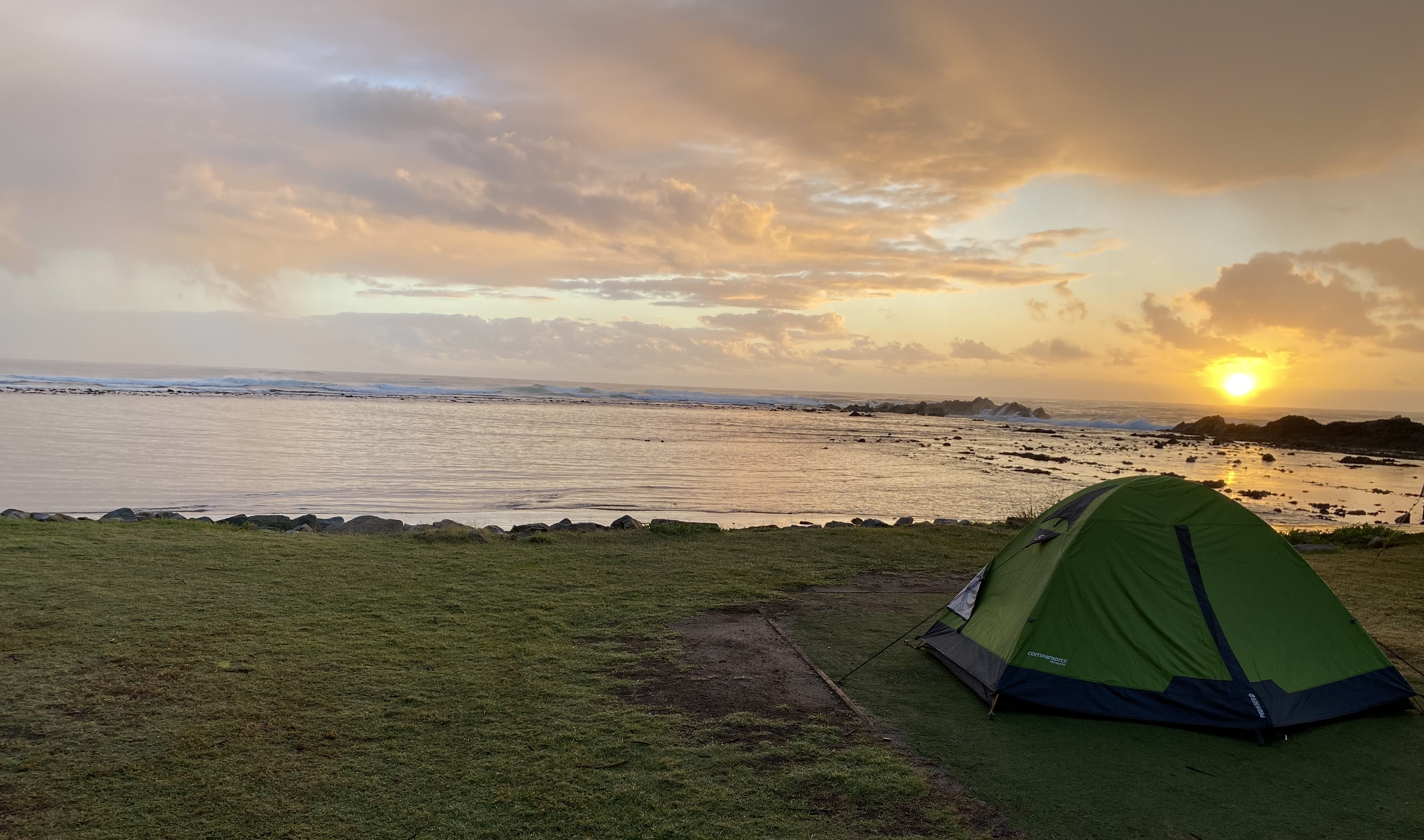
After I’d set up, I headed off on what I thought would be a short little stroll to the end of Wooli Point, which turned out to be 2.5km further along, but it was an absolute treat to get there. Gorgeous town, the weather was divine and… as usual, I couldn’t get the smile off my face. I sat and wrote in my diary for a good hour or so till it started to get cold.
Day 4: Wooli to Red Rock.
That night was full of quite a lot of ‘loud laughers’ and people walking past my tent with flip-flops. I didn’t sleep that great and was questioning why I had chosen to carry my tent rather than sleeping in a motel or cabin or something else. I realized I had been trying to recreate the absolute joy of being self-sufficient while hiking the Great Ocean Walk but really… what was I trying to prove here? The caravan parks had showers, camp-kitchens with a kettle! In hindsight, I may have been better off on this walk, carrying less and paying a little more for accommodation. Live and learn.
When I’d told Heather about my plan for the next day, and my slight concern about getting my big pack across the river, she suggested that I leave my pack with her. Several other hikers had done that a few weeks ago. Brilliant idea! As soon as she said it, I knew that was what I would be doing.
I had planned to meet Bruce and his trusty boat at 7am so this morning, to avoid any mishaps, I’d set my alarm for 5.15am. I was packed and ready by 6.15am (a record for me).
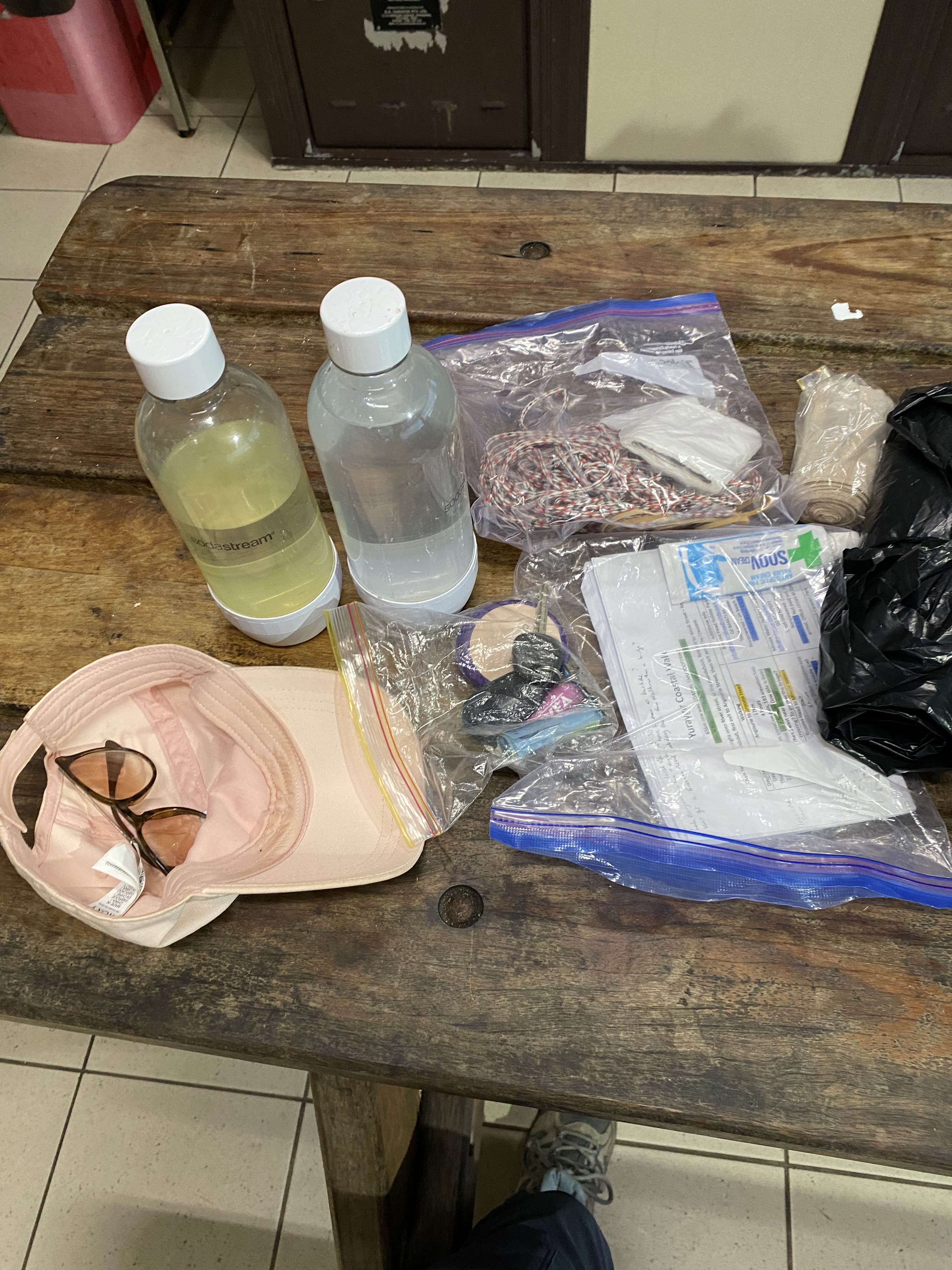
I dropped my pack with Heather at 6.45am and wondered for the 10th time how I would go with my ‘hobo’ bag that was my chosen method of carrying my water, raincoat, car keys, snake bandage, my 2 sturdy plastic bags for the river crossing, and a few other bits and pieces. This bag consisted of two small rubbish bags (double bagging for safety) that I planned to sling over my shoulder as I walked.
Bruce turned up at the boat ramp just after 7am with four other hikers who were also hiking to Red Rock that day. They were two couples, all in their mid-twenties, from Brisbane. They’d been talking about doing this hike for a couple of years. They had very minimal gear to carry, staying in accommodation and eating out each night. Their backpacks (3 bags among them) were coated in some shiny space-age stuff, so they were waterproof, though perhaps not submersible-proof.

When we hopped off the boat, I followed the group till we reached the beach. Once there, they stopped to bring out their map, and I told them that I’d leave them now to walk it together, and I’d go on ahead. I said that it was good for me that they were behind me so that if I had an accident, they could pick me up as they came past.
While having them behind me the whole way, made it feel like they were ‘nipping at my heels’ it was a good safety-backup for me. I knew that stretch of beach would be otherwise deserted and there may not be anyone coming the next day or even the next. I was pretty determined to stay ahead of them, so I went as fast as I could.
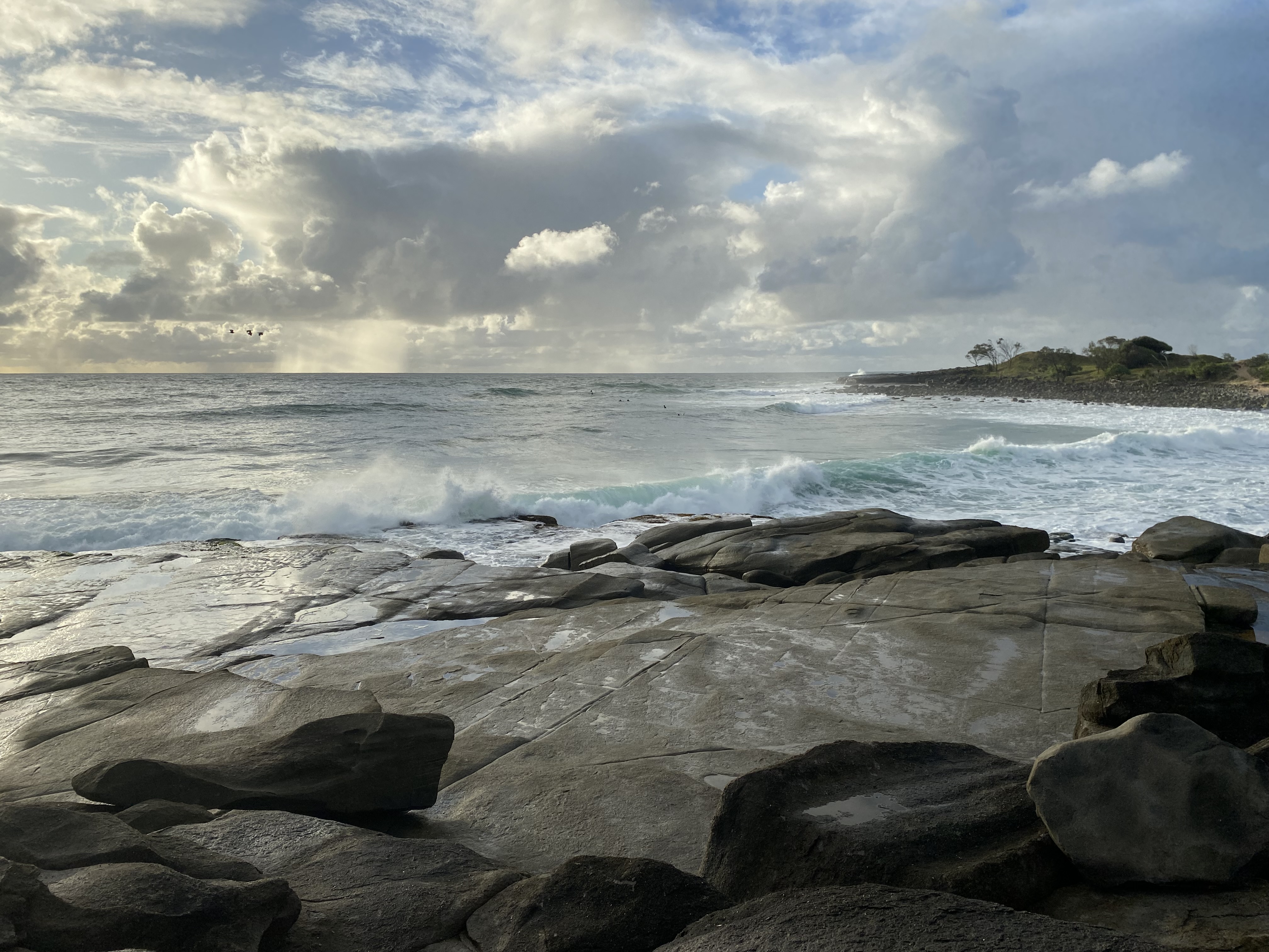
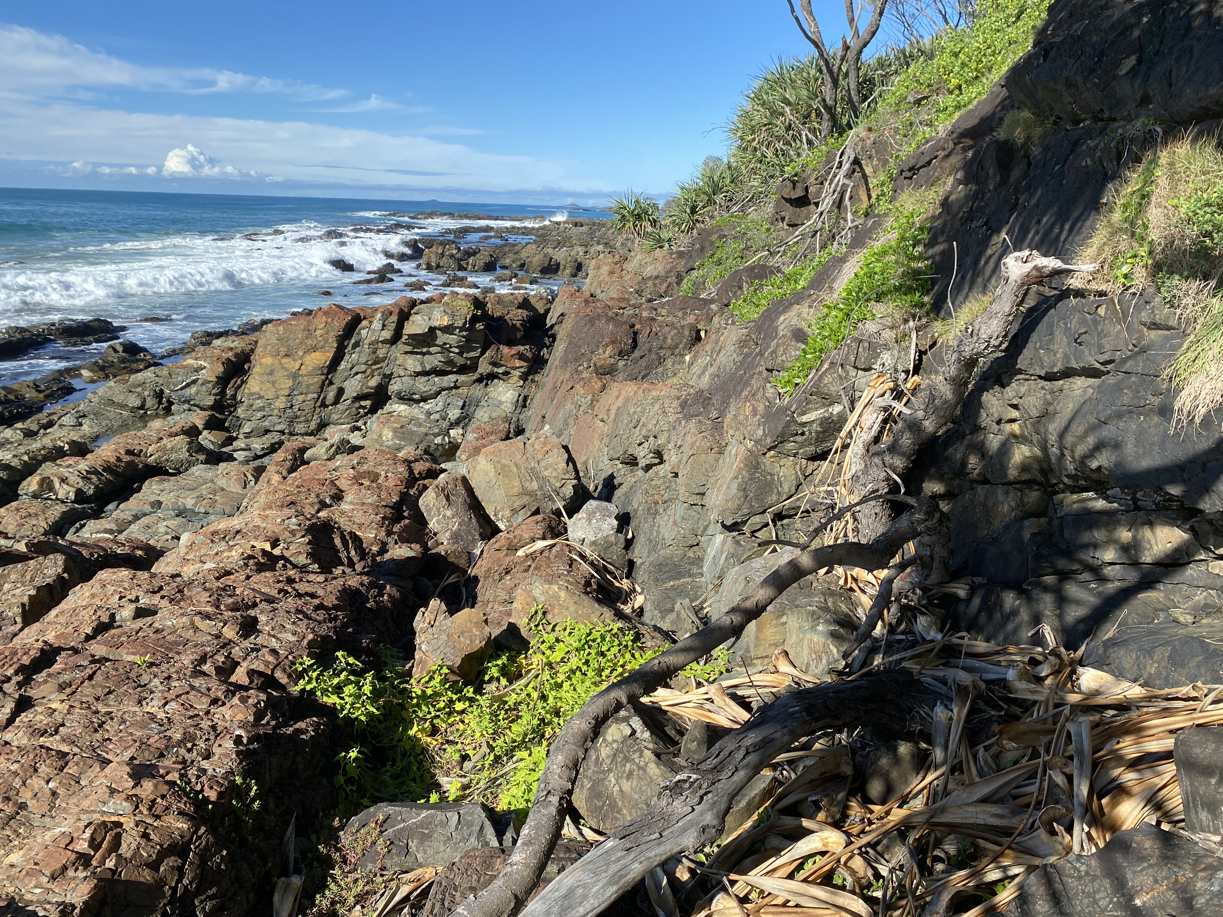
I got to the beginning of the ‘scrambling’ section pretty soon. The rock was incredibly sharp slate, but very grippy, thank goodness.
You absolutely could not attempt this at anything other than low tide. There were sections where the waves were breaking very close by at low tide.
Having a ‘hobo-bag’ instead of my heavy pack was a blessing. I think I would have had trouble with my big pack. I know I would have got through it, but it would have been far less safe as, at times, agility and being nimble-footed were very much required. Admittedly I was one-handed since I had to hold onto the bag but it was still much less tricky than scrambling with 18kgs on my back.
Sometimes, the terrain was impassable, and I had to backtrack and go above it. To my delight, I often found narrow human foot-trails, where others had gone before.
I had such fun in this part. I kept looking over my shoulder to check that I was still ahead. It felt like a fun competition. Sometimes they closed in because I’d had to backtrack or go over a tricky section. Then at other times, I was far ahead. At one stage, once onto a beach again, I was at least 1.5km ahead.
Eventually, I made it to Pebbly Beach Campground which looked like a great place to camp if you had a 4WD. Station Creek was just on the other side of that camp.
Two young boys offered to walk across the creek ahead of me to show me the lowest sections to wade through. I loved taking my boots off and the water was so cool and fresh. It only went up to my knees. I carried the boots after that.
Onto the beach again and I knew I had plenty of time to get to my final river crossing which I wanted to do at 10.50am on the dot… spot on low tide.
I’d started to slow down by then because I thought I would be wise and try to cross at the same time as the young, fit group of hikers. Safety in numbers… It didn’t take long before they turned up in the distance.
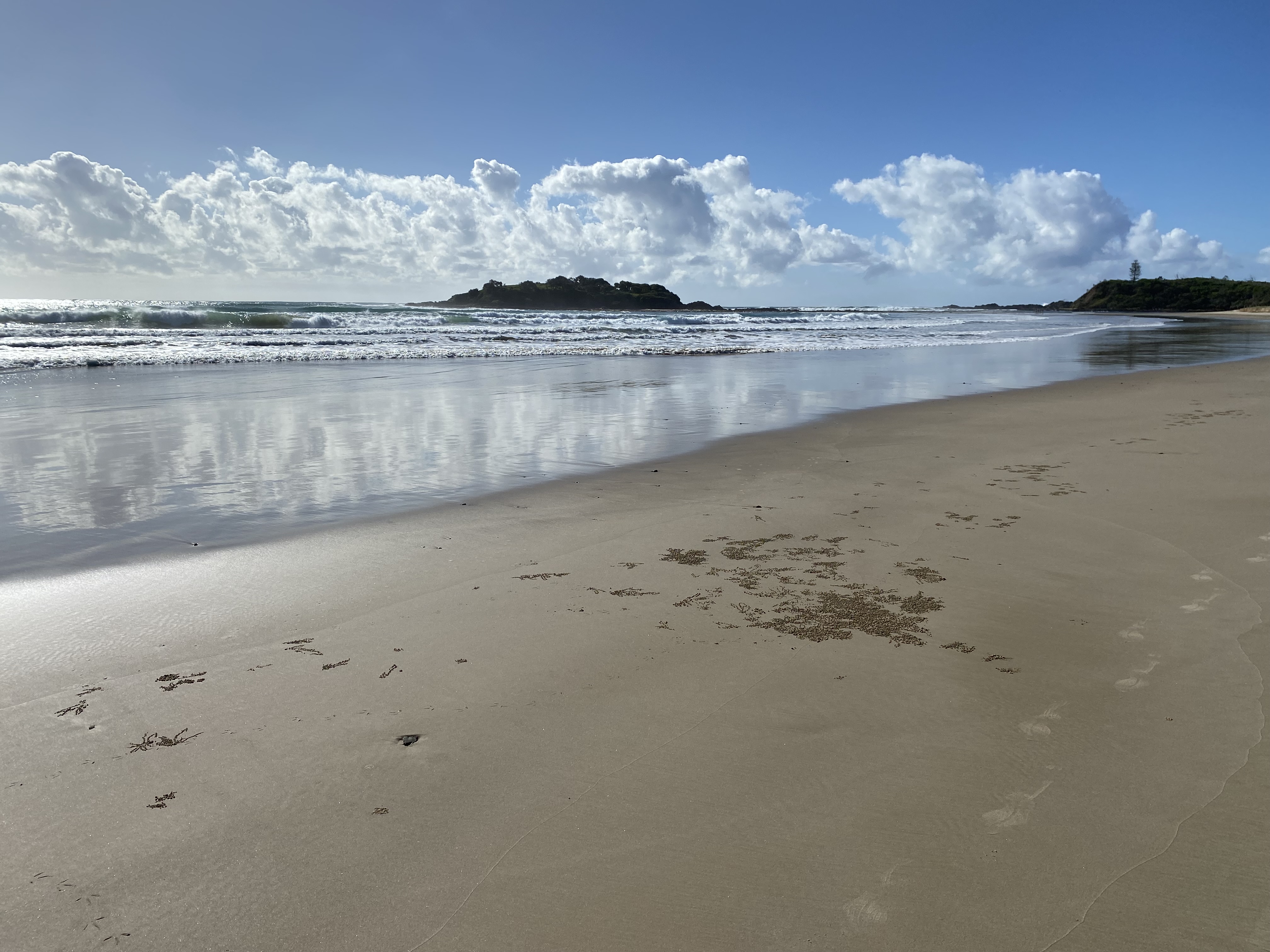
Red Rock got closer and closer and I was singing happily for most of the way, loving the firm cool sand that was delightful to walk on.
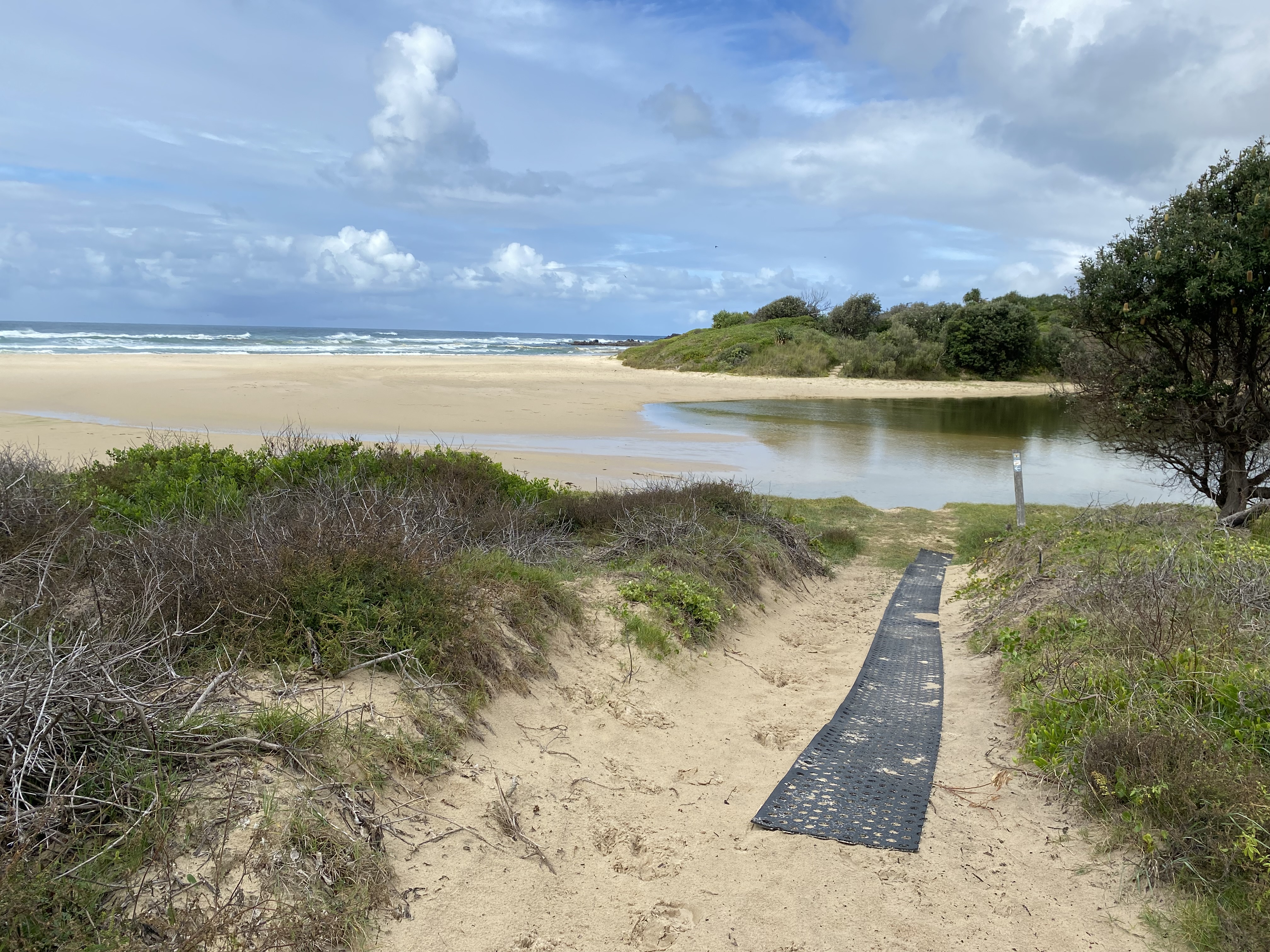
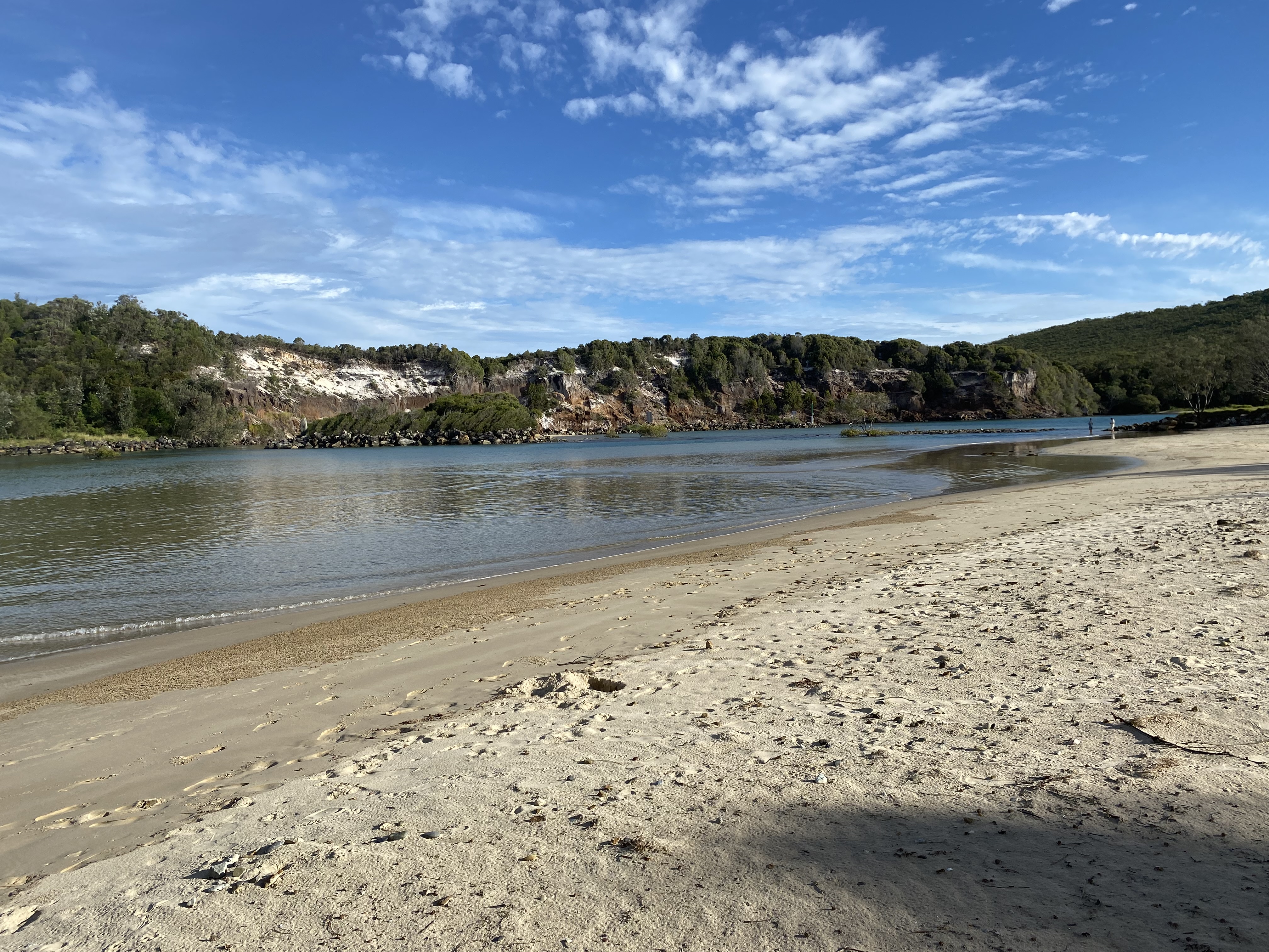
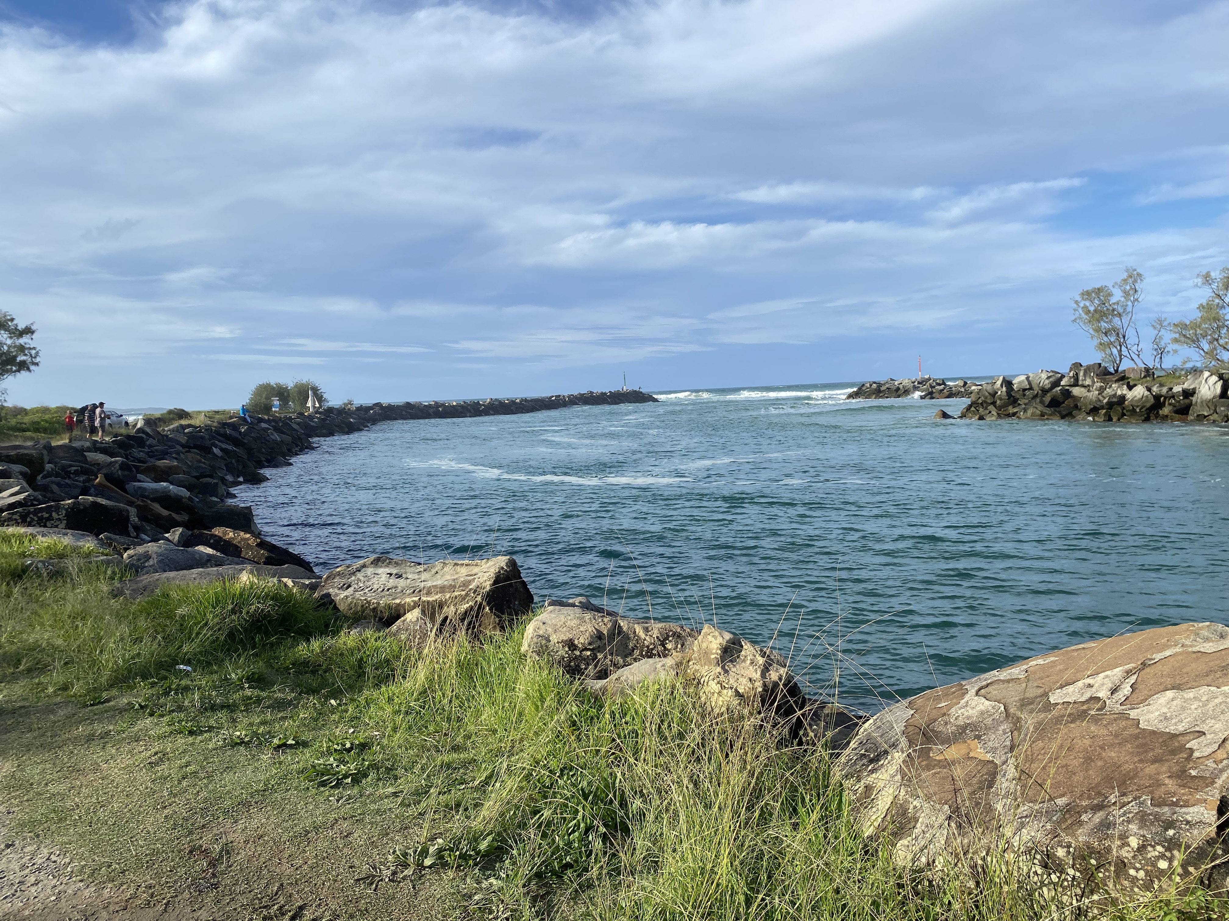
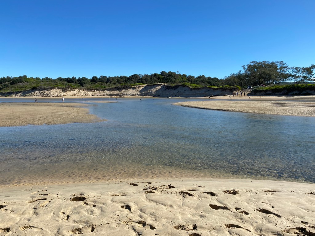
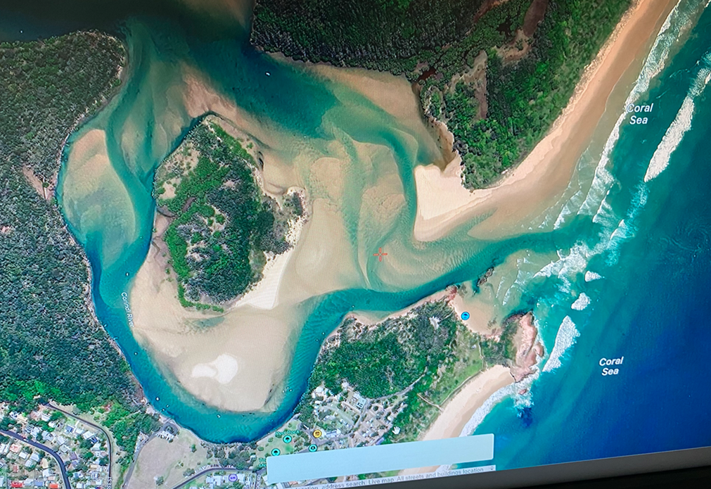
Once I got to Corinda River, I remembered that I was to walk around the bend and keep going until I could see the boat ramp on the other side where it was recommended to cross.
I was fairly certain that the first wide section of the river, was quite shallow, but that there was a deeper section on the far side near the road (where I knew my car was waiting).
Here is what Google Earth told me it looked like from above.
I sat down and started to organize my bag for the crossing. I put my boots in there too.
The four young hikers arrived then, and we all said our happy greetings. They’d loved every bit of their hike that day, though had found some of the scrambling quite challenging.
They said, they couldn’t believe how fast I’d ‘been flying’ and they just couldn’t catch me. Ha! Still got it (says the incredibly competitive me)!

They were all confident that they’d be able to carry their bags above their heads, but I offered the one girl who had a pack, one of my solid plastic bags if she wanted it. I showed her quickly how to make it into a floating bag, and we all set off.
The first bit was up to about waist high and the current was very strong going out to sea. The water was really clear, and it was so exciting to be wading through it at long last. No problem.
Once we crossed those shallow sections, the next section was covered in little blue soldier crabs. Thousands and thousands of them. We had to be careful not to step on them.
We were all thinking that this whole river-crossing thing was a bit of an exaggeration, and I personally felt a bit silly for having gone to all the trouble of learning how to do a river crossing.
At the boat ramp, it did look deep though. It was very dark. Without stopping, everyone just started wading in with their belongings above their heads. I followed. The girl with the ‘floaty’ bag, had gotten so deep it was up to her shoulders. She started to turn back, calling out, “I can’t! I have to go back! It’s too deep!”
I called back. “You’re alright. Your bag floats. Just put it in the water” which she did, and she called back ‘It floats!’ Yep. She kept going.
I then started thinking about me. Soon enough, I couldn’t reach the bottom anymore.
I held onto my floating bag with one hand and started to do breaststroke with the other. It was going very slowly and eventually, I realized there was a current taking me down the river.
We had to get straight across the river to the boat ramp because further down, there were rocks with oysters and other sharp things that may have cut our feet if we tried to get out there. I needed to let go of the bag and trust that the string I had on it would hold. The string got in my way, and it was hard to make any progress.
One of the couples had made it across and I could see they were looking a bit worried about me. I called out, ‘It’s alright, I’m nearly there.’ Which I was, but there was a bit of swimming up against the current to get back to the ramp.
I was very relieved when I could finally reach the bottom. We watched the last two make it across. I don’t know how in the world I got ahead of them, but I observed them performing some superhuman feats. The girl got across with two pairs of hiking boots held dry above the water. The boy twisted onto his back and held his bag to his stomach. I don’t know how dry it was, but it looked impressive.
When we were all out, there was some serious high-fiving going on. We all took some photos and went on our merry way.

I couldn’t believe I had actually just done that. I had feared every part of that river crossing, but I did it anyway. I didn’t die. Yeeha!!!!
Can I just say that I got caught in a rip once upon a time and I lost my confidence as a result. Now, whenever there is something required of me in the water, I seem to make a mess of it. I can swim to save myself, but that’s about it.
I had some dry clothes in my car.
Smiling the biggest smile of the whole trip (and my face already hurt from smiling so much) I hopped in my car, collected my backpack from Heather’s caravan at Wooli (a short 57-minute detour), then drove back to the Gold Coast.
Why do I like hiking solo? There are the obvious reasons: It builds confidence, it helps me appreciate my body and how powerful it is, it forces me to make decisions on my own. I simply love being independent, and it probably makes the straight-laced me, feel a little badass.
I won’t deny that there is some generalized anxiety that comes with it, but the pull to be out there is greater.
I read a beautiful hiker’s quote the other day (Gwynne Dee). “We go despite the fear. Because we are called to the woods, the forest, the glory of creation”.
John Muir wrote, “Come to the woods, for there is rest”. I just love that. There is such opportunity in nature to quiet your mind, especially when you are by yourself.
Things I learned:
- Tides matter a lot. Tides go in and out twice in a 24-hour period. And those times change a lot from day to day. (Yes… I’m a landlubber). The low tide on day 1, was 8am. On day 4, it was 10.50am.
- I found another two spirit animals to add to my main one which is the pack-horse. They are the gazelle and the ungainly otter.
- There are many different types of sand. Firm wet sand, sloppy wet sand, soft sucky fine sand, pebbly sand, smooth rock sand… and many more.
- I don’t like caravan parks very much. I much prefer to sleep in the forest.
- I’m scared of the ocean… and deep water. I knew that before I went, but I faced those fears, and I didn’t die.
- I’m scared of getting lost – walking along a coastline is good when you have zero sense of direction like me. But still, there’s still a lot of track-finding you must do on this walk. I faced the uncertainty of very vague directions and no signage, and I didn’t die.
- For me, anxiety is (kind of) the opposite of confidence. But the more I hike on my own, the more I compile pieces of evidence that show that I am capable and strong; that I am surprisingly able to cope with some uncertainty. I’ve discovered that even if I need to backtrack a little, I always find the path again. I can make a mistake and it is still okay.
The more I do this, the more I seem to be moving along that spectrum toward confidence. And that is a good place to be.

So glad you managed to cross the river. I think it was especially lucky the young couples were there with you, giving each other moral support & the main thing, just being there if you needed help! I have been thinking about you having to cross that section & was a bit worried!
It sounds like you have another great hike under your belt.
And by the way, some fantastic pics too.
Well done Laila.
Maybe another book idea – “solo hikes”?
LikeLiked by 1 person
Hi there, I just found your blog appearing on my Fb feed, and l as I lived at Bundagen some years ago, and had driven that coastal stretch many times otherwise, I read with interest, your adventure!
You mention your fear and anxieties, and all I can say is- gosh, you are being very courageous and brave for someone with your fears! I have moments of thinking about hiking, but I get concerned about being approached as a solo woman. How has that been for you and how do you manage that asepct?
Looking forward to reading about the rest of your adventuring!
LikeLike